 |
|
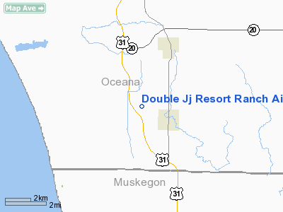
Double JJ Resort Ranch Airport |
Location & QuickFacts
| FAA Information Effective: | 2008-09-25 |
| Airport Identifier: | 42N |
| Airport Status: | Operational |
| Longitude/Latitude: | 086-22-24.0000W/43-31-01.0000N
-86.373333/43.516944 (Estimated) |
| Elevation: | 689 ft / 210.01 m (Estimated) |
| Land: | 90 acres |
| From nearest city: | 2 nautical miles NW of Rothbury, MI |
| Location: | Oceana County, MI |
| Magnetic Variation: | 04W (1995) |
Owner & Manager
| Ownership: | Privately owned |
| Owner: | Robert Lipsitz |
| Address: | 6886 Water Road
Rothbury, MI 49452 |
| Phone number: | 231-894-4444 |
| Manager: | Robert Lipsitz |
| Address: | 6886 Water Road
Rothbury, MI 49452 |
| Phone number: | 231-894-4444 |
Airport Operations and Facilities
| Airport Use: | Open to public |
| Wind indicator: | Yes |
| Segmented Circle: | No |
| Control Tower: | No |
| Sectional chart: | Chicago |
| Region: | AGL - Great Lakes |
| Boundary ARTCC: | ZAU - Chicago |
| Tie-in FSS: | LAN - Lansing |
| FSS on Airport: | No |
| FSS Toll Free: | 1-800-WX-BRIEF |
| NOTAMs Facility: | LAN (NOTAM-d service avaliable) |
Airport Communications
Runway Information
Runway 09/27
| Dimension: | 3600 x 100 ft / 1097.3 x 30.5 m |
| Surface: | TURF, Fair Condition |
| |
Runway 09 |
Runway 27 |
| Longitude: | 086-22-50.3600W | 086-22-01.5000W |
| Latitude: | 43-31-01.7800N | 43-31-01.8000N |
| Elevation: | 689.00 ft | 689.00 ft |
| Traffic Pattern: | Left | Left |
| Displaced threshold: | 406.00 ft | 1000.00 ft |
| Obstruction: | 54 ft trees, 675.0 ft from runway, 13:1 slope to clear
RWY 09 APCH RATIO 20:1 AT DSPLCD THLD. | 50 ft trees, 30.0 ft from runway, 70 ft left of centerline
APCH RATIO 20:1 AT DSPLCD THLD. |
|
Radio Navigation Aids
| ID |
Type |
Name |
Ch |
Freq |
Var |
Dist |
| LDM | NDB | Ludington | | 341.00 | 03W | 26.9 nm |
| HLM | NDB | Holland | | 233.00 | 03W | 44.3 nm |
| HIC | VOR/DME | White Cloud | 123X | 117.60 | 01W | 28.8 nm |
| MBL | VOR/DME | Manistee | 051X | 111.40 | 05W | 45.6 nm |
| MKG | VORTAC | Muskegon | 099X | 115.20 | 01W | 25.5 nm |
Remarks
- POWERED PARACHUTE TRAINING AREA.
- HORSE RESIDUE ON RY.
Images and information placed above are from
http://www.airport-data.com/airport/42N/
We thank them for the data!
| General Info
|
| Country |
United States
|
| State |
MICHIGAN
|
| FAA ID |
42N
|
| Latitude |
43-31-01.000N
|
| Longitude |
086-22-24.000W
|
| Elevation |
689 feet
|
| Near City |
ROTHBURY
|
We don't guarantee the information is fresh and accurate. The data may
be wrong or outdated.
For more up-to-date information please refer to other sources.
|
|


