 |
|
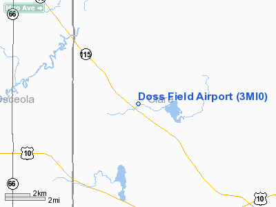
Location & QuickFacts
| FAA Information Effective: | 2008-09-25 |
| Airport Identifier: | 3MI0 |
| Airport Status: | Operational |
| Longitude/Latitude: | 085-01-19.1120W/43-56-13.0730N
-85.021976/43.936965 (Estimated) |
| Elevation: | 1050 ft / 320.04 m (Estimated) |
| Land: | 0 acres |
| From nearest city: | 4 nautical miles SW of Lake George, MI |
| Location: | Clare County, MI |
| Magnetic Variation: | 05W (1985) |
Owner & Manager
| Ownership: | Privately owned |
| Owner: | Howard J. Doss |
| Address: | Po Box 27096
Lansing, MI 48909 |
| Phone number: | 517-694-1984 |
| Address: |
|
Airport Operations and Facilities
| Airport Use: | Private |
| Wind indicator: | No |
| Segmented Circle: | No |
| Control Tower: | No |
| Landing fee charge: | No |
| Sectional chart: | Chicago |
| Region: | AGL - Great Lakes |
| Boundary ARTCC: | ZMP - Minneapolis |
| Tie-in FSS: | LAN - Lansing |
| FSS on Airport: | No |
| FSS Toll Free: | 1-800-WX-BRIEF |
Runway Information
Runway 10/28
| Dimension: | 1320 x 50 ft / 402.3 x 15.2 m |
| Surface: | TURF, |
| |
Runway 10 |
Runway 28 |
| Traffic Pattern: | Left | Left |
|
Radio Navigation Aids
| ID |
Type |
Name |
Ch |
Freq |
Var |
Dist |
| GDW | NDB | Wiggins | | 209.00 | 04W | 23.8 nm |
| CAD | NDB | Cadillac | | 269.00 | 04W | 26.4 nm |
| AMN | NDB | Alma | | 329.00 | 05W | 38.3 nm |
| BHW | NDB | Hardwood | | 236.00 | 06W | 44.6 nm |
| GYG | NDB | Grayling | | 359.00 | 06W | 49.6 nm |
| CGG | VOR | Grayling | | 109.80 | 06W | 46.5 nm |
| MOP | VOR/DME | Mount Pleasant | 043X | 110.60 | 05W | 22.6 nm |
| HTL | VOR/DME | Houghton Lake | 053X | 111.60 | 05W | 29.7 nm |
| HIC | VOR/DME | White Cloud | 123X | 117.60 | 01W | 37.2 nm |
| BXZ | VOR/DME | West Branch | 079X | 113.20 | 06W | 40.6 nm |
| MBS | VOR/DME | Saginaw | 076X | 112.90 | 03W | 47.7 nm |
| TVC | VORTAC | Traverse City | 093X | 114.60 | 02W | 49.5 nm |
Images and information placed above are from
http://www.airport-data.com/airport/3MI0/
We thank them for the data!
| General Info
|
| Country |
United States
|
| State |
MICHIGAN
|
| FAA ID |
3MI0
|
| Latitude |
43-56-13.073N
|
| Longitude |
085-01-19.112W
|
| Elevation |
1050 feet
|
| Near City |
LAKE GEORGE
|
We don't guarantee the information is fresh and accurate. The data may
be wrong or outdated.
For more up-to-date information please refer to other sources.
|
|


