 |
|
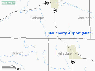
Location & QuickFacts
| FAA Information Effective: | 2008-09-25 |
| Airport Identifier: | MI35 |
| Airport Status: | Operational |
| Longitude/Latitude: | 084-49-44.8840W/42-04-40.1630N
-84.829134/42.077823 (Estimated) |
| Elevation: | 988 ft / 301.14 m (Surveyed) |
| Land: | 0 acres |
| From nearest city: | 3 nautical miles NW of Litchfield, MI |
| Location: | Calhoun County, MI |
| Magnetic Variation: | 04W (1985) |
Owner & Manager
| Ownership: | Privately owned |
| Owner: | Rolland Claucherty |
| Address: | Rt 2, 305 24 Mi Rd
Homer, MI 49245 |
| Phone number: | 517-542-3930 |
| Address: |
|
Airport Operations and Facilities
| Airport Use: | Private |
| Wind indicator: | No |
| Segmented Circle: | No |
| Control Tower: | No |
| Landing fee charge: | No |
| Sectional chart: | Detroit |
| Region: | AGL - Great Lakes |
| Boundary ARTCC: | ZOB - Cleveland |
| Tie-in FSS: | LAN - Lansing |
| FSS on Airport: | No |
| FSS Toll Free: | 1-800-WX-BRIEF |
Airport Services
| Airframe Repair: | NONE |
| Power Plant Repair: | NONE |
Runway Information
Runway 02/20
| Dimension: | 1700 x 100 ft / 518.2 x 30.5 m |
| Surface: | TURF, |
| |
Runway 02 |
Runway 20 |
| Traffic Pattern: | Left | Left |
|
Radio Navigation Aids
| ID |
Type |
Name |
Ch |
Freq |
Var |
Dist |
| BT | NDB | Batol | | 272.00 | 04W | 23.3 nm |
| ANQ | NDB | Angola | | 347.00 | 05W | 28.7 nm |
| IRS | NDB | Sturgis | | 382.00 | 04W | 31.4 nm |
| HAI | NDB | Three Rivers | | 407.00 | 02W | 34.8 nm |
| ADG | NDB | Adrian | | 278.00 | 06W | 35.8 nm |
| BYN | NDB | Bryan | | 260.00 | 04W | 39.5 nm |
| USE | NDB | Fulton | | 375.00 | 05W | 42.0 nm |
| TCU | NDB | Tecumseh | | 239.00 | 04W | 42.4 nm |
| DFI | NDB | Defiance | | 246.00 | 05W | 48.2 nm |
| LFD | VOR/DME | Litchfield | 049X | 111.20 | 05W | 3.0 nm |
| JXN | VOR/DME | Jackson | 033X | 109.60 | 05W | 19.8 nm |
| AZO | VOR/DME | Kalamazoo | 027X | 109.00 | 01W | 33.6 nm |
| BTL | VORTAC | Battle Creek | 031X | 109.40 | 02W | 23.4 nm |
| LAN | VORTAC | Lansing | 045X | 110.80 | 05W | 38.9 nm |
Images and information placed above are from
http://www.airport-data.com/airport/MI35/
We thank them for the data!
| General Info
|
| Country |
United States
|
| State |
MICHIGAN
|
| FAA ID |
MI35
|
| Latitude |
42-04-40.163N
|
| Longitude |
084-49-44.884W
|
| Elevation |
988 feet
|
| Near City |
LITCHFIELD
|
We don't guarantee the information is fresh and accurate. The data may
be wrong or outdated.
For more up-to-date information please refer to other sources.
|
|


