 |
|
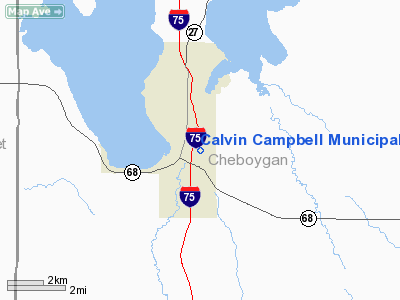
Calvin Campbell Municipal Airport |
Location & QuickFacts
| FAA Information Effective: | 2008-09-25 |
| Airport Identifier: | Y65 |
| Airport Status: | Operational |
| Longitude/Latitude: | 084-36-00.1280W/45-24-30.0420N
-84.600036/45.408345 (Estimated) |
| Elevation: | 602 ft / 183.49 m (Estimated) |
| Land: | 220 acres |
| From nearest city: | 1 nautical miles E of Indian River, MI |
| Location: | Cheboygan County, MI |
| Magnetic Variation: | 06W (1985) |
Owner & Manager
| Ownership: | Publicly owned |
| Owner: | Tusoarora Township |
| Address: | Po Box 208
Indian River, MI 49749 |
| Phone number: | 231-238-7088 |
| Manager: | Norman F. Pratt |
| Address: | 5101 Onaway Rd
Indian River, MI 49749 |
| Phone number: | 231-238-8614 |
Airport Operations and Facilities
| Airport Use: | Open to public |
| Wind indicator: | Yes |
| Segmented Circle: | Yes |
| Control Tower: | No |
| Lighting Schedule: | RDO-CTL
ACTVT LIRL RY 10/28 - CTAF. |
| Landing fee charge: | No |
| Sectional chart: | Lake Huron |
| Region: | AGL - Great Lakes |
| Boundary ARTCC: | ZMP - Minneapolis |
| Tie-in FSS: | LAN - Lansing |
| FSS on Airport: | No |
| FSS Toll Free: | 1-800-WX-BRIEF |
| NOTAMs Facility: | LAN (NOTAM-d service avaliable) |
Airport Communications
Airport Services
Runway Information
Runway 10/28
| Dimension: | 3006 x 50 ft / 916.2 x 15.2 m |
| Surface: | ASPH, Good Condition |
| Edge Lights: | Low |
| |
Runway 10 |
Runway 28 |
| Longitude: | 084-36-20.8700W | 084-35-39.1300W |
| Latitude: | 45-24-32.0000N | 45-24-27.9900N |
| Elevation: | 602.00 ft | 602.00 ft |
| Traffic Pattern: | Left | Left |
| Markings: | Basic, Fair Condition | Basic, Fair Condition |
| Displaced threshold: | 0.00 ft | 600.00 ft |
| Runway End Identifier: | No | No |
| Centerline Lights: | No | No |
| Touchdown Lights: | No | No |
| Obstruction: | 75 ft trees, 1500.0 ft from runway, 125 ft right of centerline, 17:1 slope to clear | 75 ft trees, 300.0 ft from runway, 135 ft right of centerline, 1:1 slope to clear
APCH RATIO 20:1 AT DSPLCD THR BASED ON STRAIGHT OUT OVR 125 FT TREES/HILL.
+50-75 FT TREES AT THLD 130 FT RIGHT & LEFT OF CNTRLN. |
|
Radio Navigation Aids
| ID |
Type |
Name |
Ch |
Freq |
Var |
Dist |
| BFA | NDB | Boyne Falls | | 263.00 | 06W | 19.9 nm |
| CVX | NDB | Charlevoix | | 392.00 | 05W | 29.0 nm |
| PZQ | NDB | Rogers City | | 215.00 | 07W | 32.9 nm |
| GYG | NDB | Grayling | | 359.00 | 06W | 40.7 nm |
| CXK | NDB | Clam Lake | | 251.00 | 05W | 40.9 nm |
| SJX | NDB | St James | | 382.00 | 05W | 43.8 nm |
| CGG | VOR | Grayling | | 109.80 | 06W | 44.0 nm |
| GLR | VOR/DME | Gaylord | 029X | 109.20 | 06W | 24.2 nm |
| PLN | VORTAC | Pellston | 055X | 111.80 | 06W | 13.6 nm |
| APN | VORTAC | Alpena | 025X | 108.80 | 07W | 48.3 nm |
Remarks
- DEER & BIRDS ON & INVOF OF ARPT.
- SNOW REMOVAL INTERMITTENT; TO VERIFY COND CALL 231-238-8614.
- RY 28 125 FT TREES/HILL ON RIDGELINE; IN APCH TO RY 28, APCH RATIO 20:1 AT DSPLD THLD.
- EXISTED PRIOR TO 1959
Images and information placed above are from
http://www.airport-data.com/airport/Y65/
We thank them for the data!
| General Info
|
| Country |
United States
|
| State |
MICHIGAN
|
| FAA ID |
Y65
|
| Latitude |
45-24-30.042N
|
| Longitude |
084-36-00.128W
|
| Elevation |
602 feet
|
| Near City |
INDIAN RIVER
|
We don't guarantee the information is fresh and accurate. The data may
be wrong or outdated.
For more up-to-date information please refer to other sources.
|
|


