 |
|
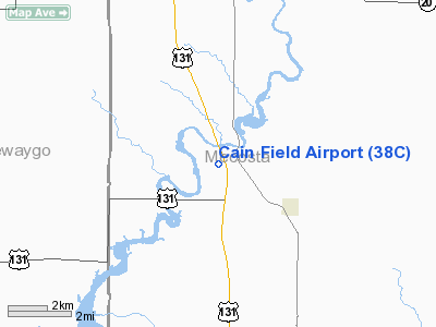
Location & QuickFacts
| FAA Information Effective: | 2008-09-25 |
| Airport Identifier: | 38C |
| Airport Status: | Operational |
| Longitude/Latitude: | 085-29-35.1560W/43-36-00.0880N
-85.493099/43.600024 (Estimated) |
| Elevation: | 889 ft / 270.97 m (Estimated) |
| Land: | 67 acres |
| From nearest city: | 2 nautical miles SE of Stanwood, MI |
| Location: | Mecosta County, MI |
| Magnetic Variation: | 04W (1985) |
Owner & Manager
| Ownership: | Privately owned |
| Owner: | Walter L. Cain |
| Address: | Route #2, 8731 Old State Road
Stanwood, MI 49346 |
| Phone number: | 231-823-2481 |
| Manager: | Walter L. Cain |
| Address: | Route #2, 8731 Old State Road
Stanwood, MI 49346 |
| Phone number: | 231-823-2481 |
Airport Operations and Facilities
| Airport Use: | Open to public |
| Wind indicator: | Yes |
| Segmented Circle: | Yes |
| Control Tower: | No |
| Landing fee charge: | No |
| Sectional chart: | Chicago |
| Region: | AGL - Great Lakes |
| Boundary ARTCC: | ZMP - Minneapolis |
| Tie-in FSS: | LAN - Lansing |
| FSS on Airport: | No |
| FSS Toll Free: | 1-800-WX-BRIEF |
| NOTAMs Facility: | LAN (NOTAM-d service avaliable) |
Airport Communications
Airport Services
| Airframe Repair: | MAJOR |
| Power Plant Repair: | MAJOR |
| Bottled Oxygen: | NONE |
| Bulk Oxygen: | NONE |
Runway Information
Runway 18/36
| Dimension: | 3450 x 100 ft / 1051.6 x 30.5 m |
| Surface: | TURF, Good Condition |
| |
Runway 18 |
Runway 36 |
| Longitude: | 085-29-33.0000W | 085-29-33.0000W |
| Latitude: | 43-36-45.0700N | 43-36-11.0000N |
| Elevation: | 889.00 ft | 889.00 ft |
| Alignment: | 127 | 0 |
| Traffic Pattern: | Left | Left |
| Displaced threshold: | 486.00 ft | 384.00 ft |
| Obstruction: | 60 ft trees, 110 ft right of centerline
RWY 18 APCH RATIO 4:1 AT DSPCLD THLD OVER 60 FT TREES, 240 FT DSTC, 125 FT R, 20:1 BASED ON STRAIGHT OUT. | 80 ft tree, 50.0 ft from runway, 124 ft right of centerline
APCH RATIO 1:1 TO DSPLCD THLD. BASED ON 60 FT TREES 111 FT L 102 FT DSTC FM DSPLCD THLD. 20:1 STRAIGHT OUT. |
|
Radio Navigation Aids
| ID |
Type |
Name |
Ch |
Freq |
Var |
Dist |
| AMN | NDB | Alma | | 329.00 | 05W | 35.1 nm |
| CAD | NDB | Cadillac | | 269.00 | 04W | 40.7 nm |
| LDM | NDB | Ludington | | 341.00 | 03W | 45.4 nm |
| GDW | NDB | Wiggins | | 209.00 | 04W | 49.5 nm |
| HIC | VOR/DME | White Cloud | 123X | 117.60 | 01W | 9.8 nm |
| MOP | VOR/DME | Mount Pleasant | 043X | 110.60 | 05W | 32.9 nm |
| GRR | VOR/DME | Grand Rapids | 106Y | 115.95 | 04W | 48.9 nm |
| MKG | VORTAC | Muskegon | 099X | 115.20 | 01W | 35.2 nm |
Remarks
- RADIO CONTROL ACFT ACTVTY ON & INVOF ARPT.
- OCNL DEER ACTIVITY ON & INVOF ARPT.
- RY 36 33 FT POWERLINE 660 FT FM DSPLCD THLD, APCH RATIO 20:1, OB.
- FUEL AVBL FOR EMERGENCIES ONLY.
- CONDITIONED UPON ARPT ABANDONMENT WHEN NEW HIWAY IS BUILT.
Images and information placed above are from
http://www.airport-data.com/airport/38C/
We thank them for the data!
| General Info
|
| Country |
United States
|
| State |
MICHIGAN
|
| FAA ID |
38C
|
| Latitude |
43-36-00.088N
|
| Longitude |
085-29-35.156W
|
| Elevation |
889 feet
|
| Near City |
STANWOOD
|
We don't guarantee the information is fresh and accurate. The data may
be wrong or outdated.
For more up-to-date information please refer to other sources.
|
|


