 |
|
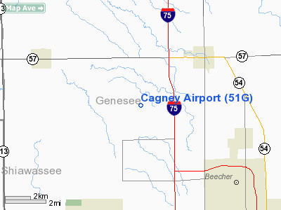
Location & QuickFacts
| FAA Information Effective: | 2008-09-25 |
| Airport Identifier: | 51G |
| Airport Status: | Operational |
| Longitude/Latitude: | 083-47-44.8630W/43-08-35.0950N
-83.795795/43.143082 (Estimated) |
| Elevation: | 722 ft / 220.07 m (Estimated) |
| Land: | 95 acres |
| From nearest city: | 3 nautical miles SW of Clio, MI |
| Location: | Genesee County, MI |
| Magnetic Variation: | 06W (1985) |
Owner & Manager
| Ownership: | Privately owned |
| Owner: | Thomas Cagney |
| Address: | 9451 N Webster Road
Clio, MI 48420 |
| Phone number: | 810-686-7627 |
| Manager: | Thomas Cagney
AMGR LIVES AT ARPT. |
| Address: | 9451 N Webster Road
Clio, MI 48420 |
| Phone number: | 810-686-7627 |
Airport Operations and Facilities
| Airport Use: | Open to public |
| Wind indicator: | Yes |
| Segmented Circle: | Yes |
| Control Tower: | No |
| Landing fee charge: | No |
| Sectional chart: | Detroit |
| Region: | AGL - Great Lakes |
| Traffic Pattern Alt: | 1000 ft |
| Boundary ARTCC: | ZOB - Cleveland |
| Tie-in FSS: | LAN - Lansing |
| FSS on Airport: | No |
| FSS Toll Free: | 1-800-WX-BRIEF |
| NOTAMs Facility: | LAN (NOTAM-d service avaliable) |
Airport Communications
Airport Services
| Airframe Repair: | MAJOR |
| Power Plant Repair: | MAJOR |
| Bottled Oxygen: | NONE |
| Bulk Oxygen: | NONE |
Runway Information
Runway 03/21
| Dimension: | 1933 x 100 ft / 589.2 x 30.5 m |
| Surface: | TURF, Poor Condition
ROUGH.
ROUGH.
ROUGH. |
| |
Runway 03 |
Runway 21 |
| Longitude: | 083-47-54.4000W | 083-47-40.6000W |
| Latitude: | 43-08-30.3000N | 43-08-46.5000N |
| Alignment: | 31 | 127 |
| Traffic Pattern: | Left | Left |
| Runway End Identifier: | No | No |
| Centerline Lights: | No | No |
| Touchdown Lights: | No | No |
| Obstruction: | 62 ft trees, 591.0 ft from runway, 9:1 slope to clear | 45 ft tree, 51.0 ft from runway, 1:1 slope to clear |
|
Runway 14/32
| Dimension: | 1895 x 140 ft / 577.6 x 42.7 m |
| Surface: | TURF, Poor Condition
ROUGH.
ROUGH.
ROUGH. |
| |
Runway 14 |
Runway 32 |
| Longitude: | 083-47-54.6000W | 083-47-38.1000W |
| Latitude: | 43-08-42.0000N | 43-08-27.7000N |
| Alignment: | 127 | 127 |
| Traffic Pattern: | Left | Left |
| Runway End Identifier: | No | No |
| Centerline Lights: | No | No |
| Touchdown Lights: | No | No |
| Obstruction: | 32 ft tree, 516.0 ft from runway, 16:1 slope to clear | 50 ft trees, 50.0 ft from runway, 30 ft right of centerline, 1:1 slope to clear |
|
Runway 18/36
| Dimension: | 1802 x 100 ft / 549.2 x 30.5 m |
| Surface: | TURF, Poor Condition
ROUGH.
ROUGH.
ROUGH. |
| |
Runway 18 |
Runway 36 |
| Longitude: | 083-47-53.6000W | 083-47-53.2000W |
| Latitude: | 43-08-45.0000N | 43-08-27.2000N |
| Alignment: | 127 | 127 |
| Traffic Pattern: | Left | Left |
| Displaced threshold: | 500.00 ft | 358.00 ft |
| Runway End Identifier: | No | No |
| Centerline Lights: | No | No |
| Touchdown Lights: | No | No |
| Obstruction: | 36 ft trees, 237.0 ft from runway, 6:1 slope to clear
APCH RATIO 20:1 TO DSPLCD THLD, +36 FT TREES, 737 FT DSTC. | 50 ft trees, 0.0 ft from runway, 100 ft left of centerline
RWY 36 APCH RATIO 7:1 AT DSPLCD THLD, 50 FT TREES 100 FT 358 FT DSTC. |
|
Radio Navigation Aids
| ID |
Type |
Name |
Ch |
Freq |
Var |
Dist |
| HYX | NDB | Browne | | 385.00 | 06W | 17.6 nm |
| OZW | NDB | Howell | | 243.00 | 05W | 31.8 nm |
| AMN | NDB | Alma | | 329.00 | 05W | 44.7 nm |
| MBS | VOR/DME | Saginaw | 076X | 112.90 | 03W | 26.4 nm |
| FNT | VORTAC | Flint | 116X | 116.90 | 06W | 10.8 nm |
| PSI | VORTAC | Pontiac | 047X | 111.00 | 03W | 29.0 nm |
| SVM | VORTAC | Salem | 090X | 114.30 | 03W | 45.0 nm |
| LAN | VORTAC | Lansing | 045X | 110.80 | 05W | 47.2 nm |
| ECK | VORTAC | Peck | 087X | 114.00 | 07W | 47.7 nm |
Remarks
- DEER ON & INVOF ARPT.
- RY 32 APCH END WET IN SPRING AFT RAIN.
- GLIDER OPNS LEFT & RIGHT TFC TO ALL RYS.
- RYS 3/21 & 14/32 LCL USE ONLY.
- EXISTED PRIOR TO 1959.
Images and information placed above are from
http://www.airport-data.com/airport/51G/
We thank them for the data!
| General Info
|
| Country |
United States
|
| State |
MICHIGAN
|
| FAA ID |
51G
|
| Latitude |
43-08-35.095N
|
| Longitude |
083-47-44.863W
|
| Elevation |
722 feet
|
| Near City |
CLIO
|
We don't guarantee the information is fresh and accurate. The data may
be wrong or outdated.
For more up-to-date information please refer to other sources.
|
|


