 |
|
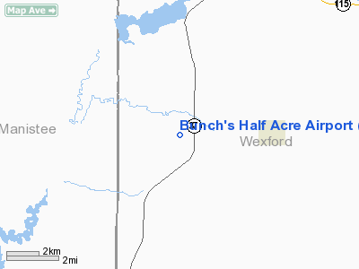
Bunch's Half Acre Airport |
Location & QuickFacts
| FAA Information Effective: | 2008-09-25 |
| Airport Identifier: | 4Y9 |
| Airport Status: | Operational |
| Longitude/Latitude: | 085-46-20.2410W/44-18-30.0170N
-85.772289/44.308338 (Estimated) |
| Elevation: | 1010 ft / 307.85 m (Surveyed) |
| Land: | 142 acres |
| From nearest city: | 3 nautical miles W of Harrietta, MI |
| Location: | Wexford County, MI |
| Magnetic Variation: | 04W (1985) |
Owner & Manager
| Ownership: | Privately owned |
| Owner: | Blain Becktold |
| Address: | 17939 Cherokee Dr
Spring Lake, MI 49456 |
| Phone number: | 616-502-0881 |
| Manager: | Blain Becktold |
| Address: | 17939 Cherokee Dr
Spring Lake, MI 49456 |
| Phone number: | 616-502-0881 |
Airport Operations and Facilities
| Airport Use: | Open to public |
| Wind indicator: | Yes |
| Segmented Circle: | No |
| Control Tower: | No |
| Landing fee charge: | No |
| Sectional chart: | Green Bay |
| Region: | AGL - Great Lakes |
| Boundary ARTCC: | ZMP - Minneapolis |
| Tie-in FSS: | LAN - Lansing |
| FSS on Airport: | No |
| FSS Toll Free: | 1-800-WX-BRIEF |
| NOTAMs Facility: | LAN (NOTAM-d service avaliable) |
Airport Communications
Airport Services
Runway Information
Runway 08/26
| Dimension: | 2400 x 100 ft / 731.5 x 30.5 m |
| Surface: | TURF, Poor Condition
RY ROUGH & UNEVEN. |
| |
Runway 08 |
Runway 26 |
| Longitude: | 085-47-16.1800W | 085-46-06.9500W |
| Latitude: | 44-18-27.5500N | 44-18-35.6400N |
| Elevation: | 1010.00 ft | 1010.00 ft |
| Traffic Pattern: | Left | Left |
| Runway End Identifier: | No | No |
| Centerline Lights: | No | No |
| Touchdown Lights: | No | No |
| Obstruction: | 50 ft trees, 60L/ ft right of centerline
APCH RATIO 20:1 OVR +60 FT TREES, 1200 FT DSTC, BASED ON STRAIGHT OUT. | 50 ft trees, 0.0 ft from runway, 100L/ ft right of centerline
APCH RATIO 26:1 OVR +85 FT TREE, 2210 FT DSTC, BASED ON STRAIGHT OUT. |
|
Radio Navigation Aids
| ID |
Type |
Name |
Ch |
Freq |
Var |
Dist |
| CAD | NDB | Cadillac | | 269.00 | 04W | 15.5 nm |
| TV | NDB | Gwenn | | 365.00 | 05W | 29.5 nm |
| LDM | NDB | Ludington | | 341.00 | 03W | 34.4 nm |
| CXK | NDB | Clam Lake | | 251.00 | 05W | 42.2 nm |
| GYG | NDB | Grayling | | 359.00 | 06W | 48.4 nm |
| MBL | VOR/DME | Manistee | 051X | 111.40 | 05W | 20.9 nm |
| HIC | VOR/DME | White Cloud | 123X | 117.60 | 01W | 44.2 nm |
| HTL | VOR/DME | Houghton Lake | 053X | 111.60 | 05W | 47.7 nm |
| TVC | VORTAC | Traverse City | 093X | 114.60 | 02W | 23.6 nm |
Remarks
- 45 FT TREES BOTH SIDES OF RY 08/26 PRIM SFC 100 FT FM RY CNTRLN.
- ARPT PHYSICAL ADDR. 9511 W. 30 RD., HARRIETTA, MI
- LARGE DEPRESSION NE OF RWY 26 END.
- ARPT CLSD WHEN SNOW COVERED.
Images and information placed above are from
http://www.airport-data.com/airport/4Y9/
We thank them for the data!
| General Info
|
| Country |
United States
|
| State |
MICHIGAN
|
| FAA ID |
4Y9
|
| Latitude |
44-18-30.017N
|
| Longitude |
085-46-20.241W
|
| Elevation |
1010 feet
|
| Near City |
HARRIETTA
|
We don't guarantee the information is fresh and accurate. The data may
be wrong or outdated.
For more up-to-date information please refer to other sources.
|
|


