 |
|
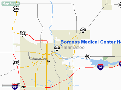
Borgess Medical Center Heliport |
Location & QuickFacts
| FAA Information Effective: | 2008-09-25 |
| Airport Identifier: | 5MI5 |
| Airport Status: | Operational |
| Longitude/Latitude: | 085-33-29.0220W/42-18-26.1440N
-85.558062/42.307262 (Estimated) |
| Elevation: | 849 ft / 258.78 m (Estimated) |
| Land: | 0 acres |
| From nearest city: | 0 nautical miles N of Kalamazoo, MI |
| Location: | Kalamazoo County, MI |
| Magnetic Variation: | 03W (1985) |
Owner & Manager
| Ownership: | Privately owned |
| Owner: | Borgess Medical Center |
| Address: | 1521 Gull Rd
Kalamazoo, MI 49001 |
| Phone number: | 616-383-4852 |
| Manager: | Robert W Mcmullan |
| Address: | 1535 Gull Rd Suite 100
Kalamazoo, MI 49001 |
| Phone number: | 616-388-6808 |
Airport Operations and Facilities
| Airport Use: | Private
MEDICAL USE. |
| Wind indicator: | Yes |
| Segmented Circle: | No |
| Control Tower: | No |
| Lighting Schedule: | SS-SR |
| Beacon Color: | Clear-Yellow (lighted seaplan base) |
| Landing fee charge: | No |
| Sectional chart: | Chicago |
| Region: | AGL - Great Lakes |
| Boundary ARTCC: | ZAU - Chicago |
| Tie-in FSS: | LAN - Lansing |
| FSS on Airport: | No |
| FSS Toll Free: | 1-800-WX-BRIEF |
Airport Communications
Airport Services
Runway Information
Helipad H1
| Dimension: | 125 x 125 ft / 38.1 x 38.1 m |
| Surface: | ASPH-CONC, |
| |
Runway H1 |
Runway |
| Traffic Pattern: | Left | Left |
|
Radio Navigation Aids
| ID |
Type |
Name |
Ch |
Freq |
Var |
Dist |
| BT | NDB | Batol | | 272.00 | 04W | 16.9 nm |
| HAI | NDB | Three Rivers | | 407.00 | 02W | 21.0 nm |
| IRS | NDB | Sturgis | | 382.00 | 04W | 30.2 nm |
| HLM | NDB | Holland | | 233.00 | 03W | 39.6 nm |
| ANQ | NDB | Angola | | 347.00 | 05W | 45.3 nm |
| AZO | VOR/DME | Kalamazoo | 027X | 109.00 | 01W | 4.2 nm |
| PMM | VOR/DME | Pullman | 058X | 112.10 | 00E | 26.1 nm |
| ELX | VOR/DME | Keeler | 113X | 116.60 | 00E | 27.0 nm |
| GRR | VOR/DME | Grand Rapids | 106Y | 115.95 | 04W | 28.9 nm |
| LFD | VOR/DME | Litchfield | 049X | 111.20 | 05W | 38.3 nm |
| JXN | VOR/DME | Jackson | 033X | 109.60 | 05W | 49.0 nm |
| BTL | VORTAC | Battle Creek | 031X | 109.40 | 02W | 13.6 nm |
| LAN | VORTAC | Lansing | 045X | 110.80 | 05W | 45.4 nm |
| GIJ | VORTAC | Gipper | 101X | 115.40 | 00E | 46.9 nm |
Remarks
- (E111-2) PRIOR TO OPNS HEL OWNER/OPER MEET KALAMAZOO ATCT; DISCUSS ATCT OPNS IN AREA; FORMULATE LTR OF AGRMT REGARDING OPNS AT BORGESS MED CNTR.
- ALL APCH/DEP RTE HEL OPNS CONDUCTED IN AREA 10-35 DEGS CLKWS; IN ADDITION RTE DEPICTED ON SUBMITTED DWG ACCEPTABLE FOR ARR/DEP RTE OPNS. TKOF/LNDG AREA MKD & LGTD; NON-OBSTRG WIND INDCR MAINTD ADJ TKOF/LNDG AREA.
Images and information placed above are from
http://www.airport-data.com/airport/5MI5/
We thank them for the data!
| General Info
|
| Country |
United States
|
| State |
MICHIGAN
|
| FAA ID |
5MI5
|
| Latitude |
42-18-26.144N
|
| Longitude |
085-33-29.022W
|
| Elevation |
849 feet
|
| Near City |
KALAMAZOO
|
We don't guarantee the information is fresh and accurate. The data may
be wrong or outdated.
For more up-to-date information please refer to other sources.
|
|


