 |
|
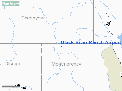
Black River Ranch Airport |
Location & QuickFacts
| FAA Information Effective: | 2008-09-25 |
| Airport Identifier: | 1MI3 |
| Airport Status: | Operational |
| Longitude/Latitude: | 084-19-18.0540W/45-11-45.0440N
-84.321682/45.195846 (Estimated) |
| Elevation: | 880 ft / 268.22 m (Estimated) |
| Land: | 0 acres |
| From nearest city: | 10 nautical miles SW of Onaway, MI |
| Location: | Montmorency County, MI |
| Magnetic Variation: | 06W (1985) |
Owner & Manager
| Ownership: | Privately owned |
| Owner: | Gerald Gillett |
| Address: | Black River Ranch
Onaway, MI 49765 |
| Phone number: | 517-733-8375 |
| Manager: | Andrew S. Zynda |
| Address: | Box 113
Williamston, MI 48895 |
| Phone number: | 517-655-2106 |
Airport Operations and Facilities
| Airport Use: | Private |
| Wind indicator: | No |
| Segmented Circle: | No |
| Control Tower: | No |
| Landing fee charge: | No |
| Sectional chart: | Lake Huron |
| Region: | AGL - Great Lakes |
| Boundary ARTCC: | ZMP - Minneapolis |
| Tie-in FSS: | LAN - Lansing |
| FSS on Airport: | No |
| FSS Toll Free: | 1-800-WX-BRIEF |
Airport Services
| Airframe Repair: | NONE |
| Power Plant Repair: | NONE |
Runway Information
Runway E/W
| Dimension: | 3900 x 60 ft / 1188.7 x 18.3 m |
| Surface: | ASPH, |
| |
Runway E |
Runway W |
| Traffic Pattern: | Left | Left |
|
Radio Navigation Aids
| ID |
Type |
Name |
Ch |
Freq |
Var |
Dist |
| PZQ | NDB | Rogers City | | 215.00 | 07W | 24.6 nm |
| BFA | NDB | Boyne Falls | | 263.00 | 06W | 25.5 nm |
| GYG | NDB | Grayling | | 359.00 | 06W | 34.4 nm |
| CVX | NDB | Charlevoix | | 392.00 | 05W | 40.6 nm |
| CXK | NDB | Clam Lake | | 251.00 | 05W | 42.9 nm |
| CGG | VOR | Grayling | | 109.80 | 06W | 35.4 nm |
| GLR | VOR/DME | Gaylord | 029X | 109.20 | 06W | 19.6 nm |
| PLN | VORTAC | Pellston | 055X | 111.80 | 06W | 29.9 nm |
| APN | VORTAC | Alpena | 025X | 108.80 | 07W | 33.1 nm |
Remarks
- ESTABLISHED PRIOR TO 1959
Images and information placed above are from
http://www.airport-data.com/airport/1MI3/
We thank them for the data!
| General Info
|
| Country |
United States
|
| State |
MICHIGAN
|
| FAA ID |
1MI3
|
| Latitude |
45-11-45.044N
|
| Longitude |
084-19-18.054W
|
| Elevation |
880 feet
|
| Near City |
ONAWAY
|
We don't guarantee the information is fresh and accurate. The data may
be wrong or outdated.
For more up-to-date information please refer to other sources.
|
|


