 |
|
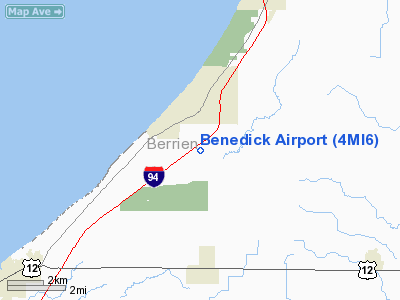
Location & QuickFacts
| FAA Information Effective: | 2008-09-25 |
| Airport Identifier: | 4MI6 |
| Airport Status: | Operational |
| Longitude/Latitude: | 086-36-52.0820W/41-51-28.1530N
-86.614467/41.857820 (Estimated) |
| Elevation: | 660 ft / 201.17 m (Estimated) |
| Land: | 0 acres |
| From nearest city: | 3 nautical miles N of Three Oaks, MI |
| Location: | Berrien County, MI |
| Magnetic Variation: | 02W (1990) |
Owner & Manager
| Ownership: | Privately owned |
| Owner: | Richard J Benedick |
| Address: | 14418 Three Oaks Rd
Three Oaks, MI 49128 |
| Phone number: | 616-469-1558 |
| Address: |
|
Airport Operations and Facilities
| Airport Use: | Private |
| Wind indicator: | Yes |
| Segmented Circle: | No |
| Control Tower: | No |
| Sectional chart: | Chicago |
| Region: | AGL - Great Lakes |
| Boundary ARTCC: | ZAU - Chicago |
| Tie-in FSS: | LAN - Lansing |
| FSS Toll Free: | 1-800-WX-BRIEF |
Runway Information
Runway 09/27
| Dimension: | 2300 x 50 ft / 701.0 x 15.2 m |
| Surface: | TURF,
SOFT WHEN WET & UNUSBL DURING EARLY SPRING DUE TO THAW; MODERATELY ROLLING TERRAIN. |
| |
Runway 09 |
Runway 27 |
| Traffic Pattern: | Left | Left |
| Obstruction: | | 15 ft road |
|
Radio Navigation Aids
| ID |
Type |
Name |
Ch |
Freq |
Var |
Dist |
| MGC | NDB | Michigan City | | 203.00 | 01W | 12.8 nm |
| IUL | NDB | La Porte | | 356.00 | 03W | 22.7 nm |
| VP | NDB | Sedly | | 212.00 | 02W | 27.1 nm |
| CPB | NDB | Culver | | 391.00 | 01W | 39.9 nm |
| RWN | NDB | Winamac/dcmsnd | | 335.00 | 00W | 45.9 nm |
| HAI | NDB | Three Rivers | | 407.00 | 02W | 46.2 nm |
| MX | NDB | Kedzi | | 248.00 | 01W | 48.7 nm |
| ELX | VOR/DME | Keeler | 113X | 116.60 | 00E | 27.9 nm |
| OXI | VOR/DME | Knox | 103X | 115.60 | 00E | 32.2 nm |
| PMM | VOR/DME | Pullman | 058X | 112.10 | 00E | 43.0 nm |
| GIJ | VORTAC | Gipper | 101X | 115.40 | 00E | 14.3 nm |
| GSH | VORTAC | Goshen | 084X | 113.70 | 00E | 33.1 nm |
| CGT | VORTAC | Chicago Heights | 089X | 114.20 | 02E | 47.8 nm |
Remarks
- CLEAR 125' EITHER SIDE OF CNTRLN & 200' END OF RY; OBS REMOVED/LOWERED OR THR DSPLCD TO PRVD 20:1 SLOPE.
Images and information placed above are from
http://www.airport-data.com/airport/4MI6/
We thank them for the data!
| General Info
|
| Country |
United States
|
| State |
MICHIGAN
|
| FAA ID |
4MI6
|
| Latitude |
41-51-28.153N
|
| Longitude |
086-36-52.082W
|
| Elevation |
660 feet
|
| Near City |
THREE OAKS
|
We don't guarantee the information is fresh and accurate. The data may
be wrong or outdated.
For more up-to-date information please refer to other sources.
|
|


