 |
|
Location & QuickFacts
| FAA Information Effective: | 2008-09-25 |
| Airport Identifier: | 6B3 |
| Airport Status: | Operational |
| Longitude/Latitude: | 084-00-18.2000W/43-02-26.5000N
-84.005056/43.040694 (Estimated) |
| Elevation: | 740 ft / 225.55 m (Estimated) |
| Land: | 70 acres |
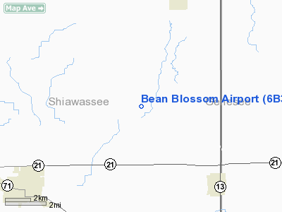
| From nearest city: | 5 nautical miles SW of New Lothrop, MI |
| Location: | Shiawassee County, MI |
| Magnetic Variation: | 06W (1995) |
Owner & Manager
| Ownership: | Privately owned |
| Owner: | Neil H. Campbell |
| Address: | 8100 E. Cronk Road
Corunna, MI 48817 |
| Phone number: | 810-638-5017 |
| Manager: | Neil H. Campbell |
| Address: | 8100 E. Cronk Road
Corunna, MI 48817 |
| Phone number: | 810-638-5017 |
Airport Operations and Facilities
| Airport Use: | Open to public |
| Wind indicator: | Yes |
| Segmented Circle: | No |
| Control Tower: | No |
| Sectional chart: | Detroit |
| Region: | AGL - Great Lakes |
| Boundary ARTCC: | ZOB - Cleveland |
| Tie-in FSS: | LAN - Lansing |
| FSS on Airport: | No |
| FSS Toll Free: | 1-800-WX-BRIEF |
| NOTAMs Facility: | LAN (NOTAM-d service avaliable) |
Airport Communications
Airport Services
Runway Information
Runway 03/21
| Dimension: | 1900 x 80 ft / 579.1 x 24.4 m |
| Surface: | TURF, Fair Condition |
| |
Runway 03 |
Runway 21 |
| Longitude: | 084-00-24.0100W | 084-00-12.4600W |
| Latitude: | 43-02-18.0700N | 43-02-34.8300N |
| Traffic Pattern: | Left | Left |
| Obstruction: | 57 ft trees, 228.0 ft from runway, 95 ft right of centerline, 4:1 slope to clear | 24 ft pline, 490.0 ft from runway, 20:1 slope to clear |
|
Radio Navigation Aids
| ID |
Type |
Name |
Ch |
Freq |
Var |
Dist |
| HYX | NDB | Browne | | 385.00 | 06W | 24.4 nm |
| OZW | NDB | Howell | | 243.00 | 05W | 24.5 nm |
| AMN | NDB | Alma | | 329.00 | 05W | 38.2 nm |
| MBS | VOR/DME | Saginaw | 076X | 112.90 | 03W | 29.7 nm |
| MOP | VOR/DME | Mount Pleasant | 043X | 110.60 | 05W | 47.4 nm |
| FNT | VORTAC | Flint | 116X | 116.90 | 06W | 12.2 nm |
| PSI | VORTAC | Pontiac | 047X | 111.00 | 03W | 29.2 nm |
| LAN | VORTAC | Lansing | 045X | 110.80 | 05W | 36.2 nm |
| SVM | VORTAC | Salem | 090X | 114.30 | 03W | 42.1 nm |
Remarks
- PRVDD THE AREA 125 FT EITHER SIDE OF RY & 200 FT OFF RY ENDS IS CLEAR; ANY OBSTN IN APCH ARE REMOVED OR LOWERED OR THLD DSPLCD TO PROVIDE A CLEAR 20:1 APCH.
Images and information placed above are from
http://www.airport-data.com/airport/6B3/
We thank them for the data!
| General Info
|
| Country |
United States
|
| State |
MICHIGAN
|
| FAA ID |
6B3
|
| Latitude |
43-02-25.000N
|
| Longitude |
084-00-34.000W
|
| Elevation |
740 feet
|
| Near City |
NEW LOTHROP
|
We don't guarantee the information is fresh and accurate. The data may
be wrong or outdated.
For more up-to-date information please refer to other sources.
|
|


