 |
|
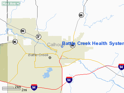
Battle Creek Health System Helistop Heliport |
Location & QuickFacts
| FAA Information Effective: | 2008-09-25 |
| Airport Identifier: | MI69 |
| Airport Status: | Operational |
| Longitude/Latitude: | 085-10-43.9720W/42-19-51.1460N
-85.178881/42.330874 (Estimated) |
| Elevation: | 855 ft / 260.60 m (Estimated) |
| Land: | 0 acres |
| From nearest city: | 1 nautical miles N of Battle Creek, MI |
| Location: | Calhoun County, MI |
| Magnetic Variation: | 04W (1985) |
Owner & Manager
| Ownership: | Privately owned |
| Owner: | Battle Creek Health System |
| Address: | 300 North Avenue
Battle Creek, MI 49016 |
| Phone number: | 616-966-8000 |
| Manager: | Dan Dahmen |
| Address: | 300 North Ave
Battle Creek, MI 49016 |
| Phone number: | 616-964-5921 |
Airport Operations and Facilities
| Airport Use: | Private
MEDICAL USE. |
| Wind indicator: | Yes |
| Segmented Circle: | No |
| Control Tower: | No |
| Lighting Schedule: | PHONE REQ
FOR PERIMETER LGTS CALL AMGR ON 616-964-5921. |
| Landing fee charge: | No |
| Sectional chart: | Chicago |
| Region: | AGL - Great Lakes |
| Boundary ARTCC: | ZAU - Chicago |
| Tie-in FSS: | LAN - Lansing |
| FSS on Airport: | No |
| FSS Toll Free: | 1-800-WX-BRIEF |
Runway Information
Helipad H1
| Dimension: | 80 x 80 ft / 24.4 x 24.4 m |
| Surface: | CONC, |
| |
Runway H1 |
Runway |
| Traffic Pattern: | Right | Left |
|
Radio Navigation Aids
| ID |
Type |
Name |
Ch |
Freq |
Var |
Dist |
| BT | NDB | Batol | | 272.00 | 04W | 1.9 nm |
| HAI | NDB | Three Rivers | | 407.00 | 02W | 29.0 nm |
| IRS | NDB | Sturgis | | 382.00 | 04W | 33.1 nm |
| ANQ | NDB | Angola | | 347.00 | 05W | 41.7 nm |
| AZO | VOR/DME | Kalamazoo | 027X | 109.00 | 01W | 17.6 nm |
| LFD | VOR/DME | Litchfield | 049X | 111.20 | 05W | 24.5 nm |
| GRR | VOR/DME | Grand Rapids | 106Y | 115.95 | 04W | 30.8 nm |
| JXN | VOR/DME | Jackson | 033X | 109.60 | 05W | 32.3 nm |
| PMM | VOR/DME | Pullman | 058X | 112.10 | 00E | 41.9 nm |
| ELX | VOR/DME | Keeler | 113X | 116.60 | 00E | 43.5 nm |
| BTL | VORTAC | Battle Creek | 031X | 109.40 | 02W | 3.5 nm |
| LAN | VORTAC | Lansing | 045X | 110.80 | 05W | 31.5 nm |
Remarks
- NO FUEL SUPPLY, NO REPAIR FACILITIES.
- ALL INGRESS/EGRESS OPERATIONS ARE CONDUCTED EAST OR WEST OF THE HELISTOP.
Images and information placed above are from
http://www.airport-data.com/airport/MI69/
We thank them for the data!
| General Info
|
| Country |
United States
|
| State |
MICHIGAN
|
| FAA ID |
MI69
|
| Latitude |
42-19-51.146N
|
| Longitude |
085-10-43.972W
|
| Elevation |
855 feet
|
| Near City |
BATTLE CREEK
|
We don't guarantee the information is fresh and accurate. The data may
be wrong or outdated.
For more up-to-date information please refer to other sources.
|
|


