 |
|
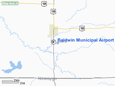
Baldwin Municipal Airport |
Location & QuickFacts
| FAA Information Effective: | 2008-09-25 |
| Airport Identifier: | 7D3 |
| Airport Status: | Operational |
| Longitude/Latitude: | 085-50-31.6450W/43-52-31.7550N
-85.842124/43.875487 (Estimated) |
| Elevation: | 828 ft / 252.37 m (Estimated) |
| Land: | 135 acres |
| From nearest city: | 2 nautical miles S of Baldwin, MI |
| Location: | Lake County, MI |
| Magnetic Variation: | 04W (1985) |
Owner & Manager
| Ownership: | Publicly owned |
| Owner: | Village Of Baldwin |
| Address: | Po Box 339
Baldwin, MI 49304 |
| Phone number: | 231-745-3587 |
| Manager: | James Rock |
| Address: | P.o. Box 909
Baldwin, MI 49304 |
| Phone number: | 231-745-4511
AMGR HOME PHONE 231-745-7453/WORK 231-745-4511. |
Airport Operations and Facilities
| Airport Use: | Open to public |
| Wind indicator: | Yes |
| Segmented Circle: | Yes |
| Control Tower: | No |
| Landing fee charge: | No |
| Sectional chart: | Chicago |
| Region: | AGL - Great Lakes |
| Boundary ARTCC: | ZMP - Minneapolis |
| Tie-in FSS: | LAN - Lansing |
| FSS on Airport: | No |
| FSS Toll Free: | 1-800-WX-BRIEF |
| NOTAMs Facility: | LAN (NOTAM-d service avaliable) |
| Federal Agreements: | GSY |
Airport Communications
Airport Services
| Airframe Repair: | NONE |
| Power Plant Repair: | NONE |
| Bottled Oxygen: | NONE |
| Bulk Oxygen: | NONE |
Runway Information
Runway 05/23
| Dimension: | 2800 x 100 ft / 853.4 x 30.5 m |
| Surface: | TURF, Fair Condition
CONSIDERABLE PAVEMENT CRACKING WITH VEGETATION GROWING THROUGH CRACKS. |
| |
Runway 05 |
Runway 23 |
| Longitude: | 085-51-01.8420W | 085-50-33.7050W |
| Latitude: | 43-52-24.4630N | 43-52-43.2210N |
| Alignment: | 47 | 127 |
| Traffic Pattern: | Left | Left |
| Displaced threshold: | 800.00 ft | 800.00 ft |
| Runway End Identifier: | No | No |
| Centerline Lights: | No | No |
| Touchdown Lights: | No | No |
| Obstruction: | 62 ft trees, 375.0 ft from runway, 130 ft left of centerline, 6:1 slope to clear
APCH RATIO 20:1 AT DSPLCD THLD. | 53 ft trees, 276.0 ft from runway, 126 ft left of centerline, 5:1 slope to clear
APCH RATIO 20:1 AT DSPLCD THLD. |
|
Runway 09/27
| Dimension: | 3800 x 75 ft / 1158.2 x 22.9 m |
| Surface: | ASPH, Poor Condition
CONSIDERABLE PAVEMENT CRACKING WITH VEGETATION GROWING THROUGH CRACKS. |
| Weight Limit: | Single wheel: 10000 lbs. |
| |
Runway 09 |
Runway 27 |
| Longitude: | 085-50-45.6370W | 085-49-53.8840W |
| Latitude: | 43-52-31.5000N | 43-52-28.9350N |
| Elevation: | 818.00 ft | 828.00 ft |
| Alignment: | 94 | 127 |
| Traffic Pattern: | Left | Left |
| Markings: | Basic, Poor Condition
RY 09 MARKINGS FADED AND OBSCURED BY VEGETATION. | Basic, Poor Condition |
| Runway End Identifier: | No | No |
| Centerline Lights: | No | No |
| Touchdown Lights: | No | No |
| Obstruction: | 68 ft trees, 1575.0 ft from runway, 20:1 slope to clear | 50 ft trees, 1205.0 ft from runway, 20:1 slope to clear |
|
Radio Navigation Aids
| ID |
Type |
Name |
Ch |
Freq |
Var |
Dist |
| LDM | NDB | Ludington | | 341.00 | 03W | 25.1 nm |
| CAD | NDB | Cadillac | | 269.00 | 04W | 30.3 nm |
| HIC | VOR/DME | White Cloud | 123X | 117.60 | 01W | 18.9 nm |
| MBL | VOR/DME | Manistee | 051X | 111.40 | 05W | 29.7 nm |
| MKG | VORTAC | Muskegon | 099X | 115.20 | 01W | 43.3 nm |
| TVC | VORTAC | Traverse City | 093X | 114.60 | 02W | 49.3 nm |
Remarks
Images and information placed above are from
http://www.airport-data.com/airport/7D3/
We thank them for the data!
| General Info
|
| Country |
United States
|
| State |
MICHIGAN
|
| FAA ID |
7D3
|
| Latitude |
43-52-31.755N
|
| Longitude |
085-50-31.645W
|
| Elevation |
828 feet
|
| Near City |
BALDWIN
|
We don't guarantee the information is fresh and accurate. The data may
be wrong or outdated.
For more up-to-date information please refer to other sources.
|
|


