 |
|
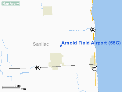
Location & QuickFacts
| FAA Information Effective: | 2008-09-25 |
| Airport Identifier: | 55G |
| Airport Status: | Operational |
| Longitude/Latitude: | 082-36-23.7350W/43-17-52.0900N
-82.606593/43.297803 (Estimated) |
| Elevation: | 780 ft / 237.74 m (Estimated) |
| Land: | 160 acres |
| From nearest city: | 2 nautical miles NE of Croswell, MI |
| Location: | Sanilac County, MI |
| Magnetic Variation: | 07W (1985) |
Owner & Manager
| Ownership: | Privately owned |
| Owner: | Robert Perry |
| Address: | 4343 Croswell Rd
Croswell, MI 48422 |
| Phone number: | 810-679-2487 |
| Manager: | Bart Perry |
| Address: | 4343 Croswell Road
Croswell, MI 48422 |
| Phone number: | 810-679-2487 |
Airport Operations and Facilities
| Airport Use: | Open to public |
| Wind indicator: | Yes |
| Segmented Circle: | No |
| Control Tower: | No |
| Landing fee charge: | No |
| Sectional chart: | Detroit |
| Region: | AGL - Great Lakes |
| Boundary ARTCC: | ZOB - Cleveland |
| Tie-in FSS: | LAN - Lansing |
| FSS on Airport: | No |
| FSS Toll Free: | 1-800-WX-BRIEF |
| NOTAMs Facility: | LAN (NOTAM-d service avaliable) |
Airport Communications
| CTAF: | 122.800 |
| Unicom: | 122.800
UNICOM NOT REGULARLY MONITORED. |
Airport Services
| Bottled Oxygen: | NONE |
| Bulk Oxygen: | NONE |
Runway Information
Runway 07/25
| Dimension: | 2570 x 75 ft / 783.3 x 22.9 m |
| Surface: | TURF, Good Condition |
| |
Runway 07 |
Runway 25 |
| Longitude: | 082-36-40.9800W | 082-36-08.2200W |
| Latitude: | 43-17-46.7400N | 43-17-55.2000N |
| Elevation: | 780.00 ft | 780.00 ft |
| Traffic Pattern: | Left | Left |
| Markings: | None,
RY 07 DSPLCD THLD MKD WITH 3 FT BOARDS, RY 7/25 THLDS DEFINED BY MOWING. | None, |
| Displaced threshold: | 540.00 ft | 0.00 ft |
| Runway End Identifier: | No | No |
| Centerline Lights: | No | No |
| Touchdown Lights: | No | No |
| Obstruction: | 40 ft pline
RWY 07 APCH RATIO 10:1 AT DSPLCD THLD , +40' TREE 400' DST, 55' L. | 24 ft trees, 480.0 ft from runway, 20 ft right of centerline, 20:1 slope to clear |
|
Runway 18/36
| Dimension: | 2585 x 140 ft / 787.9 x 42.7 m |
| Surface: | TURF, Good Condition |
| |
Runway 18 |
Runway 36 |
| Longitude: | 082-36-29.1000W | 082-36-27.4200W |
| Latitude: | 43-18-04.8600N | 43-17-39.3600N |
| Elevation: | 780.00 ft | 780.00 ft |
| Traffic Pattern: | Left | Left |
| Displaced threshold: | 500.00 ft | 470.00 ft |
| Runway End Identifier: | No | No |
| Centerline Lights: | No | No |
| Touchdown Lights: | No | No |
| Obstruction: | 70 ft trees, 1250.0 ft from runway, 17:1 slope to clear
RWY 18 APCH RATIO 25:1 AT DSPLCD THLD. | 29 ft pline, 11.0 ft from runway, 97 ft left of centerline
RWY 36 APCH RATIO AT DSPLCD THLD 20:1; DSPLCD THLD 5 FT ABOVE END OF RY. |
|
Radio Navigation Aids
| ID |
Type |
Name |
Ch |
Freq |
Var |
Dist |
| ZR | NDB | Sarnia | | 404.00 | 06W | 27.0 nm |
| GD | NDB | Goderich | | 286.00 | 08W | 46.7 nm |
| MTC | TACAN | Selfridge | 064X | | 06W | 42.3 nm |
| BAX | VOR/DME | Bad Axe | 019X | 108.20 | 05W | 33.5 nm |
| ECK | VORTAC | Peck | 087X | 114.00 | 07W | 5.5 nm |
Remarks
- WINTER OPNS SKIS ONLY.
- ARPT CLSD NOV-MAR. WINTER OPNS SKIS ONLY.
- AIRSPACE CONDITIONED UPON ESTABLISHMENT OF COMPATIBLE TFC PATTERN W/ADJACENT ARPTS.
Images and information placed above are from
http://www.airport-data.com/airport/55G/
We thank them for the data!
| General Info
|
| Country |
United States
|
| State |
MICHIGAN
|
| FAA ID |
55G
|
| Latitude |
43-17-52.090N
|
| Longitude |
082-36-23.735W
|
| Elevation |
780 feet
|
| Near City |
CROSWELL
|
We don't guarantee the information is fresh and accurate. The data may
be wrong or outdated.
For more up-to-date information please refer to other sources.
|
|


