 |
|
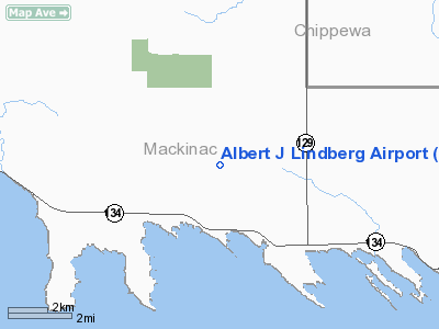
Albert J Lindberg Airport |
Location & QuickFacts
| FAA Information Effective: | 2008-09-25 |
| Airport Identifier: | 5Y1 |
| Airport Status: | Operational |
| Longitude/Latitude: | 084-25-11.1290W/46-02-09.0590N
-84.419758/46.035850 (Estimated) |
| Elevation: | 760 ft / 231.65 m (Estimated) |
| Land: | 160 acres |
| From nearest city: | 2 nautical miles N of Hessel, MI |
| Location: | Mackinac County, MI |
| Magnetic Variation: | 06W (1985) |
Owner & Manager
| Ownership: | Publicly owned |
| Owner: | Clark Township |
| Address: | Po Box 367
Cedarville, MI 49719
ARPT PHYSICAL ADDRESS: 2106 THREE MILE RD, MAIL ADDRESS: PO BOX 207, HESSEL MI 49745. |
| Phone number: | 906-484-2672 |
| Manager: | John Strehler |
| Address: | P.o. Box 367
Cedarville, MI 49719 |
| Phone number: | 906-484-2672
AMGR AFTR HRS 906-484-3228 OR 906-484-3028 |
Airport Operations and Facilities
| Airport Use: | Open to public |
| Wind indicator: | Yes |
| Segmented Circle: | Yes |
| Control Tower: | No |
| Lighting Schedule: | DUSK-DAWN
ACTVT MIRL RY 09/27 AND PAPI RYS 09 & 27 - CTAF. |
| Beacon Color: | Clear-Green (lighted land airport)
ROTG BCN OTS. |
| Landing fee charge: | No |
| Sectional chart: | Lake Huron |
| Region: | AGL - Great Lakes |
| Boundary ARTCC: | ZMP - Minneapolis |
| Responsible ARTCC: | ZYZ - Toronto |
| Tie-in FSS: | GRB - Green Bay |
| FSS on Airport: | No |
| FSS Toll Free: | 1-800-WX-BRIEF |
| NOTAMs Facility: | GRB (NOTAM-d service avaliable) |
Airport Communications
Airport Services
| Airframe Repair: | MAJOR |
| Power Plant Repair: | MAJOR |
Runway Information
Runway 09/27
| Dimension: | 3700 x 60 ft / 1127.8 x 18.3 m |
| Surface: | ASPH, Good Condition |
| Edge Lights: | Medium |
| |
Runway 09 |
Runway 27 |
| Longitude: | 084-25-35.9300W | 084-24-46.3100W |
| Latitude: | 46-02-09.0400N | 46-02-09.0400N |
| Elevation: | 760.00 ft | 760.00 ft |
| Traffic Pattern: | Left | Left |
| Markings: | Basic, Fair Condition | Basic, Fair Condition |
| Crossing Height: | 40.00 ft | 25.00 ft |
| Displaced threshold: | 200.00 ft | 0.00 ft |
| VASI: | 2-light PAPI on left side | 2-light PAPI on left side |
| Visual Glide Angle: | 4.00° | 3.50° |
| Obstruction: | 42 ft trees, 452.0 ft from runway, 170 ft right of centerline, 6:1 slope to clear
APCH RATIO 20:1 AT DSPLCD THLD. | 56 ft trees, 1320.0 ft from runway, 20:1 slope to clear |
|
Radio Navigation Aids
| ID |
Type |
Name |
Ch |
Freq |
Var |
Dist |
| CI | NDB | Koloe | | 400.00 | 06W | 18.5 nm |
| DRM | NDB | Drummond Island | | 218.00 | 07W | 28.3 nm |
| A | NDB | Gros Cap | | 286.00 | 06W | 29.8 nm |
| PZQ | NDB | Rogers City | | 215.00 | 07W | 45.5 nm |
| SSM | VOR/DME | Sault Ste Marie | 059X | 112.20 | 04W | 23.0 nm |
| ERY | VOR/DME | Newberry | 019X | 108.20 | 06W | 46.6 nm |
| PLN | VORTAC | Pellston | 055X | 111.80 | 06W | 26.4 nm |
Remarks
Images and information placed above are from
http://www.airport-data.com/airport/5Y1/
We thank them for the data!
| General Info
|
| Country |
United States
|
| State |
MICHIGAN
|
| FAA ID |
5Y1
|
| Latitude |
46-02-09.059N
|
| Longitude |
084-25-11.129W
|
| Elevation |
760 feet
|
| Near City |
HESSEL
|
We don't guarantee the information is fresh and accurate. The data may
be wrong or outdated.
For more up-to-date information please refer to other sources.
|
|


