 |
|
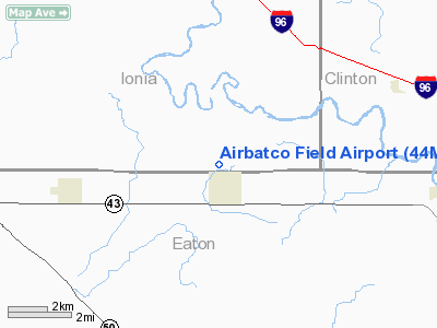
Location & QuickFacts
| FAA Information Effective: | 2008-09-25 |
| Airport Identifier: | 44MI |
| Airport Status: | Operational |
| Longitude/Latitude: | 084-53-59.9750W/42-46-25.1240N
-84.899993/42.773646 (Estimated) |
| Elevation: | 852 ft / 259.69 m (Surveyed) |
| Land: | 7 acres |
| From nearest city: | 1 nautical miles NW of Mulliken, MI |
| Location: | Ionia County, MI |
| Magnetic Variation: | 04W (1985) |
Owner & Manager
| Ownership: | Privately owned |
| Owner: | John C & Carla J Gallagher |
| Address: | 8633 Eaton Hwy
Mulliken, MI 48861 |
| Phone number: | 517-649-8717 |
| Manager: | John C Gallagher |
| Address: | 8633 Eaton Hwy
Mulliken, MI 48861 |
| Phone number: | 517-649-8717 |
Airport Operations and Facilities
| Airport Use: | Private |
| Wind indicator: | Yes |
| Segmented Circle: | No |
| Control Tower: | No |
| Landing fee charge: | No |
| Sectional chart: | Detroit |
| Region: | AGL - Great Lakes |
| Boundary ARTCC: | ZOB - Cleveland |
| Tie-in FSS: | LAN - Lansing |
| FSS on Airport: | No |
| FSS Toll Free: | 1-800-WX-BRIEF |
Airport Services
| Airframe Repair: | NONE |
| Power Plant Repair: | NONE |
| Bottled Oxygen: | NONE |
| Bulk Oxygen: | NONE |
Runway Information
Runway 18/36
| Dimension: | 2033 x 100 ft / 619.7 x 30.5 m |
| Surface: | TURF, Poor Condition
SFC ROUGH & IREG WITH ROLLING TERRAIN. |
| |
Runway 18 |
Runway 36 |
| Traffic Pattern: | Left | Left |
| Displaced threshold: | 383.00 ft | 0.00 ft |
| Runway End Identifier: | No | No |
| Centerline Lights: | No | No |
| Touchdown Lights: | No | No |
| Obstruction: | 50 ft trees
APCH RATIO 0:1 AT DSPLCD THR; +25 FT TREES 0 FT DSTC 50 FT LR. | 50 ft tree, 10.0 ft from runway, 50 ft left of centerline, 1:1 slope to clear |
|
Radio Navigation Aids
| ID |
Type |
Name |
Ch |
Freq |
Var |
Dist |
| BT | NDB | Batol | | 272.00 | 04W | 27.8 nm |
| AMN | NDB | Alma | | 329.00 | 05W | 33.4 nm |
| OZW | NDB | Howell | | 243.00 | 05W | 41.2 nm |
| GRR | VOR/DME | Grand Rapids | 106Y | 115.95 | 04W | 26.4 nm |
| JXN | VOR/DME | Jackson | 033X | 109.60 | 05W | 36.6 nm |
| LFD | VOR/DME | Litchfield | 049X | 111.20 | 05W | 43.2 nm |
| AZO | VOR/DME | Kalamazoo | 027X | 109.00 | 01W | 43.3 nm |
| LAN | VORTAC | Lansing | 045X | 110.80 | 05W | 9.5 nm |
| BTL | VORTAC | Battle Creek | 031X | 109.40 | 02W | 31.9 nm |
Remarks
- OCCASIONAL DEER ON RWY.
- NO SNOW REMOVAL
- ARPT CLSD APR & MAY.
Images and information placed above are from
http://www.airport-data.com/airport/44MI/
We thank them for the data!
| General Info
|
| Country |
United States
|
| State |
MICHIGAN
|
| FAA ID |
44MI
|
| Latitude |
42-46-25.124N
|
| Longitude |
084-53-59.975W
|
| Elevation |
852 feet
|
| Near City |
MULLIKEN
|
We don't guarantee the information is fresh and accurate. The data may
be wrong or outdated.
For more up-to-date information please refer to other sources.
|
|


