 |
|
|
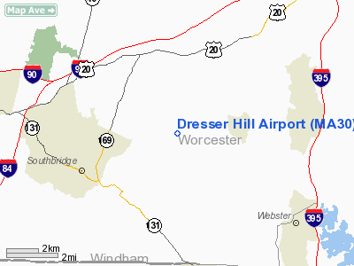
Location & QuickFacts
|
FAA
Information Effective: |
2008-09-25 |
|
Airport Identifier: |
MA30 |
|
Airport Status: |
Operational |
|
Longitude/Latitude: |
071-57-58.2650W/42-06-00.3420N
-71.966185/42.100095 (Estimated) |
|
Elevation: |
810 ft / 246.89 m (Estimated) |
|
Land: |
0 acres |
|
From
nearest city: |
0 nautical miles of Charlton, MA |
|
Location: |
Worcester County, MA |
|
Magnetic Variation: |
15W (1985) |
Owner & Manager
|
Ownership: |
Privately owned |
|
Owner: |
Lowell L. Baylies |
|
Address: |
189 Dresser Hill Rd.
Charlton, MA 01507 |
|
Phone number: |
508-248-4584 |
|
Manager: |
Lowell L. Baylies |
|
Address: |
189 Dresser Hill Rd.
Charlton, MA 01507 |
|
Phone number: |
508-248-4584 |
Airport Operations and
Facilities
|
Airport Use: |
Private |
|
Wind indicator: |
Yes |
|
Segmented Circle: |
No |
|
Control Tower: |
No |
|
Landing fee charge: |
No |
|
Sectional chart: |
New York |
|
Region: |
ANE - New England |
|
Boundary ARTCC: |
ZBW - Boston |
|
Tie-in FSS: |
BDR - Bridgeport |
|
FSS on Airport: |
No |
|
FSS Toll Free: |
1-800-WX-BRIEF |
Airport Services
|
Airframe Repair: |
NONE |
|
Power Plant Repair: |
NONE |
|
Runway Information
Runway N/S
|
Dimension: |
2000 x 300 ft / 609.6 x 91.4 m |
|
Surface: |
TURF, |
|
|
Runway N
|
Runway S
|
|
Traffic Pattern: |
Left |
Left |
|
Radio Navigation Aids
|
ID |
Type |
Name |
Ch |
Freq |
Var |
Dist |
|
ORW |
FAN MARKER |
Canton |
|
|
15W |
36.4 nm |
|
SFZ |
NDB |
Central |
|
241.00 |
15W |
23.9 nm |
|
FIT |
NDB |
Fitchburg |
|
365.00 |
15W |
28.6 nm |
|
ORE |
NDB |
Orange |
|
205.00 |
15W |
31.5 nm |
|
IHM |
NDB |
Mansfield |
|
220.00 |
16W |
34.8 nm |
|
HF |
NDB |
Lomis |
|
244.00 |
15W |
40.6 nm |
|
SKR |
NDB |
Shaker Hill |
|
251.00 |
16W |
41.0 nm |
|
TAN |
NDB |
Taunton |
|
227.00 |
16W |
44.5 nm |
|
AS |
NDB |
Chern |
|
359.00 |
16W |
46.4 nm |
|
LQ |
NDB |
Lyndy |
|
382.00 |
16W |
49.4 nm |
|
NZW |
TACAN |
South Weymouth |
061X |
|
15W |
45.9 nm |
|
PUT |
VOR/DME |
Putnam |
121X |
117.40 |
14W |
10.3 nm |
|
ORW |
VOR/DME |
Norwich |
037X |
110.00 |
14W |
32.7 nm |
|
HFD |
VOR/DME |
Hartford |
096X |
114.90 |
13W |
37.9 nm |
|
CTR |
VOR/DME |
Chester |
098X |
115.10 |
13W |
45.3 nm |
|
GON |
VOR/DME |
Groton |
45Y |
110.85 |
14W |
46.4 nm |
|
CEF |
VORTAC |
Westover |
87X |
114.00 |
14W |
25.6 nm |
|
GDM |
VORTAC |
Gardner |
043X |
110.60 |
14W |
27.1 nm |
|
PVD |
VORTAC |
Providence |
103X |
115.60 |
14W |
33.0 nm |
|
BAF |
VORTAC |
Barnes |
077X |
113.00 |
14W |
33.6 nm |
|
BDL |
VORTAC |
Bradley |
027X |
109.00 |
14W |
33.6 nm |
|
EEN |
VORTAC |
Keene |
031X |
109.40 |
14W |
44.2 nm |
|
BOS |
VORTAC |
Boston |
074X |
112.70 |
16W |
46.1 nm |
|
ORH |
VOT |
Worcester |
|
108.20 |
|
10.9 nm |
|
PVD |
VOT |
Providence |
|
108.20 |
|
33.1 nm |
|
BDL |
VOT |
Bradley Intl |
|
111.40 |
|
33.5 nm |
|
BED |
VOT |
Laurence G Hanscom Fld |
|
110.00 |
|
37.4 nm |
|
HFD |
VOT |
Hartford |
|
108.20 |
|
37.7 nm |
|
BOS |
VOT |
Boston Logan Intl |
|
111.00 |
|
45.2 nm |
|
GON |
VOT |
Groton |
|
110.25 |
|
46.7 nm |
Remarks
-
NON-COMPLIANCE WITH FAR
157
Based Aircraft
|
Aircraft
based on field: |
2 |
|
Single
Engine Airplanes: |
2 |
Dresser Hill Airport
Address:
Worcester County, MA
Tel:
508-248-4584
Images
and information placed above are from
http://www.airport-data.com/airport/MA30/
We
thank them for the data!
| General Info |
| Country |
United States |
| State |
MASSACHUSETTS |
| FAA ID |
MA30 |
| Latitude |
42-06-00.342N |
| Longitude |
071-57-58.265W |
| Elevation |
810 feet |
| Near City |
CHARLTON |
We don't guarantee the information is fresh and accurate. The data may
be wrong or outdated.
For more up-to-date information please refer to other sources.
|
|


