 |
|
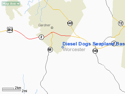
Diesel Dogs Seaplane Base |
|
Location & QuickFacts
|
FAA
Information Effective: |
2008-09-25 |
|
Airport Identifier: |
MA40 |
|
Airport Status: |
Operational |
|
Longitude/Latitude: |
071-58-06.2760W/42-32-36.3210N
-71.968410/42.543422 (Estimated) |
|
Elevation: |
325 ft / 99.06 m (Estimated) |
|
Land: |
0 acres |
|
From
nearest city: |
1 nautical miles SE of Gardner, MA |
|
Location: |
Worcester County, MA |
|
Magnetic Variation: |
15W (1995) |
Owner & Manager
|
Ownership: |
Privately owned |
|
Owner: |
Wendell Lehman |
|
Address: |
253 Lovewell St
Gardner, MA 01440 |
|
Phone number: |
978-632-9794 |
|
Manager: |
Wendell Lehman |
|
Address: |
253 Lovewell St
Gardner, MA 01440 |
|
Phone number: |
978-632-9794 |
Airport Operations and Facilities
|
Airport Use: |
Private |
|
Segmented Circle: |
No |
|
Control Tower: |
No |
|
Sectional chart: |
New York |
|
Region: |
ANE - New England |
|
Boundary ARTCC: |
ZBW - Boston |
|
Tie-in FSS: |
BDR - Bridgeport |
|
FSS
Toll Free: |
1-800-WX-BRIEF |
|
Runway Information
Runway 09W/27W
|
Dimension: |
3000 x 150 ft / 914.4 x 45.7 m |
|
Surface: |
WATER, |
|
|
Runway 09W
|
Runway 27W
|
|
Traffic Pattern: |
Left |
Left |
|
Runway 11W/29W
|
Dimension: |
4000 x 150 ft / 1219.2 x 45.7 m |
|
Surface: |
WATER, |
|
|
Runway 11W
|
Runway 29W
|
|
Traffic Pattern: |
Left |
Left |
|
Runway 15W/33W
|
Dimension: |
4000 x 150 ft / 1219.2 x 45.7 m |
|
Surface: |
WATER, |
|
|
Runway 15W
|
Runway 33W
|
|
Traffic Pattern: |
Left |
Left |
|
Radio Navigation Aids
|
ID |
Type |
Name |
Ch |
Freq |
Var |
Dist |
|
ORW |
FAN MARKER |
Canton |
|
|
15W |
43.0 nm |
|
BVY |
FAN MARKER |
Beverly |
|
|
|
45.6 nm |
|
FIT |
NDB |
Fitchburg |
|
365.00 |
15W |
9.4 nm |
|
ORE |
NDB |
Orange |
|
205.00 |
15W |
14.1 nm |
|
AS |
NDB |
Chern |
|
359.00 |
16W |
23.3 nm |
|
DRY |
NDB |
Derry |
|
338.00 |
16W |
32.0 nm |
|
SKR |
NDB |
Shaker Hill |
|
251.00 |
16W |
35.4 nm |
|
CO |
NDB |
Epsom |
|
216.00 |
16W |
41.4 nm |
|
SFZ |
NDB |
Central |
|
241.00 |
15W |
43.2 nm |
|
LQ |
NDB |
Lyndy |
|
382.00 |
16W |
44.9 nm |
|
TOF |
NDB |
Topsfield |
|
269.00 |
16W |
45.0 nm |
|
VWD |
NDB |
Mount Snow |
|
224.00 |
15W |
45.8 nm |
|
IHM |
NDB |
Mansfield |
|
220.00 |
16W |
47.3 nm |
|
MHT |
VOR/DME |
Manchester |
091X |
114.40 |
15W |
32.9 nm |
|
PUT |
VOR/DME |
Putnam |
121X |
117.40 |
14W |
35.8 nm |
|
LWM |
VOR/DME |
Lawrence |
072X |
112.50 |
15W |
40.4 nm |
|
CTR |
VOR/DME |
Chester |
098X |
115.10 |
13W |
46.1 nm |
|
GDM |
VORTAC |
Gardner |
043X |
110.60 |
14W |
4.0 nm |
|
EEN |
VORTAC |
Keene |
031X |
109.40 |
14W |
20.8 nm |
|
CEF |
VORTAC |
Westover |
87X |
114.00 |
14W |
32.3 nm |
|
BAF |
VORTAC |
Barnes |
077X |
113.00 |
14W |
40.4 nm |
|
CON |
VORTAC |
Concord |
076X |
112.90 |
15W |
44.2 nm |
|
BOS |
VORTAC |
Boston |
074X |
112.70 |
16W |
44.8 nm |
|
BDL |
VORTAC |
Bradley |
027X |
109.00 |
14W |
48.4 nm |
|
ORH |
VOT |
Worcester |
|
108.20 |
|
17.2 nm |
|
BED |
VOT |
Laurence G Hanscom Fld |
|
110.00 |
|
30.5 nm |
|
BOS |
VOT |
Boston Logan Intl |
|
111.00 |
|
43.2 nm |
|
BDL |
VOT |
Bradley Intl |
|
111.40 |
|
48.3 nm |
Remarks
-
PRVDD
PROPONENT ENSURES NO CONFLICTS WITH TFC PATTERN AT GARDNER MUNI ARPT; VFR
OPNS ONLY; ALL UNDERWATER HAZARD AREAS MKD WITH BUOYS; AND ALL USERS ARE
NOTIFIED & COMPLY WITH THESE CONDITIONS.
Diesel Dogs Seaplane Base
Address:
Worcester County, MA
Tel:
978-632-9794
Images
and information placed above are from
http://www.airport-data.com/airport/MA40/
We
thank them for the data!
| General Info |
| Country |
United States |
| State |
MASSACHUSETTS |
| FAA ID |
MA40 |
| Latitude |
42-32-36.321N |
| Longitude |
071-58-06.276W |
| Elevation |
325 feet |
| Near City |
GARDNER |
We don't guarantee the information is fresh and accurate. The data may
be wrong or outdated.
For more up-to-date information please refer to other sources.
|
|


