 |
|
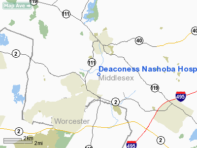
Deaconess Nashoba Hospital Heliport |
|
|
|
Location & QuickFacts
|
FAA
Information Effective: |
2008-09-25 |
|
Airport Identifier: |
1MA1 |
|
Airport Status: |
Operational |
|
Longitude/Latitude: |
071-34-26.2410W/42-34-35.3260N
-71.573956/42.576479 (Estimated) |
|
Elevation: |
308 ft / 93.88 m (Estimated) |
|
Land: |
0 acres |
|
From
nearest city: |
0 nautical miles N of Ayer, MA |
|
Location: |
Middlesex County, MA |
|
Magnetic Variation: |
16W (1985) |
Owner & Manager
|
Ownership: |
Privately owned |
|
Owner: |
Deaconess Nashoba Hospital |
|
Address: |
200 Groton Road
Ayer, MA 01432 |
|
Phone number: |
978-784-9361 |
|
Manager: |
Mitchell Wood
DIRECTOR, SUPPORT SERVICES. |
|
Address: |
200 Groton Road
Ayer, MA 01432 |
|
Phone number: |
978-784-9361 |
Airport Operations and Facilities
|
Airport Use: |
Private
MEDICAL USE. |
|
Wind
indicator: |
Yes |
|
Segmented Circle: |
No |
|
Control Tower: |
No |
|
Lighting Schedule: |
PHONE REQ
FOR PERIMETER LGTS CALL 978-784-9000. |
|
Landing fee charge: |
No |
|
Sectional chart: |
New York |
|
Region: |
ANE - New England |
|
Boundary ARTCC: |
ZBW - Boston |
|
Tie-in FSS: |
BDR - Bridgeport |
|
FSS
on Airport: |
No |
|
FSS
Toll Free: |
1-800-WX-BRIEF |
|
Runway Information
Helipad H1
|
Dimension: |
40 x 40 ft / 12.2 x 12.2 m |
|
Surface: |
CONC, |
|
|
Runway H1
|
Runway
|
|
Traffic Pattern: |
Left |
Left |
|
Obstruction: |
20 ft bldg, 140.0 ft from runway |
|
|
Radio Navigation Aids
|
ID |
Type |
Name |
Ch |
Freq |
Var |
Dist |
|
BVY |
FAN MARKER |
Beverly |
|
|
|
28.0 nm |
|
ORW |
FAN MARKER |
Canton |
|
|
15W |
31.3 nm |
|
FIT |
NDB |
Fitchburg |
|
365.00 |
15W |
8.3 nm |
|
AS |
NDB |
Chern |
|
359.00 |
16W |
14.9 nm |
|
SKR |
NDB |
Shaker Hill |
|
251.00 |
16W |
19.0 nm |
|
DRY |
NDB |
Derry |
|
338.00 |
16W |
19.3 nm |
|
TOF |
NDB |
Topsfield |
|
269.00 |
16W |
27.4 nm |
|
LQ |
NDB |
Lyndy |
|
382.00 |
16W |
28.1 nm |
|
ORE |
NDB |
Orange |
|
205.00 |
15W |
31.5 nm |
|
CO |
NDB |
Epsom |
|
216.00 |
16W |
33.0 nm |
|
IHM |
NDB |
Mansfield |
|
220.00 |
16W |
38.3 nm |
|
SFZ |
NDB |
Central |
|
241.00 |
15W |
39.7 nm |
|
TAN |
NDB |
Taunton |
|
227.00 |
16W |
48.8 nm |
|
IMR |
NDB |
Marshfield |
|
368.00 |
16W |
49.2 nm |
|
NZW |
TACAN |
South Weymouth |
061X |
|
15W |
38.2 nm |
|
MHT |
VOR/DME |
Manchester |
091X |
114.40 |
15W |
19.7 nm |
|
LWM |
VOR/DME |
Lawrence |
072X |
112.50 |
15W |
23.4 nm |
|
PUT |
VOR/DME |
Putnam |
121X |
117.40 |
14W |
39.2 nm |
|
PSM |
VOR/DME |
Pease |
112X |
116.50 |
16W |
44.7 nm |
|
GDM |
VORTAC |
Gardner |
043X |
110.60 |
14W |
21.5 nm |
|
BOS |
VORTAC |
Boston |
074X |
112.70 |
16W |
29.1 nm |
|
EEN |
VORTAC |
Keene |
031X |
109.40 |
14W |
34.3 nm |
|
CON |
VORTAC |
Concord |
076X |
112.90 |
15W |
38.7 nm |
|
CEF |
VORTAC |
Westover |
87X |
114.00 |
14W |
48.0 nm |
|
BED |
VOT |
Laurence G Hanscom Fld |
|
110.00 |
|
14.2 nm |
|
ORH |
VOT |
Worcester |
|
108.20 |
|
22.7 nm |
|
BOS |
VOT |
Boston Logan Intl |
|
111.00 |
|
27.3 nm |
Remarks
Deaconess Nashoba Hospital Heliport
Address:
Middlesex County, MA
Tel:
978-784-9361
Images
and information placed above are from
http://www.airport-data.com/airport/1MA1/
We
thank them for the data!
| General Info |
| Country |
United States |
| State |
MASSACHUSETTS |
| FAA ID |
1MA1 |
| Latitude |
42-34-35.326N |
| Longitude |
071-34-26.241W |
| Elevation |
308 feet |
| Near City |
AYER |
We don't guarantee the information is fresh and accurate. The data may
be wrong or outdated.
For more up-to-date information please refer to other sources.
|
|


