 |
|
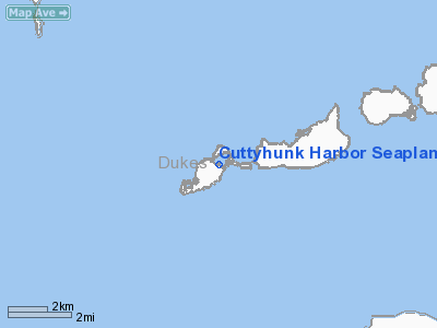
Cuttyhunk Harbor Seaplane Base |
|
Location & QuickFacts
|
FAA
Information Effective: |
2008-09-25 |
|
Airport Identifier: |
6MA9 |
|
Airport Status: |
Operational |
|
Longitude/Latitude: |
070-55-38.1260W/41-25-23.3870N
-70.927257/41.423163 (Estimated) |
|
Elevation: |
0 ft / 0.00 m (Estimated) |
|
Land: |
0 acres |
|
From
nearest city: |
0 nautical miles N of Cuttyhunk, MA |
|
Location: |
Bristol County, MA |
|
Magnetic Variation: |
15W (1990) |
Owner & Manager
|
Ownership: |
Privately owned |
|
Owner: |
Island Shuttle, Inc. |
|
Address: |
123 R Purchase St.
Middleboro, MA 02346 |
|
Phone number: |
508-947-9339 |
|
Manager: |
Gid A. Fisher, Pres. |
|
Address: |
123 R Purchase St.
Middleboro, MA 02346 |
|
Phone number: |
508-947-9339 |
Airport Operations and
Facilities
|
Airport Use: |
Private |
|
Segmented Circle: |
No |
|
Control Tower: |
No |
|
Sectional chart: |
New York |
|
Region: |
ANE - New England |
|
Boundary ARTCC: |
ZBW - Boston |
|
Tie-in FSS: |
BDR - Bridgeport |
|
FSS
on Airport: |
No |
|
FSS
Toll Free: |
1-800-WX-BRIEF |
|
Runway Information
Runway 03/21
|
Dimension: |
2500 x 100 ft / 762.0 x 30.5 m |
|
Surface: |
WATER, |
|
|
Runway 03
|
Runway 21
|
|
Traffic Pattern: |
Left |
Left |
|
Runway 09/27
|
Dimension: |
2500 x 100 ft / 762.0 x 30.5 m |
|
Surface: |
WATER, |
|
|
Runway 09
|
Runway 27
|
|
Traffic Pattern: |
Left |
Left |
|
Radio Navigation Aids
|
ID |
Type |
Name |
Ch |
Freq |
Var |
Dist |
|
ORW |
FAN MARKER |
Canton |
|
|
15W |
45.4 nm |
|
FFF |
NDB |
Plymouth |
|
257.00 |
16W |
26.1 nm |
|
TAN |
NDB |
Taunton |
|
227.00 |
16W |
27.5 nm |
|
TUK |
NDB |
Nantucket |
|
194.00 |
15W |
35.0 nm |
|
IHM |
NDB |
Mansfield |
|
220.00 |
16W |
36.9 nm |
|
SFZ |
NDB |
Central |
|
241.00 |
15W |
39.0 nm |
|
IMR |
NDB |
Marshfield |
|
368.00 |
16W |
42.1 nm |
|
CQX |
NDB |
Nauset |
|
279.00 |
16W |
45.2 nm |
|
FMH |
TACAN |
Otis |
105X |
|
15W |
23.4 nm |
|
NZW |
TACAN |
South Weymouth |
061X |
|
15W |
43.6 nm |
|
MVY |
VOR/DME |
Marthas Vineyard |
092X |
114.50 |
15W |
14.3 nm |
|
SEY |
VOR/DME |
Sandy Point |
125X |
117.80 |
15W |
33.1 nm |
|
ACK |
VOR/DME |
Nantucket |
109X |
116.20 |
15W |
41.5 nm |
|
ORW |
VOR/DME |
Norwich |
037X |
110.00 |
14W |
48.9 nm |
|
PVD |
VORTAC |
Providence |
103X |
115.60 |
14W |
28.9 nm |
|
PVD |
VOT |
Providence |
|
108.20 |
|
28.8 nm |
Remarks
-
PROVIDED
OPNS ARE CONDUCTED DURG VFR WEATHER CONDITIONS.
Cuttyhunk Harbor Seaplane Base
Address:
Bristol County, MA
Tel:
508-947-9339
Images
and information placed above are from
http://www.airport-data.com/airport/6MA9/
We
thank them for the data!
| General Info |
| Country |
United States |
| State |
MASSACHUSETTS |
| FAA ID |
6MA9 |
| Latitude |
41-25-23.387N |
| Longitude |
070-55-38.126W |
| Elevation |
0 feet |
| Near City |
CUTTYHUNK |
We don't guarantee the information is fresh and accurate. The data may
be wrong or outdated.
For more up-to-date information please refer to other sources.
|
|


