 |
|
|
Location & QuickFacts
|
FAA
Information Effective: |
2008-09-25 |
|
Airport Identifier: |
MA28 |
|
Airport Status: |
Operational |
|
Longitude/Latitude: |
072-45-35.3390W/42-02-00.3420N
-72.759816/42.033428 (Estimated) |
|
Elevation: |
225 ft / 68.58 m (Estimated) |
|
Land: |
0 acres |
|
From
nearest city: |
2 nautical miles S of Southwick, MA |
|
Location: |
Hampden County, MA |
|
Magnetic Variation: |
14W (1985) |
Owner & Manager
|
Ownership: |
Privately owned |
|
Owner: |
Lawrence E. Durocher |
|
Address: |
1 Pine Road
Southwick, MA 01077 |
|
Phone number: |
413-569-3928 |
|
Manager: |
Lawrence E. Durocher |
|
Address: |
1 Pine Road
Southwick, MA 01077 |
|
Phone number: |
413-569-3928 |
Airport Operations and Facilities
|
Airport Use: |
Private |
|
Segmented Circle: |
No |
|
Control Tower: |
No |
|
Sectional chart: |
New York |
|
Region: |
ANE - New England |
|
Boundary ARTCC: |
ZBW - Boston |
|
Tie-in FSS: |
BTV - Burlington |
|
FSS
Toll Free: |
1-800-WX-BRIEF |
|
Runway Information
Helipad H1
|
Dimension: |
10 x 10 ft / 3.0 x 3.0 m |
|
Surface: |
DIRT-TURF,
RAISED PLATFORM. |
|
|
Runway H1
|
Runway
|
|
Traffic Pattern: |
Left |
Left |
|
Radio Navigation Aids
|
ID |
Type |
Name |
Ch |
Freq |
Var |
Dist |
|
GBR |
FAN MARKER |
Sheffield |
|
|
13W |
27.5 nm |
|
PSF |
FAN MARKER |
Abyss |
|
|
13W |
32.4 nm |
|
HF |
NDB |
Lomis |
|
244.00 |
15W |
24.7 nm |
|
GBR |
NDB |
Great Barrington |
|
395.00 |
14W |
30.1 nm |
|
MMK |
NDB |
Meriden |
|
238.00 |
14W |
31.6 nm |
|
DXT |
NDB |
Dalton |
|
370.00 |
15W |
32.0 nm |
|
TBY |
NDB |
Waterbury |
|
257.00 |
14W |
34.9 nm |
|
ORE |
NDB |
Orange |
|
205.00 |
15W |
38.4 nm |
|
PFH |
NDB |
Philmont |
|
272.00 |
13W |
44.9 nm |
|
CTR |
VOR/DME |
Chester |
098X |
115.10 |
13W |
17.7 nm |
|
HFD |
VOR/DME |
Hartford |
096X |
114.90 |
13W |
25.4 nm |
|
PWL |
VOR/DME |
Pawling |
090X |
114.30 |
12W |
40.8 nm |
|
PUT |
VOR/DME |
Putnam |
121X |
117.40 |
14W |
41.2 nm |
|
MAD |
VOR/DME |
Madison |
041X |
110.40 |
13W |
43.4 nm |
|
ORW |
VOR/DME |
Norwich |
037X |
110.00 |
14W |
44.5 nm |
|
HVN |
VOR/DME |
New Haven |
035X |
109.80 |
13W |
46.7 nm |
|
BDL |
VORTAC |
Bradley |
027X |
109.00 |
14W |
6.4 nm |
|
BAF |
VORTAC |
Barnes |
077X |
113.00 |
14W |
8.0 nm |
|
CEF |
VORTAC |
Westover |
87X |
114.00 |
14W |
14.3 nm |
|
GDM |
VORTAC |
Gardner |
043X |
110.60 |
14W |
43.8 nm |
|
BDL |
VOT |
Bradley Intl |
|
111.40 |
|
6.6 nm |
|
HFD |
VOT |
Hartford |
|
108.20 |
|
18.6 nm |
|
ORH |
VOT |
Worcester |
|
108.20 |
|
42.1 nm |
Remarks
-
PROVIDED
VFR CONDITIONS ONLY; INGRESS/EGRESS FROM 035 TO 150; OPS AREA IS FENCED
IN.
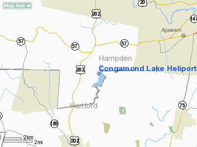
Congamond Lake Heliport
Address:
Hampden County, MA
Tel:
413-569-3928
Images
and information placed above are from
http://www.airport-data.com/airport/MA28/
We
thank them for the data!
| General Info |
| Country |
United States |
| State |
MASSACHUSETTS |
| FAA ID |
MA28 |
| Latitude |
42-02-00.342N |
| Longitude |
072-45-35.339W |
| Elevation |
225 feet |
| Near City |
SOUTHWICK |
We don't guarantee the information is fresh and accurate. The data may
be wrong or outdated.
For more up-to-date information please refer to other sources.
|
|


