 |
|
|
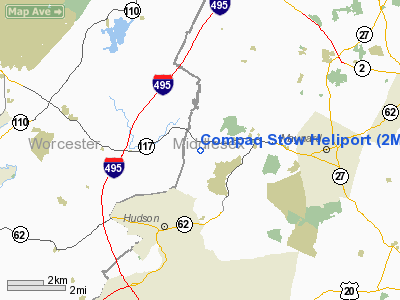
Location & QuickFacts
|
FAA
Information Effective: |
2008-09-25 |
|
Airport Identifier: |
2MA8 |
|
Airport Status: |
Operational |
|
Longitude/Latitude: |
071-32-30.2340W/42-25-51.3340N
-71.541732/42.430926 (Estimated) |
|
Elevation: |
250 ft / 76.20 m (Estimated) |
|
Land: |
0 acres |
|
From
nearest city: |
1 nautical miles W of Stow, MA |
|
Location: |
Middlesex County, MA |
|
Magnetic Variation: |
16W (1980) |
Owner & Manager
|
Ownership: |
Privately owned |
|
Owner: |
Compaq Comp Corp Ms2-3/c17 |
|
Address: |
111 Powdermill Rd
Maynard, MA 01754 |
|
Phone number: |
978-493-6163 |
|
Manager: |
Joe Poznick Ms2-3/c17 |
|
Address: |
111 Powdermill Rd
Maynard, MA 01754 |
|
Phone number: |
978-493-8401 |
Airport Operations and
Facilities
|
Airport Use: |
Private |
|
Segmented Circle: |
No |
|
Control Tower: |
No |
|
Landing fee charge: |
No |
|
Sectional chart: |
New York |
|
Region: |
ANE - New England |
|
Boundary ARTCC: |
ZBW - Boston |
|
Tie-in FSS: |
BDR - Bridgeport |
|
FSS on Airport: |
No |
|
FSS Toll Free: |
1-800-WX-BRIEF |
Airport Communications
|
Runway Information
Helipad H1
|
Dimension: |
20 x 15 ft / 6.1 x 4.6 m |
|
Surface: |
GRVL, |
|
|
Runway H1
|
Runway
|
|
Traffic Pattern: |
Left |
Left |
|
Radio Navigation Aids
|
ID |
Type |
Name |
Ch |
Freq |
Var |
Dist |
|
ORW |
FAN MARKER |
Canton |
|
|
15W |
23.8 nm |
|
BVY |
FAN MARKER |
Beverly |
|
|
|
28.6 nm |
|
FIT |
NDB |
Fitchburg |
|
365.00 |
15W |
12.0 nm |
|
SKR |
NDB |
Shaker Hill |
|
251.00 |
16W |
16.2 nm |
|
AS |
NDB |
Chern |
|
359.00 |
16W |
23.7 nm |
|
LQ |
NDB |
Lyndy |
|
382.00 |
16W |
25.7 nm |
|
DRY |
NDB |
Derry |
|
338.00 |
16W |
27.2 nm |
|
TOF |
NDB |
Topsfield |
|
269.00 |
16W |
28.3 nm |
|
IHM |
NDB |
Mansfield |
|
220.00 |
16W |
30.0 nm |
|
SFZ |
NDB |
Central |
|
241.00 |
15W |
30.9 nm |
|
ORE |
NDB |
Orange |
|
205.00 |
15W |
34.0 nm |
|
TAN |
NDB |
Taunton |
|
227.00 |
16W |
40.7 nm |
|
CO |
NDB |
Epsom |
|
216.00 |
16W |
41.5 nm |
|
IMR |
NDB |
Marshfield |
|
368.00 |
16W |
43.4 nm |
|
FFF |
NDB |
Plymouth |
|
257.00 |
16W |
48.1 nm |
|
NZW |
TACAN |
South Weymouth |
061X |
|
15W |
31.7 nm |
|
LWM |
VOR/DME |
Lawrence |
072X |
112.50 |
15W |
27.2 nm |
|
MHT |
VOR/DME |
Manchester |
091X |
114.40 |
15W |
27.4 nm |
|
PUT |
VOR/DME |
Putnam |
121X |
117.40 |
14W |
31.6 nm |
|
GDM |
VORTAC |
Gardner |
043X |
110.60 |
14W |
23.9 nm |
|
BOS |
VORTAC |
Boston |
074X |
112.70 |
16W |
24.9 nm |
|
EEN |
VORTAC |
Keene |
031X |
109.40 |
14W |
39.7 nm |
|
PVD |
VORTAC |
Providence |
103X |
115.60 |
14W |
42.8 nm |
|
CEF |
VORTAC |
Westover |
87X |
114.00 |
14W |
46.0 nm |
|
CON |
VORTAC |
Concord |
076X |
112.90 |
15W |
47.4 nm |
|
BED |
VOT |
Laurence G Hanscom Fld |
|
110.00 |
|
11.5 nm |
|
ORH |
VOT |
Worcester |
|
108.20 |
|
17.5 nm |
|
BOS |
VOT |
Boston Logan Intl |
|
111.00 |
|
23.3 nm |
|
PVD |
VOT |
Providence |
|
108.20 |
|
42.8 nm |
Remarks
Compaq Stow Heliport
Address:
Middlesex County, MA
Tel:
978-493-6163,
978-493-8401
Images
and information placed above are from
http://www.airport-data.com/airport/2MA8/
We
thank them for the data!
| General Info |
| Country |
United States |
| State |
MASSACHUSETTS |
| FAA ID |
2MA8 |
| Latitude |
42-25-51.334N |
| Longitude |
071-32-30.234W |
| Elevation |
250 feet |
| Near City |
STOW |
We don't guarantee the information is fresh and accurate. The data may
be wrong or outdated.
For more up-to-date information please refer to other sources.
|
|


