 |
|
|
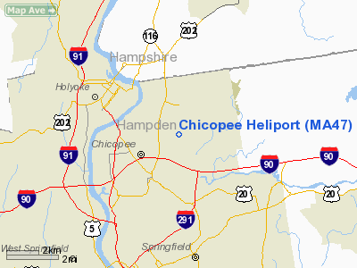
Location & QuickFacts
|
FAA
Information Effective: |
2008-09-25 |
|
Airport Identifier: |
MA47 |
|
Airport Status: |
Operational |
|
Longitude/Latitude: |
072-33-41.3170W/42-10-57.3340N
-72.561477/42.182593 (Estimated) |
|
Elevation: |
245 ft / 74.68 m (Estimated) |
|
Land: |
0 acres |
|
From
nearest city: |
3 nautical miles NE of Chicopee, MA |
|
Location: |
Hampden County, MA |
|
Magnetic Variation: |
15W (1990) |
Owner & Manager
|
Ownership: |
Privately owned |
|
Owner: |
Duval Precision Grinding Inc |
|
Address: |
940 Sheridan St
Chicopee, MA 01022 |
|
Phone number: |
413-593-3060 |
|
Manager: |
Ronald J Duval, Pres |
|
Address: |
940 Sheridan St
Chicopee, MA 01022 |
|
Phone number: |
413-593-3060 |
Airport Operations and Facilities
|
Airport Use: |
Private |
|
Wind
indicator: |
Yes |
|
Segmented Circle: |
Yes |
|
Control Tower: |
No |
|
Lighting Schedule: |
PHONE REQ
FOR FLOODLIGHTS PHONE 413-593-3060. |
|
Sectional chart: |
New York |
|
Region: |
ANE - New England |
|
Boundary ARTCC: |
ZBW - Boston |
|
Tie-in FSS: |
BTV - Burlington |
|
FSS
Toll Free: |
1-800-WX-BRIEF |
|
Runway Information
Helipad H1
|
Dimension: |
150 x 60 ft / 45.7 x 18.3 m |
|
Surface: |
ASPH, |
|
|
Runway H1
|
Runway
|
|
Traffic Pattern: |
Left |
Left |
|
Radio Navigation Aids
|
ID |
Type |
Name |
Ch |
Freq |
Var |
Dist |
|
PSF |
FAN MARKER |
Abyss |
|
|
13W |
33.3 nm |
|
GBR |
FAN MARKER |
Sheffield |
|
|
13W |
35.9 nm |
|
ORE |
NDB |
Orange |
|
205.00 |
15W |
26.2 nm |
|
DXT |
NDB |
Dalton |
|
370.00 |
15W |
32.1 nm |
|
HF |
NDB |
Lomis |
|
244.00 |
15W |
33.0 nm |
|
GBR |
NDB |
Great Barrington |
|
395.00 |
14W |
37.5 nm |
|
FIT |
NDB |
Fitchburg |
|
365.00 |
15W |
42.0 nm |
|
MMK |
NDB |
Meriden |
|
238.00 |
14W |
42.1 nm |
|
VWD |
NDB |
Mount Snow |
|
224.00 |
15W |
46.7 nm |
|
TBY |
NDB |
Waterbury |
|
257.00 |
14W |
47.1 nm |
|
CTR |
VOR/DME |
Chester |
098X |
115.10 |
13W |
18.5 nm |
|
HFD |
VOR/DME |
Hartford |
096X |
114.90 |
13W |
32.6 nm |
|
PUT |
VOR/DME |
Putnam |
121X |
117.40 |
14W |
34.8 nm |
|
ORW |
VOR/DME |
Norwich |
037X |
110.00 |
14W |
45.3 nm |
|
CEF |
VORTAC |
Westover |
87X |
114.00 |
14W |
1.8 nm |
|
BAF |
VORTAC |
Barnes |
077X |
113.00 |
14W |
7.0 nm |
|
BDL |
VORTAC |
Bradley |
027X |
109.00 |
14W |
15.6 nm |
|
GDM |
VORTAC |
Gardner |
043X |
110.60 |
14W |
31.3 nm |
|
EEN |
VORTAC |
Keene |
031X |
109.40 |
14W |
38.7 nm |
|
BDL |
VOT |
Bradley Intl |
|
111.40 |
|
15.6 nm |
|
HFD |
VOT |
Hartford |
|
108.20 |
|
27.2 nm |
|
ORH |
VOT |
Worcester |
|
108.20 |
|
31.3 nm |
Remarks
-
OPERATIONS CONDUCTED DURING DAYTIME VISUAL FLIGHT RULE WEATHER CONDITIONS
AND COORDINATION OF APCH/DEPARTURE OPERATIONS WITH WESTOVER AFB ATCT.
Based Aircraft
|
Aircraft
based on field: |
1 |
|
Helicopters: |
1 |
Chicopee Heliport
Address:
Hampden County, MA
Tel:
413-593-3060
Images
and information placed above are from
http://www.airport-data.com/airport/MA47/
We
thank them for the data!
| General Info |
| Country |
United States |
| State |
MASSACHUSETTS |
| FAA ID |
MA47 |
| Latitude |
42-10-57.334N |
| Longitude |
072-33-41.317W |
| Elevation |
245 feet |
| Near City |
CHICOPEE |
We don't guarantee the information is fresh and accurate. The data may
be wrong or outdated.
For more up-to-date information please refer to other sources.
|
|


