 |
|
| Cape Cod Airport |
| IATA: 2B1 – ICAO: K2B1 |
| Summary |
| Airport type |
Public |
| Operator |
Town of Barnstable |
| Location |
Marstons Mills, Massachusetts |
| Elevation AMSL |
103 ft / 31 m |
| Coordinates |
41°41′07.0″N 70°24′08.1″W / 41.68528°N 70.40225°W / 41.68528; -70.40225Coordinates: 41°41′07.0″N 70°24′08.1″W / 41.68528°N 70.40225°W / 41.68528; -70.40225 |
| Runways |
| Direction |
Length |
Surface |
| ft |
m |
| 9/27 |
2700 |
823 |
Turf |
| 17/35 |
2060 |
628 |
Turf |
| 5/23 |
2035 |
620 |
Turf |
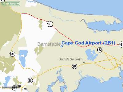
Cape Cod Airport, (IATA: 2B1, ICAO: K2B1) in Marstons Mills, Massachusetts is a public airport owned by the Town of Barnstable. It has three runways, averages 75 flights per week, and has approximately 20 aircraft based on its field. Biplane Rides, flight school, and skydive operations on the field. In the 1930s, the 101st Observation Squadron of the Massachusetts National Guard attended summer training here.
The above content comes from Wikipedia and is published under free licenses – click here to read more.
|
Location & QuickFacts
|
FAA
Information Effective: |
2008-09-25 |
|
Airport Identifier: |
2B1 |
|
Airport Status: |
Operational |
|
Longitude/Latitude: |
070-24-08.1000W/41-41-07.0000N
-70.402250/41.685278 (Estimated) |
|
Elevation: |
103 ft / 31.39 m (Estimated) |
|
Land: |
88 acres |
|
From
nearest city: |
5 nautical miles SE of Marston Mills, MA |
|
Location: |
Barnstable County, MA |
|
Magnetic Variation: |
16W (1985) |
Owner & Manager
|
Ownership: |
Publicly owned |
|
Owner: |
Town Of Barnstable |
|
Address: |
367 Main Street
Hyannis, MA 02601 |
|
Phone number: |
508-862-4000 |
|
Manager: |
Christopher Sciderwicz |
|
Address: |
4 Sea Lane
Bourne, MA 02532 |
|
Phone number: |
508-428-8732 |
Airport Operations and Facilities
|
Airport Use: |
Open to public |
|
Wind
indicator: |
Yes |
|
Segmented Circle: |
No |
|
Control Tower: |
No |
|
Landing fee charge: |
No |
|
Sectional chart: |
New York |
|
Region: |
ANE - New England |
|
Traffic Pattern Alt: |
700 ft |
|
Boundary ARTCC: |
ZBW - Boston |
|
Tie-in FSS: |
BDR - Bridgeport |
|
FSS
on Airport: |
No |
|
FSS
Toll Free: |
1-800-WX-BRIEF |
|
NOTAMs Facility: |
BDR (NOTAM-d service avaliable) |
Airport Communications
Airport Services
|
Fuel
available: |
100LL |
|
Airframe Repair: |
MINOR |
|
Power Plant Repair: |
MINOR |
|
Bottled Oxygen: |
NONE |
|
Bulk
Oxygen: |
NONE |
|
Runway Information
Runway 05/23
|
Dimension: |
2035 x 50 ft / 620.3 x 15.2 m |
|
Surface: |
TURF, Good Condition |
|
|
Runway 05
|
Runway 23
|
|
Longitude: |
070-24-09.2434W |
070-23-55.6029W |
|
Latitude: |
41-40-58.1276N |
41-41-13.4484N |
|
Elevation: |
91.00 ft |
94.00 ft |
|
Traffic Pattern: |
Left |
Left |
|
Obstruction: |
10 ft trees, 40.0 ft from runway, 125 ft right of centerline,
4:1 slope to clear |
50 ft trees, 200.0 ft from runway, 12 ft right of centerline,
4:1 slope to clear |
|
Runway 09/27
|
Dimension: |
2700 x 60 ft / 823.0 x 18.3 m |
|
Surface: |
TURF, Good Condition |
|
|
Runway 09
|
Runway 27
|
|
Longitude: |
070-24-27.2314W |
070-23-56.2256W |
|
Latitude: |
41-41-03.3333N |
41-41-10.6954N |
|
Elevation: |
98.00 ft |
95.00 ft |
|
Traffic Pattern: |
Left |
Left |
|
Obstruction: |
3 ft trees, 24.0 ft from runway, 75 ft left of centerline, 9:1
slope to clear |
30 ft trees, 148.0 ft from runway, 60 ft right of centerline,
5:1 slope to clear |
|
Runway 17/35
|
Dimension: |
2060 x 60 ft / 627.9 x 18.3 m |
|
Surface: |
TURF, Good Condition |
|
|
Runway 17
|
Runway 35
|
|
Longitude: |
070-24-14.0264W |
070-24-03.7765W |
|
Latitude: |
41-41-16.0961N |
41-41-00.1911N |
|
Elevation: |
103.00 ft |
89.00 ft |
|
Traffic Pattern: |
Left |
Left |
|
Obstruction: |
18 ft trees, 72.0 ft from runway, 60 ft right of centerline,
4:1 slope to clear |
9 ft pline, 36.0 ft from runway, 75 ft right of centerline, 4:1
slope to clear |
|
Radio Navigation Aids
|
ID |
Type |
Name |
Ch |
Freq |
Var |
Dist |
|
ORW |
FAN MARKER |
Canton |
|
|
15W |
44.0 nm |
|
CQX |
NDB |
Nauset |
|
279.00 |
16W |
18.5 nm |
|
FFF |
NDB |
Plymouth |
|
257.00 |
16W |
20.4 nm |
|
PVC |
NDB |
Provincetown |
|
389.00 |
16W |
24.4 nm |
|
TUK |
NDB |
Nantucket |
|
194.00 |
15W |
27.0 nm |
|
IMR |
NDB |
Marshfield |
|
368.00 |
16W |
27.6 nm |
|
TAN |
NDB |
Taunton |
|
227.00 |
16W |
29.9 nm |
|
IHM |
NDB |
Mansfield |
|
220.00 |
16W |
40.4 nm |
|
FMH |
TACAN |
Otis |
105X |
|
15W |
5.2 nm |
|
NZW |
TACAN |
South Weymouth |
061X |
|
15W |
36.8 nm |
|
MVY |
VOR/DME |
Marthas Vineyard |
092X |
114.50 |
15W |
19.8 nm |
|
LFV |
VOR/DME |
Marconi |
094X |
114.70 |
16W |
25.8 nm |
|
ACK |
VOR/DME |
Nantucket |
109X |
116.20 |
15W |
29.6 nm |
|
PVD |
VORTAC |
Providence |
103X |
115.60 |
14W |
46.2 nm |
|
BOS |
VORTAC |
Boston |
074X |
112.70 |
16W |
48.2 nm |
|
PVD |
VOT |
Providence |
|
108.20 |
|
46.0 nm |
|
BOS |
VOT |
Boston Logan Intl |
|
111.00 |
|
49.9 nm |
Remarks
-
< OTIS VCNTY TFC HELICOPTER HEAVY & JET MILITARY HI-SPEED OF
AWARE>
-
BE ALERT FOR RADIO
CONTROL AIRPLANES NE CORNER AIRFIELD.
-
BANNER TOW OPS IN
PROGRESS JUN THRU AUG NORTH SIDE OF AIRFIELD.
-
GLIDER TOW OPNS DURG
DALGT HRS.
-
PPR REQUIRED FOR RY
05/23 OPERATIONS.
-
PARACHUTE JUMPING ON FLD.
-
ESTAB PRIOR TO 1959.
Based Aircraft
|
Aircraft
based on field: |
21 |
|
Single
Engine Airplanes: |
17 |
|
Multi
Engine Airplanes: |
1 |
|
Gliders: |
2 |
|
Ultralights: |
1 |
Operational Statistics
Time
Period: 2007-04-03 - 2008-04-01
|
Aircraft
Operations: |
25/Week |
|
General
Aviation Local: |
76.9% |
|
General
Aviation Itinerant: |
23.1% |
Cape Cod Airport
Address:
Barnstable County, MA
Tel:
508-862-4000,
508-428-8732
Images
and information placed above are from
http://www.airport-data.com/airport/2B1/
We
thank them for the data!
| General Info |
| Country |
United States |
| State |
MASSACHUSETTS |
| FAA ID |
2B1 |
| Latitude |
41-41-07.000N |
| Longitude |
070-24-08.100W |
| Elevation |
103 feet |
| Near City |
MARSTON MILLS |
We don't guarantee the information is fresh and accurate. The data may
be wrong or outdated.
For more up-to-date information please refer to other sources.
|
|


