 |
|
|
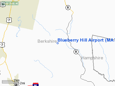
Location & QuickFacts
|
FAA
Information Effective: |
2008-09-25 |
|
Airport Identifier: |
MA77 |
|
Airport Status: |
Operational |
|
Longitude/Latitude: |
073-08-51.3720W/42-22-30.3100N
-73.147603/42.375086 (Estimated) |
|
Elevation: |
2000 ft / 609.60 m (Estimated) |
|
Land: |
20 acres |
|
From
nearest city: |
0 nautical miles of Washington, MA |
|
Location: |
Berkshire County, MA |
|
Magnetic Variation: |
14W (1985) |
Owner & Manager
|
Ownership: |
Privately owned |
|
Owner: |
Roy J. Wiley |
|
Address: |
Washington Mtn Rd
Washington, MA 01223 |
|
Phone number: |
413-623-5859 |
|
Manager: |
Roy J. Wiley |
|
Address: |
Washington Mtn Rd
Washington, MA 01223 |
|
Phone number: |
413-623-5859 |
Airport Operations and
Facilities
|
Airport Use: |
Private |
|
Wind indicator: |
Yes |
|
Segmented Circle: |
No |
|
Control Tower: |
No |
|
Landing fee charge: |
No |
|
Sectional chart: |
New York |
|
Region: |
ANE - New England |
|
Boundary ARTCC: |
ZBW - Boston |
|
Tie-in FSS: |
BDR - Bridgeport |
|
FSS on Airport: |
No |
|
FSS Toll Free: |
1-800-WX-BRIEF |
Airport Services
|
Airframe Repair: |
NONE |
|
Power Plant Repair: |
NONE |
|
Runway Information
Runway 16/34
|
Dimension: |
1800 x 100 ft / 548.6 x 30.5 m |
|
Surface: |
TURF, |
|
|
Runway 16
|
Runway 34
|
|
Traffic Pattern: |
Left |
Left |
|
Radio Navigation Aids
|
ID |
Type |
Name |
Ch |
Freq |
Var |
Dist |
|
PSF |
FAN MARKER |
Abyss |
|
|
13W |
5.7 nm |
|
GBR |
FAN MARKER |
Sheffield |
|
|
13W |
17.7 nm |
|
DXT |
NDB |
Dalton |
|
370.00 |
15W |
5.8 nm |
|
GBR |
NDB |
Great Barrington |
|
395.00 |
14W |
16.2 nm |
|
PFH |
NDB |
Philmont |
|
272.00 |
13W |
26.6 nm |
|
VWD |
NDB |
Mount Snow |
|
224.00 |
15W |
35.5 nm |
|
ORE |
NDB |
Orange |
|
205.00 |
15W |
39.9 nm |
|
HEU |
NDB |
Hunter |
|
356.00 |
14W |
45.1 nm |
|
CTR |
VOR/DME |
Chester |
098X |
115.10 |
13W |
10.1 nm |
|
CAM |
VOR/DME |
Cambridge |
097X |
115.00 |
14W |
38.2 nm |
|
PWL |
VOR/DME |
Pawling |
090X |
114.30 |
12W |
41.6 nm |
|
BAF |
VORTAC |
Barnes |
077X |
113.00 |
14W |
23.1 nm |
|
CEF |
VORTAC |
Westover |
87X |
114.00 |
14W |
29.6 nm |
|
BDL |
VORTAC |
Bradley |
027X |
109.00 |
14W |
33.2 nm |
|
ALB |
VORTAC |
Albany |
100X |
115.30 |
13W |
36.6 nm |
|
EEN |
VORTAC |
Keene |
031X |
109.40 |
14W |
45.5 nm |
|
GDM |
VORTAC |
Gardner |
043X |
110.60 |
14W |
49.4 nm |
|
BDL |
VOT |
Bradley Intl |
|
111.40 |
|
33.4 nm |
|
ALB |
VOT |
Albany County |
|
108.20 |
|
37.1 nm |
|
HFD |
VOT |
Hartford |
|
108.20 |
|
44.4 nm |
Remarks
-
OWNER
DESIRES NOT TO BE CHARTED.
-
VFR ONLY.
Based Aircraft
|
Aircraft
based on field: |
1 |
|
Single
Engine Airplanes: |
1 |
Blueberry Hill Airport
Address:
Berkshire County, MA
Tel:
413-623-5859
Images
and information placed above are from
http://www.airport-data.com/airport/MA77/
We
thank them for the data!
| General Info |
| Country |
United States |
| State |
MASSACHUSETTS |
| FAA ID |
MA77 |
| Latitude |
42-22-30.310N |
| Longitude |
073-08-51.372W |
| Elevation |
2000 feet |
| Near City |
WASHINGTON |
We don't guarantee the information is fresh and accurate. The data may
be wrong or outdated.
For more up-to-date information please refer to other sources.
|
|


