 |
|
Beverly Municipal Airport |
| Beverly Municipal Airport |
| IATA: BVY â ICAO: KBVY â FAA LID: BVY |
| Summary |
| Airport type |
Public |
| Owner |
City of Beverly |
| Location |
Beverly, Massachusetts |
| Elevation AMSL |
107 ft / 33 m |
| Coordinates |
42°35.05â²N 70°54.99â²W / 42.58417°N 70.9165°W / 42.58417; -70.9165Coordinates: 42°35.05â²N 70°54.99â²W / 42.58417°N 70.9165°W / 42.58417; -70.9165 |
| Website |
www.BeverlyAirport.com |
| Runways |
| Direction |
Length |
Surface |
| ft |
m |
| 9/27 |
4,755 |
1,449 |
Asphalt |
| 16/34 |
5,001 |
1,524 |
Asphalt |
| Statistics (2006) |
| Aircraft operations |
42,601 |
| Based aircraft |
113 |
| Source: Federal Aviation Administration |
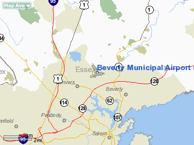
Beverly Municipal Airport (IATA: BVY, ICAO: KBVY, FAA LID: BVY) is a public-use airport located three miles (5 km) northwest of the central business district of Beverly, a city in Essex County, Massachusetts, United States. This airport is owned by City of Beverly.
It is designated by the FAA as a reliever airport, which means it is available to relieve Logan International Airport of small general aviation type aircraft during Logan's peak traffic times. History
Beverly Municipal Airport was built in 1928 through the efforts of the Beverly Aero Club and the Beverly Chamber of Commerce. The U.S. Navy operated the airport during World War II under a joint-use agreement. Ownership of the airport was transferred back to the City of Beverly in 1950.
Facilities and aircraft
Beverly Municipal Airport covers an area of 470 acres (190 ha) which contains two runways: 9/27 measuring 4,755 x 150 ft (1,449 x 46 m) and 16/34 5,001 x 100 ft (1,524 x 30 m).
For 12-month period ending September 1, 2006, the airport had 42,601 aircraft operations, an average of 116 per day: 99% general aviation, 1% air taxi and <1% military. There are 113 aircraft based at this airport: 89% single engine, 4% multi-engine, 1% jet aircraft and 5% helicopters.
Civil Air Patrol Squadron MA-019, Beverly Composite Squadron, is headquartered at Beverly Municipal Airport in the old airport control tower.
Notable events at Beverly Airport
On July 16, 1936, bandleader Orville Knapp, brother of actress Evalyn Knapp, died in a plane crash here after he misjudged a landing maneuver and stalled in mid-air.
SCCA auto races were held at Beverly Airport in 1955 and 1956. The inaugural races were held on July 4, 1955. Phil Hill was the 1955 overall champion. The 1956 champion was Carroll Shelby.
A scene in the 2000 film The Perfect Storm, was shot at Beverly Airport.
In May 2008, a scene for the movie The Proposal was filmed at Beverly Airport.
On August 27, 2010 - Michael Costales, age 30, a flight instructor at Beverly Municipal Airport, was struck and killed by an aircraft moving propeller. Costales had taxied his aircraft out to the run-up area of the active runway, 34 at Beverly Municipal Airport. At about 12:30 PM, Costales got out of his Piper PA 28 Cherokee aircraft to assist another flight instructor and his student with fastening the canopy of their PiperSport aircraft. As Costales got out of his aircraft and walked toward the other aircraft, he was struck by his aircraftâs propeller. The student pilot in the PiperSport aircraft called 911 but Costales was killed instantly. The airport was then shut down for a couple of hours as investigators tried to figure out what caused this event.
The above content comes from Wikipedia and is published under free licenses – click here to read more.
|
Location & QuickFacts
|
FAA
Information Effective: |
2008-09-25 |
|
Airport Identifier: |
BVY |
|
Airport Status: |
Operational |
|
Longitude/Latitude: |
070-54-58.1199W/42-35-02.9077N
-70.916144/42.584141 (Estimated) |
|
Elevation: |
107 ft / 32.61 m (Surveyed) |
|
Land: |
470 acres |
|
From
nearest city: |
3 nautical miles NW of Beverly, MA |
|
Location: |
Essex County, MA |
|
Magnetic Variation: |
16W (1985) |
Owner & Manager
|
Ownership: |
Publicly owned |
|
Owner: |
City Of Beverly |
|
Address: |
City Hall, Cabot St
Beverly, MA 01915 |
|
Phone number: |
978-921-6000 |
|
Manager: |
Robert Mezzetti |
|
Address: |
46 L.p. Henderson Road
Beverly, MA 01915 |
|
Phone number: |
978-921-6072 |
Airport Operations and
Facilities
|
Airport Use: |
Open to public |
|
Wind
indicator: |
Yes |
|
Segmented Circle: |
Yes |
|
Control Tower: |
Yes |
|
Lighting Schedule: |
DUSK-DAWN
ACTVT MIRL RYS 09/27 & 16/34; MALS RY 16 & REIL RY 34 - CTAF; WHEN
ATCT CLSD ACTVT PAPI RY 16 - CTAF. |
|
Beacon Color: |
Clear-Green (lighted land airport) |
|
Sectional chart: |
New York |
|
Region: |
ANE - New England |
|
Boundary ARTCC: |
ZBW - Boston |
|
Tie-in FSS: |
BDR - Bridgeport |
|
FSS
on Airport: |
No |
|
FSS
Toll Free: |
1-800-WX-BRIEF |
|
NOTAMs Facility: |
BVY (NOTAM-d service avaliable) |
|
Federal Agreements: |
NGPY3 |
Airport Communications
|
CTAF: |
125.200 |
|
Unicom: |
122.950 |
Airport Services
|
Fuel
available: |
100LLA
FUEL SVC 0600-2200; AFT HRS AVBL BY PRIOR REQ ONLY CALL
978-774-2070. |
|
Airframe Repair: |
MAJOR |
|
Power Plant Repair: |
MAJOR |
|
Bottled Oxygen: |
HIGH/LOW |
|
Runway Information
Runway 09/27
|
Dimension: |
4755 x 100 ft / 1449.3 x 30.5 m |
|
Surface: |
ASPH, Fair Condition |
|
Weight
Limit: |
Single wheel: 30000 lbs.
Dual wheel: 114000 lbs.
Dual tandem wheel: 180000 lbs. |
|
Edge
Lights: |
Medium |
|
|
Runway 09
|
Runway 27
|
|
Longitude: |
070-55-29.1200W |
070-54-27.9400W |
|
Latitude: |
42-34-47.0800N |
42-34-59.8100N |
|
Elevation: |
72.00 ft |
91.00 ft |
|
Alignment: |
74 |
127 |
|
Traffic Pattern: |
Left |
Left |
|
Markings: |
Basic, Good Condition |
Basic, Good Condition |
|
Displaced threshold: |
0.00 ft |
250.00 ft |
|
Obstruction: |
10 ft tree, 300.0 ft from runway, 150 ft left of centerline, 10:1
slope to clear |
29 ft trees, 396.0 ft from runway, 125 ft right of centerline, 6:1
slope to clear
RWY 27 20:1 TO DSPLCD THLD. |
|
Runway 16/34
|
Dimension: |
5001 x 100 ft / 1524.3 x 30.5 m |
|
Surface: |
ASPH, Good Condition |
|
Weight
Limit: |
Single wheel: 30000 lbs.
Dual wheel: 55000 lbs.
Dual tandem wheel: 103000 lbs. |
|
Edge
Lights: |
Medium |
|
|
Runway 16
|
Runway 34
|
|
Longitude: |
070-55-18.9300W |
070-54-36.5300W |
|
Latitude: |
42-35-30.9999N |
42-34-52.8100N |
|
Elevation: |
107.00 ft |
82.00 ft |
|
Alignment: |
127 |
127 |
|
ILS
Type: |
LOC/DME |
|
|
Traffic Pattern: |
Left |
Left |
|
Markings: |
Non-precision instrument, Good Condition |
Non-precision instrument, Good Condition |
|
Crossing Height: |
40.00 ft |
0.00 ft |
|
Displaced threshold: |
239.00 ft |
0.00 ft |
|
VASI: |
4-light PAPI on left side |
|
|
Visual
Glide Angle: |
3.50° |
0.00° |
|
Approach lights: |
MALS
RY 16 NSTD MALS - 800 FT. |
|
|
Runway
End Identifier: |
|
Yes |
|
Obstruction: |
32 ft trees, 1000.0 ft from runway, 125 ft right of centerline, 25:1
slope to clear
RWY 16 34:1 TO DSPLCD THLD. |
27 ft , 750.0 ft from runway, 125 ft right of centerline, 20:1 slope
to clear |
|
Radio Navigation Aids
|
ID |
Type |
Name |
Ch |
Freq |
Var |
Dist |
|
BVY |
FAN MARKER |
Beverly |
|
|
|
2.0 nm |
|
ORW |
FAN MARKER |
Canton |
|
|
15W |
27.6 nm |
|
TOF |
NDB |
Topsfield |
|
269.00 |
16W |
2.8 nm |
|
LQ |
NDB |
Lyndy |
|
382.00 |
16W |
8.2 nm |
|
SKR |
NDB |
Shaker Hill |
|
251.00 |
16W |
14.0 nm |
|
DRY |
NDB |
Derry |
|
338.00 |
16W |
27.3 nm |
|
IMR |
NDB |
Marshfield |
|
368.00 |
16W |
31.1 nm |
|
AS |
NDB |
Chern |
|
359.00 |
16W |
33.5 nm |
|
IHM |
NDB |
Mansfield |
|
220.00 |
16W |
37.1 nm |
|
FIT |
NDB |
Fitchburg |
|
365.00 |
15W |
37.3 nm |
|
ESG |
NDB |
Rollins |
|
260.00 |
16W |
38.4 nm |
|
CO |
NDB |
Epsom |
|
216.00 |
16W |
39.9 nm |
|
TAN |
NDB |
Taunton |
|
227.00 |
16W |
42.8 nm |
|
PVC |
NDB |
Provincetown |
|
389.00 |
16W |
43.7 nm |
|
FFF |
NDB |
Plymouth |
|
257.00 |
16W |
44.6 nm |
|
SFZ |
NDB |
Central |
|
241.00 |
15W |
47.4 nm |
|
NZW |
TACAN |
South Weymouth |
061X |
|
15W |
26.2 nm |
|
LWM |
VOR/DME |
Lawrence |
072X |
112.50 |
15W |
12.3 nm |
|
MHT |
VOR/DME |
Manchester |
091X |
114.40 |
15W |
26.3 nm |
|
PSM |
VOR/DME |
Pease |
112X |
116.50 |
16W |
30.3 nm |
|
BOS |
VORTAC |
Boston |
074X |
112.70 |
16W |
14.0 nm |
|
CON |
VORTAC |
Concord |
076X |
112.90 |
15W |
48.0 nm |
|
BOS |
VOT |
Boston Logan Intl |
|
111.00 |
|
13.3 nm |
|
BED |
VOT |
Laurence G Hanscom Fld |
|
110.00 |
|
17.9 nm |
|
ORH |
VOT |
Worcester |
|
108.20 |
|
46.4 nm |
Remarks
-
RY
SAFETY AREAS HAE DROP OFFS AND/OR ROUGH TERRAIN.
-
PARKING-WEST SIDE TRANSIENT AT NORTH ATLANTIC AIR. EAST SIDE TRANSIENT
PARKING FOR SMALL ACFT LOCATED ON NORTH END OF EAST RAMP; LARGER ACFT BY
SOUTH END OF EAST RAMP.
-
ALL
ARRIVAL/DEPARTURE ACFT FOLLOW MANUFACTURER'S RECOMMENDED PROCEDURES FOR
QUIET OPS & MINIMUM NOISE.
-
NOISE
SENSITIVE AREA OFF EOR 09.
-
BIRDS
FREQUENTLY ON OR INVOF ARPT; OCCASIONAL DEER OR COYOTE ON RY.
-
TRANSIENT ACFT MUST USE ANTI-THEFT DEVICE WHEN ACFT UNATDD.
-
NOISE
SENSITIVE ARPT - VOLUNTARY COMPLIANCE REQUESTED OF ALL ACFT EXCEEDING 75DB
TO NOT LAND/DEPART ARPT 2300-0700.
-
NO
TIEDOWNS ROPES ON PUBLIC TRANSIENT PARKING.
-
EAST
RAMP SFC ROUGH WITH LOOSE STONES & 2 INCH DEPRESSIONS.
-
BTN
2200-0700 CLOSE FLIGHT PLAN WITH BOS ATCT - 121.6.
-
OVERNIGHT PARKING FEE.
-
NOISE
ABATEMENT PROCEDURES IN EFFECT CTC AMGR 978-921-6072.
-
FILED
FOR RECORD PURPOSES ONLY.
Based Aircraft
|
Aircraft
based on field: |
121 |
|
Single
Engine Airplanes: |
96 |
|
Multi
Engine Airplanes: |
19 |
|
Jet Engine
Airplanes: |
1 |
|
Helicopters: |
5 |
Operational Statistics
Time
Period: 2006-05-02 - 2007-05-01
|
Aircraft
Operations: |
190/Day |
|
Air Taxi: |
1.3% |
|
General
Aviation Local: |
48.1% |
|
General
Aviation Itinerant: |
50.0% |
|
Military: |
0.6% |
Beverly Municipal Airport
Address:
Essex County, MA
Tel:
978-921-6000,
978-921-6072
Images
and information placed above are from
http://www.airport-data.com/airport/BVY/
We
thank them for the data!
| General Info |
| Country |
United States |
| State |
MASSACHUSETTS |
| FAA ID |
BVY |
| Latitude |
42-35-03.016N |
| Longitude |
070-54-59.466W |
| Elevation |
108 feet |
| Near City |
BEVERLY |
We don't guarantee the information is fresh and accurate. The data may
be wrong or outdated.
For more up-to-date information please refer to other sources.
|
|


