 |
|
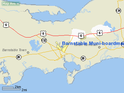
Barnstable Municipal-boardman/polando Field Airport |
Barnstable Municipal Airport
Boardman/Polando Field |
| IATA: HYA â ICAO: KHYA â FAA LID: HYA |
| Summary |
| Airport type |
Public |
| Owner |
Town of Barnstable |
| Location |
Hyannis, Massachusetts |
| Hub for |
- Cape Air
- Nantucket Airlines
|
| Elevation AMSL |
55 ft / 17 m |
| Coordinates |
41°40â²10â³N 070°16â²49â³W / 41.66944°N 70.28028°W / 41.66944; -70.28028 |
| Runways |
| Direction |
Length |
Surface |
| ft |
m |
| 6/24 |
5,425 |
1,654 |
Asphalt/grooved |
| 15/33 |
5,252 |
1,601 |
Asphalt/grooved |
| Statistics (2006) |
| Aircraft operations |
117,402 |
| Based aircraft |
58 |
| Source: Federal Aviation Administration |
Barnstable Municipal Airport (IATA: HYA, ICAO: KHYA, FAA LID: HYA), also known as Boardman/Polando Field, is a public airport located on Cape Cod, one mile (2 km) north of the central business district of Hyannis, in Barnstable County, Massachusetts, United States. This airport is publicly owned by Town of Barnstable. It is Cape Cod's major airport as well as an air hub for the Cape and the Islands (Martha's Vineyard and Nantucket). The airport is served by scheduled commercial flights as well as charters and general aviation.
The airport was founded in 1928. During World War II it was also known as Naval Auxiliary Airfield Hyannis and both the Navy and Army Air Forces flew antisubmarine patrols from the airport.
It was renamed Barnstable Municipal Airport - Boardman/Polando Field in honor of Massachusetts aviation pioneers Russell Boardman and John Polando in 1981. Facilities and aircraft
Barnstable Municipal Airport covers an area of 639 acres (2.6 km²) which contains two runways: 6/24 measuring 5,425 x 150 ft (1,654 x 46 m) and 15/33 measuring 5,252 x 150 ft (1,601 x 46 m).
For 12-month period ending May 31, 2006, the airport had 117,969 aircraft operations, an average of 323 per day: 73% air taxi, 27% general aviation, <1% military. There are 72 aircraft based at this airport: 79% single engine, 20% multi-engine and 1% jet aircraft.
Airlines and destinations
| Airlines |
Destinations |
| Cape Air |
Boston, Martha's Vineyard, Nantucket |
| Nantucket Airlines |
Nantucket |
| Island Airlines |
Nantucket |
| US Airways Express operated by Colgan Air |
Martha's Vineyard |
Commercial Aircraft Handled at HYA
- Cessna 402 (Cape Air, Island Airlines, and Nantucket Airlines) There are rumors that Cape Air has been in discussions to phase out the Cessna 402 and replace it with the ATR 42, for higher passenger loads, less frequent flights, and to reduce noise pollution.
- Cessna 208 (Island Airlines)
- SAAB 340 (US Airways Express operated by Colgan Air.)
In the past, other Commercial Aircraft that served KHYA have included the NAMC YS-11, Douglas DC-3, McDonnell Douglas DC-9, Boeing 737, Boeing 727, ATR 42, and Bombardier Dash 8. Seasonally, many corporate aircraft frequent KHYA including the Dassault Falcon 20, Bombardier Challenger 600, Learjet, Cessna Citation, Gulfstream IV, and the Boeing Business Jet.
Ground transportation
The airport is accessible through MA Route 28 or from US 6 through MA Route 132. Barnstable Municipal Airport is also served by local taxi services as well as four major car rental agencies. The Cape Cod Regional Transit Authority provides public transportation to and from the airport as part of the "Villager"/ Route 132 line.
Accidents and incidents
- Air New England Flight 248: On June 17, 1979, a commercial airliner that crashed on ILS approach. All of those on the plane survived with the exception of the pilot, who was killed instantly.
- Colgan Air Flight 9446: On August 26, 2003 a Beech 1900D operated by Colgan Air for US Airways Express hit the water shortly after taking off from Barnstable Municipal Airport. Both pilots died.
The above content comes from Wikipedia and is published under free licenses – click here to read more.
|
Location & QuickFacts
|
FAA
Information Effective: |
2008-09-25 |
|
Airport Identifier: |
HYA |
|
Airport Status: |
Operational |
|
Longitude/Latitude: |
070-16-49.2810W/41-40-09.6110N
-70.280356/41.669336 (Estimated) |
|
Elevation: |
55 ft / 16.76 m (Surveyed) |
|
Land: |
639 acres |
|
From
nearest city: |
1 nautical miles N of Hyannis, MA |
|
Location: |
Barnstable County, MA |
|
Magnetic Variation: |
16W (1995) |
Owner & Manager
|
Ownership: |
Publicly owned |
|
Owner: |
Town Of Barnstable |
|
Address: |
Town Hall 367 Main St
Hyannis, MA 02601 |
|
Phone number: |
508-862-4600 |
|
Manager: |
Quincy Mosby |
|
Address: |
480 Barnstable Rd
Hyannis, MA 02601 |
|
Phone number: |
508-775-2020 |
Airport Operations and Facilities
|
Airport Use: |
Open to public |
|
Wind
indicator: |
Yes |
|
Segmented Circle: |
Yes |
|
Control Tower: |
Yes |
|
Lighting Schedule: |
DUSK-DAWN
ACTVT HIRL RYS 06/24 AND 15/33; AND MALSR RYS 15 AND 24 - CTAF. |
|
Beacon Color: |
Clear-Green (lighted land airport) |
|
Landing fee charge: |
No
LANDING FEE FOR ALL ACFT OVER 6000 LBS. |
|
Sectional chart: |
New York |
|
Region: |
ANE - New England |
|
Boundary ARTCC: |
ZBW - Boston |
|
Tie-in FSS: |
BDR - Bridgeport |
|
FSS
on Airport: |
No |
|
FSS
Toll Free: |
1-800-WX-BRIEF |
|
NOTAMs Facility: |
HYA (NOTAM-d service avaliable) |
|
Certification type/date: |
I A S 05/1973
CLSD TO UNSKED ACR OPNS WITH MORE THAN 9 PSGR SEATS 0000-0600 EXCP
1 HOUR PPR AMGR 508-778-7770. |
|
Federal Agreements: |
NGPY3 |
Airport Communications
|
CTAF: |
119.500 |
|
Unicom: |
122.950 |
Airport Services
|
Fuel
available: |
100LLA |
|
Airframe Repair: |
MAJOR |
|
Power Plant Repair: |
MAJOR |
|
Bottled Oxygen: |
NONE |
|
Bulk
Oxygen: |
NONE |
|
Runway Information
Runway 06/24
|
Dimension: |
5425 x 150 ft / 1653.5 x 45.7 m |
|
Surface: |
ASPH, Good Condition |
|
Surface
Treatment: |
Saw-cut or plastic Grooved |
|
Weight
Limit: |
Single wheel: 30000 lbs.
Dual wheel: 108000 lbs. |
|
Edge
Lights: |
High |
|
|
Runway 06
|
Runway 24
|
|
Longitude: |
070-16-57.9860W |
070-16-03.3890W |
|
Latitude: |
41-39-52.5500N |
41-40-27.1380N |
|
Elevation: |
44.00 ft |
39.00 ft |
|
Alignment: |
50 |
127 |
|
ILS
Type: |
|
ILS/DME |
|
Traffic Pattern: |
Left |
Left |
|
Markings: |
Precision instrument, Good Condition |
Precision instrument, Good Condition |
|
Crossing Height: |
36.00 ft |
0.00 ft |
|
Displaced threshold: |
406.00 ft |
0.00 ft |
|
VASI: |
4-light PAPI on left side |
|
|
Visual
Glide Angle: |
3.00° |
0.00° |
|
RVR
Equipment: |
|
touchdown |
|
Approach lights: |
|
MALSR |
|
Runway
End Identifier: |
Yes |
|
|
Obstruction: |
17 ft tree, 450.0 ft from runway, 300 ft right of centerline, 14:1
slope to clear
APCH RATIO 25:1 TO DSPLCD THLD. |
20 ft train, 400.0 ft from runway, 300 ft left of centerline, 10:1
slope to clear |
|
Runway 15/33
|
Dimension: |
5252 x 150 ft / 1600.8 x 45.7 m |
|
Surface: |
ASPH, Good Condition |
|
Surface
Treatment: |
Saw-cut or plastic Grooved |
|
Weight
Limit: |
Single wheel: 30000 lbs.
Dual wheel: 108000 lbs. |
|
Edge
Lights: |
High |
|
|
Runway 15
|
Runway 33
|
|
Longitude: |
070-17-30.8340W |
070-16-46.1370W |
|
Latitude: |
41-40-29.1760N |
41-39-49.5590N |
|
Elevation: |
54.00 ft |
43.00 ft |
|
Alignment: |
127 |
127 |
|
ILS
Type: |
ILS/DME |
|
|
Traffic Pattern: |
Left |
Left |
|
Markings: |
Precision instrument, Good Condition |
Precision instrument, Good Condition |
|
Crossing Height: |
0.00 ft |
45.00 ft |
|
Displaced threshold: |
0.00 ft |
150.00 ft
RY 33 APCH RATIO TO DSPLCD THLD 34:1. |
|
VASI: |
|
4-box on left side |
|
Visual
Glide Angle: |
0.00° |
3.00° |
|
RVR
Equipment: |
touchdown |
|
|
Approach lights: |
MALSR |
|
|
Obstruction: |
146 ft pline, 5175.0 ft from runway, 34:1 slope to clear |
32 ft tree, 1000.0 ft from runway, 100 ft right of centerline, 25:1
slope to clear
APCH RATIO 20:1 TO DSPLCD THLD. |
|
Radio Navigation Aids
|
ID |
Type |
Name |
Ch |
Freq |
Var |
Dist |
|
ORW |
FAN MARKER |
Canton |
|
|
15W |
48.9 nm |
|
CQX |
NDB |
Nauset |
|
279.00 |
16W |
13.1 nm |
|
PVC |
NDB |
Provincetown |
|
389.00 |
16W |
24.2 nm |
|
TUK |
NDB |
Nantucket |
|
194.00 |
15W |
24.5 nm |
|
FFF |
NDB |
Plymouth |
|
257.00 |
16W |
25.8 nm |
|
IMR |
NDB |
Marshfield |
|
368.00 |
16W |
31.2 nm |
|
TAN |
NDB |
Taunton |
|
227.00 |
16W |
35.3 nm |
|
IHM |
NDB |
Mansfield |
|
220.00 |
16W |
45.7 nm |
|
FMH |
TACAN |
Otis |
105X |
|
15W |
10.5 nm |
|
NZW |
TACAN |
South Weymouth |
061X |
|
15W |
41.2 nm |
|
MVY |
VOR/DME |
Marthas Vineyard |
092X |
114.50 |
15W |
22.2 nm |
|
LFV |
VOR/DME |
Marconi |
094X |
114.70 |
16W |
23.6 nm |
|
ACK |
VOR/DME |
Nantucket |
109X |
116.20 |
15W |
25.9 nm |
Remarks
-
ANT ON
TANK 4600' SE ELEV 208'; STANDPIPE 7050' NORTH 236'; OBSTN LGTD.
-
<
BARNSTABLE WITH ... W AFB...10NM OTIS CONFUSE NOT DO AFB. VCNTY TFC
HELICOPTER HEAVY & JET MILITARY HI-SPEED OF AWARE>
-
BIRDS;
DEER; COYOTES ON & INVOF ARPT.
-
ARPT HAS
NOISE ABATEMENT CONTACT AMGR 508-778-7765.
-
TOUCH &
GO OPNS PROHIBITED BTN 2100-0559 UNLESS PRIOR APPROVAL BY AMGR.
-
ALL
TRANSCIENT & GEN AVIATION PILOTS MUST CONTACT ARPT OPNS ON FREQ 122.95
PRIOR TO ENGINE SHUTDOWN FOR AIRFIELD ESCORT.
-
ESTAB PRIOR TO 1959.
Based Aircraft
|
Aircraft
based on field: |
71 |
|
Single
Engine Airplanes: |
57 |
|
Multi
Engine Airplanes: |
14 |
Operational Statistics
Time
Period: 2006-06-01 - 2007-05-31
|
Aircraft
Operations: |
342/Day |
|
Air Taxi: |
75.6% |
|
General
Aviation Local: |
4.9% |
|
General
Aviation Itinerant: |
19.2% |
|
Military: |
0.2% |
Barnstable Municipal-boardman/polando
Field Airport
Address:
Barnstable County, MA
Tel:
508-862-4600,
508-775-2020
Images
and information placed above are from
http://www.airport-data.com/airport/HYA/
We
thank them for the data!
| General Info |
| Country |
United States |
| State |
MASSACHUSETTS |
| FAA ID |
HYA |
| Latitude |
41-40-09.611N |
| Longitude |
070-16-49.281W |
| Elevation |
55 feet |
| Near City |
HYANNIS |
We don't guarantee the information is fresh and accurate. The data may
be wrong or outdated.
For more up-to-date information please refer to other sources.
|
|


