 |
|
|
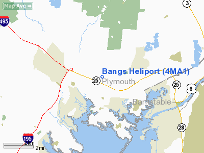
Location & QuickFacts
|
FAA
Information Effective: |
2008-09-25 |
|
Airport Identifier: |
4MA1 |
|
Airport Status: |
Operational |
|
Longitude/Latitude: |
070-41-17.1220W/41-46-37.3740N
-70.688089/41.777048 (Estimated) |
|
Elevation: |
30 ft / 9.14 m (Estimated) |
|
Land: |
0 acres |
|
From
nearest city: |
2 nautical miles SW of Wareham, MA |
|
Location: |
Plymouth County, MA |
|
Magnetic Variation: |
16W (1985) |
Owner & Manager
|
Ownership: |
Privately owned |
|
Owner: |
James E. Ashley |
|
Address: |
419 County Road
West Wareham, MA 02576 |
|
Phone number: |
617-295-9063 |
|
Manager: |
James E. Ashley |
|
Address: |
419 County Road
West Wareham, MA 02576 |
|
Phone number: |
617-295-9063 |
Airport Operations and
Facilities
|
Airport Use: |
Private |
|
Segmented Circle: |
No |
|
Control Tower: |
No |
|
Landing fee charge: |
No |
|
Sectional chart: |
New York |
|
Region: |
ANE - New England |
|
Boundary ARTCC: |
ZBW - Boston |
|
Tie-in FSS: |
BDR - Bridgeport |
|
FSS
on Airport: |
No |
|
FSS
Toll Free: |
1-800-WX-BRIEF |
|
Runway Information
Helipad H1
|
Dimension: |
75 x 75 ft / 22.9 x 22.9 m |
|
Surface: |
TURF, |
|
|
Runway H1
|
Runway
|
|
Traffic Pattern: |
Left |
Left |
|
Radio Navigation Aids
|
ID |
Type |
Name |
Ch |
Freq |
Var |
Dist |
|
ORW |
FAN MARKER |
Canton |
|
|
15W |
31.0 nm |
|
FFF |
NDB |
Plymouth |
|
257.00 |
16W |
6.7 nm |
|
TAN |
NDB |
Taunton |
|
227.00 |
16W |
15.9 nm |
|
IMR |
NDB |
Marshfield |
|
368.00 |
16W |
19.3 nm |
|
IHM |
NDB |
Mansfield |
|
220.00 |
16W |
26.5 nm |
|
PVC |
NDB |
Provincetown |
|
389.00 |
16W |
27.2 nm |
|
CQX |
NDB |
Nauset |
|
279.00 |
16W |
31.7 nm |
|
SFZ |
NDB |
Central |
|
241.00 |
15W |
36.8 nm |
|
TUK |
NDB |
Nantucket |
|
194.00 |
15W |
38.2 nm |
|
LQ |
NDB |
Lyndy |
|
382.00 |
16W |
42.4 nm |
|
SKR |
NDB |
Shaker Hill |
|
251.00 |
16W |
46.3 nm |
|
FMH |
TACAN |
Otis |
105X |
|
15W |
10.5 nm |
|
NZW |
TACAN |
South Weymouth |
061X |
|
15W |
25.0 nm |
|
MVY |
VOR/DME |
Marthas Vineyard |
092X |
114.50 |
15W |
23.1 nm |
|
LFV |
VOR/DME |
Marconi |
094X |
114.70 |
16W |
32.5 nm |
|
ACK |
VOR/DME |
Nantucket |
109X |
116.20 |
15W |
42.1 nm |
|
PVD |
VORTAC |
Providence |
103X |
115.60 |
14W |
33.4 nm |
|
BOS |
VORTAC |
Boston |
074X |
112.70 |
16W |
37.4 nm |
|
PVD |
VOT |
Providence |
|
108.20 |
|
33.3 nm |
|
BOS |
VOT |
Boston Logan Intl |
|
111.00 |
|
39.0 nm |
|
BED |
VOT |
Laurence G Hanscom Fld |
|
110.00 |
|
49.4 nm |
Remarks
-
OWNER
DESIRES HELIPORT NOT BE CHARTED
-
VFR USE ONLY.
Based Aircraft
|
Aircraft
based on field: |
1 |
|
Helicopters: |
1 |
Bangs Heliport
Address:
Plymouth County, MA
Tel:
617-295-9063
Images
and information placed above are from
http://www.airport-data.com/airport/4MA1/
We
thank them for the data!
| General Info |
| Country |
United States |
| State |
MASSACHUSETTS |
| FAA ID |
4MA1 |
| Latitude |
41-46-37.374N |
| Longitude |
070-41-17.122W |
| Elevation |
30 feet |
| Near City |
WAREHAM |
We don't guarantee the information is fresh and accurate. The data may
be wrong or outdated.
For more up-to-date information please refer to other sources.
|
|


