 |
|
|
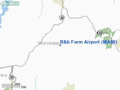
Location & QuickFacts
|
FAA
Information Effective: |
2008-09-25 |
|
Airport Identifier: |
MA89 |
|
Airport Status: |
Operational |
|
Longitude/Latitude: |
072-06-14.0000W/42-20-46.0000N
-72.103889/42.346111 (Estimated) |
|
Elevation: |
980 ft / 298.70 m (Estimated) |
|
Land: |
0 acres |
|
From
nearest city: |
2 nautical miles NE of New Braintree, MA |
|
Location: |
Worcester County, MA |
|
Magnetic Variation: |
15W (2000) |
Owner & Manager
|
Ownership: |
Privately owned |
|
Owner: |
Catherine Bauman & Donald Beyer |
|
Address: |
71 Lakeshore Dr.
Sterling, MA 01564 |
|
Phone number: |
978-365-4027 |
|
Manager: |
Catherine Bauman & Donald Beyer |
|
Address: |
71 Lakeshore Dr.
Sterling, MA 01564 |
|
Phone number: |
978-365-4027 |
Airport Operations and Facilities
|
Airport Use: |
Private |
|
Segmented Circle: |
No |
|
Control Tower: |
No |
|
Sectional chart: |
New York |
|
Region: |
ANE - New England |
|
Boundary ARTCC: |
ZBW - Boston |
|
Tie-in FSS: |
BDR - Bridgeport |
|
FSS
Toll Free: |
1-800-WX-BRIEF |
|
Runway Information
Runway 16/34
|
Dimension: |
2000 x 100 ft / 609.6 x 30.5 m |
|
Surface: |
TURF, |
|
|
Runway 16
|
Runway 34
|
|
Traffic Pattern: |
Left |
Right |
|
Obstruction: |
60 ft trees |
60 ft trees |
|
Radio Navigation Aids
|
ID |
Type |
Name |
Ch |
Freq |
Var |
Dist |
|
ORW |
FAN MARKER |
Canton |
|
|
15W |
43.8 nm |
|
PSF |
FAN MARKER |
Abyss |
|
|
13W |
49.7 nm |
|
ORE |
NDB |
Orange |
|
205.00 |
15W |
15.6 nm |
|
FIT |
NDB |
Fitchburg |
|
365.00 |
15W |
19.7 nm |
|
AS |
NDB |
Chern |
|
359.00 |
16W |
36.3 nm |
|
SFZ |
NDB |
Central |
|
241.00 |
15W |
37.6 nm |
|
SKR |
NDB |
Shaker Hill |
|
251.00 |
16W |
41.6 nm |
|
DRY |
NDB |
Derry |
|
338.00 |
16W |
44.4 nm |
|
IHM |
NDB |
Mansfield |
|
220.00 |
16W |
45.4 nm |
|
DXT |
NDB |
Dalton |
|
370.00 |
15W |
47.9 nm |
|
VWD |
NDB |
Mount Snow |
|
224.00 |
15W |
48.5 nm |
|
HF |
NDB |
Lomis |
|
244.00 |
15W |
48.7 nm |
|
PUT |
VOR/DME |
Putnam |
121X |
117.40 |
14W |
26.2 nm |
|
CTR |
VOR/DME |
Chester |
098X |
115.10 |
13W |
37.7 nm |
|
MHT |
VOR/DME |
Manchester |
091X |
114.40 |
15W |
45.2 nm |
|
HFD |
VOR/DME |
Hartford |
096X |
114.90 |
13W |
46.8 nm |
|
ORW |
VOR/DME |
Norwich |
037X |
110.00 |
14W |
47.7 nm |
|
GDM |
VORTAC |
Gardner |
043X |
110.60 |
14W |
12.2 nm |
|
CEF |
VORTAC |
Westover |
87X |
114.00 |
14W |
20.8 nm |
|
EEN |
VORTAC |
Keene |
031X |
109.40 |
14W |
28.2 nm |
|
BAF |
VORTAC |
Barnes |
077X |
113.00 |
14W |
29.4 nm |
|
BDL |
VORTAC |
Bradley |
027X |
109.00 |
14W |
35.7 nm |
|
PVD |
VORTAC |
Providence |
103X |
115.60 |
14W |
48.0 nm |
|
BOS |
VORTAC |
Boston |
074X |
112.70 |
16W |
49.5 nm |
|
ORH |
VOT |
Worcester |
|
108.20 |
|
11.5 nm |
|
BDL |
VOT |
Bradley Intl |
|
111.40 |
|
35.6 nm |
|
BED |
VOT |
Laurence G Hanscom Fld |
|
110.00 |
|
36.9 nm |
|
HFD |
VOT |
Hartford |
|
108.20 |
|
44.1 nm |
|
PVD |
VOT |
Providence |
|
108.20 |
|
48.1 nm |
|
BOS |
VOT |
Boston Logan Intl |
|
111.00 |
|
48.1 nm |
Remarks
-
OWNER
DESIRES ARPT NOT BE CHARTED.
-
PRVDD
VFR OPNS & RIGHT TRAFFIC RY 34 DUE TO PROXIMITY TO BARRE-HILLER AIRPORT.
Based Aircraft
|
Aircraft
based on field: |
2 |
|
Single
Engine Airplanes: |
2 |
B And b Farm Airport
Address:
Worcester County, MA
Tel:
978-365-4027
Images
and information placed above are from
http://www.airport-data.com/airport/MA89/
We
thank them for the data!
| General Info |
| Country |
United States |
| State |
MASSACHUSETTS |
| FAA ID |
MA89 |
| Latitude |
42-20-46.000N |
| Longitude |
072-06-14.000W |
| Elevation |
980 feet |
| Near City |
NEW BRAINTREE |
We don't guarantee the information is fresh and accurate. The data may
be wrong or outdated.
For more up-to-date information please refer to other sources.
|
|


