 |
|
|
Location & QuickFacts
|
FAA
Information Effective: |
2008-09-25 |
|
Airport Identifier: |
MA54 |
|
Airport Status: |
Operational |
|
Longitude/Latitude: |
072-25-34.3060W/42-18-00.3290N
-72.426196/42.300091 (Estimated) |
|
Elevation: |
320 ft / 97.54 m (Estimated) |
|
Land: |
5 acres |
|
From
nearest city: |
2 nautical miles SE of Belchertown, MA |
|
Location: |
Hampshire County, MA |
|
Magnetic Variation: |
15W (1985) |
Owner & Manager
|
Ownership: |
Privately owned |
|
Owner: |
Patricia Gosselin |
|
Address: |
161 Bay Road
Belchertown, MA 01007 |
|
Phone number: |
413-323-7144 |
|
Manager: |
Patricia Gosselin |
|
Address: |
161 Bay Road
Belchertown, MA 01007 |
|
Phone number: |
413-323-7144 |
Airport Operations and Facilities
|
Airport Use: |
Private |
|
Wind
indicator: |
Yes |
|
Segmented Circle: |
No |
|
Control Tower: |
No |
|
Sectional chart: |
New York |
|
Region: |
ANE - New England |
|
Boundary ARTCC: |
ZBW - Boston |
|
Tie-in FSS: |
BDR - Bridgeport |
|
FSS
Toll Free: |
1-800-WX-BRIEF |
|
Runway Information
Helipad H1
|
Dimension: |
150 x 75 ft / 45.7 x 22.9 m |
|
Surface: |
TURF, |
|
|
Runway H1
|
Runway
|
|
Traffic Pattern: |
Left |
Left |
|
Radio Navigation Aids
|
ID |
Type |
Name |
Ch |
Freq |
Var |
Dist |
|
PSF |
FAN MARKER |
Abyss |
|
|
13W |
36.2 nm |
|
GBR |
FAN MARKER |
Sheffield |
|
|
13W |
43.0 nm |
|
ORE |
NDB |
Orange |
|
205.00 |
15W |
17.3 nm |
|
FIT |
NDB |
Fitchburg |
|
365.00 |
15W |
33.3 nm |
|
DXT |
NDB |
Dalton |
|
370.00 |
15W |
34.6 nm |
|
HF |
NDB |
Lomis |
|
244.00 |
15W |
40.9 nm |
|
VWD |
NDB |
Mount Snow |
|
224.00 |
15W |
42.4 nm |
|
GBR |
NDB |
Great Barrington |
|
395.00 |
14W |
44.1 nm |
|
SFZ |
NDB |
Central |
|
241.00 |
15W |
47.7 nm |
|
AS |
NDB |
Chern |
|
359.00 |
16W |
48.2 nm |
|
CTR |
VOR/DME |
Chester |
098X |
115.10 |
13W |
23.3 nm |
|
PUT |
VOR/DME |
Putnam |
121X |
117.40 |
14W |
33.2 nm |
|
HFD |
VOR/DME |
Hartford |
096X |
114.90 |
13W |
40.0 nm |
|
ORW |
VOR/DME |
Norwich |
037X |
110.00 |
14W |
48.6 nm |
|
CEF |
VORTAC |
Westover |
87X |
114.00 |
14W |
7.6 nm |
|
BAF |
VORTAC |
Barnes |
077X |
113.00 |
14W |
15.3 nm |
|
GDM |
VORTAC |
Gardner |
043X |
110.60 |
14W |
22.0 nm |
|
BDL |
VORTAC |
Bradley |
027X |
109.00 |
14W |
24.5 nm |
|
EEN |
VORTAC |
Keene |
031X |
109.40 |
14W |
30.3 nm |
|
BDL |
VOT |
Bradley Intl |
|
111.40 |
|
24.6 nm |
|
ORH |
VOT |
Worcester |
|
108.20 |
|
24.9 nm |
|
HFD |
VOT |
Hartford |
|
108.20 |
|
35.4 nm |
Remarks
-
DAY VFR
OPNS ONLY; LNDG AREA OUTLINED.
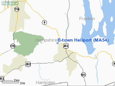
B-town Heliport
Address:
Hampshire County, MA
Tel:
413-323-7144
Images
and information placed above are from
http://www.airport-data.com/airport/MA54/
We
thank them for the data!
| General Info |
| Country |
United States |
| State |
MASSACHUSETTS |
| FAA ID |
MA54 |
| Latitude |
42-18-00.329N |
| Longitude |
072-25-34.306W |
| Elevation |
320 feet |
| Near City |
BELCHERTOWN |
We don't guarantee the information is fresh and accurate. The data may
be wrong or outdated.
For more up-to-date information please refer to other sources.
|
|


