 |
|
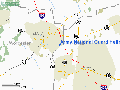
Army National Guard Heliport |
|
Location & QuickFacts
|
FAA
Information Effective: |
2008-09-25 |
|
Airport Identifier: |
MA46 |
|
Airport Status: |
Operational |
|
Longitude/Latitude: |
071-29-03.2200W/42-07-50.3500N
-71.484228/42.130653 (Estimated) |
|
Elevation: |
300 ft / 91.44 m (Estimated) |
|
Land: |
0 acres |
|
From
nearest city: |
2 nautical miles W of Milford, MA |
|
Location: |
Worcester County, MA |
|
Magnetic Variation: |
15W (1995) |
Owner & Manager
|
Ownership: |
Publicly owned |
|
Owner: |
Ma Army National Guard |
|
Address: |
50 Maple Street
Milford, MA 01757 |
|
Phone number: |
508-233-6580 |
|
Manager: |
State Army Aviation Officer |
|
Address: |
50 Maple Street
Milford, MA 01757 |
|
Phone number: |
508-233-6580 |
Airport Operations and Facilities
|
Airport Use: |
Private |
|
Segmented Circle: |
No |
|
Control Tower: |
No |
|
Sectional chart: |
New York |
|
Region: |
ANE - New England |
|
Boundary ARTCC: |
ZBW - Boston |
|
Tie-in FSS: |
BDR - Bridgeport |
|
FSS
on Airport: |
No |
|
FSS
Toll Free: |
1-800-WX-BRIEF |
|
Runway Information
Helipad H1
|
Dimension: |
15 x 15 ft / 4.6 x 4.6 m |
|
Surface: |
CONC, |
|
|
Runway H1
|
Runway
|
|
Traffic Pattern: |
Left |
Left |
|
Radio Navigation Aids
|
ID |
Type |
Name |
Ch |
Freq |
Var |
Dist |
|
ORW |
FAN MARKER |
Canton |
|
|
15W |
14.9 nm |
|
BVY |
FAN MARKER |
Beverly |
|
|
|
37.5 nm |
|
SFZ |
NDB |
Central |
|
241.00 |
15W |
12.7 nm |
|
IHM |
NDB |
Mansfield |
|
220.00 |
16W |
14.9 nm |
|
SKR |
NDB |
Shaker Hill |
|
251.00 |
16W |
23.8 nm |
|
TAN |
NDB |
Taunton |
|
227.00 |
16W |
25.9 nm |
|
FIT |
NDB |
Fitchburg |
|
365.00 |
15W |
28.0 nm |
|
LQ |
NDB |
Lyndy |
|
382.00 |
16W |
30.2 nm |
|
FFF |
NDB |
Plymouth |
|
257.00 |
16W |
34.9 nm |
|
IMR |
NDB |
Marshfield |
|
368.00 |
16W |
36.1 nm |
|
TOF |
NDB |
Topsfield |
|
269.00 |
16W |
37.6 nm |
|
AS |
NDB |
Chern |
|
359.00 |
16W |
42.0 nm |
|
ORE |
NDB |
Orange |
|
205.00 |
15W |
44.3 nm |
|
DRY |
NDB |
Derry |
|
338.00 |
16W |
44.6 nm |
|
NZW |
TACAN |
South Weymouth |
061X |
|
15W |
24.4 nm |
|
PUT |
VOR/DME |
Putnam |
121X |
117.40 |
14W |
19.2 nm |
|
LWM |
VOR/DME |
Lawrence |
072X |
112.50 |
15W |
40.5 nm |
|
ORW |
VOR/DME |
Norwich |
037X |
110.00 |
14W |
41.5 nm |
|
MHT |
VOR/DME |
Manchester |
091X |
114.40 |
15W |
44.6 nm |
|
PVD |
VORTAC |
Providence |
103X |
115.60 |
14W |
24.5 nm |
|
BOS |
VORTAC |
Boston |
074X |
112.70 |
16W |
25.9 nm |
|
GDM |
VORTAC |
Gardner |
043X |
110.60 |
14W |
35.7 nm |
|
CEF |
VORTAC |
Westover |
87X |
114.00 |
14W |
46.6 nm |
|
ORH |
VOT |
Worcester |
|
108.20 |
|
19.0 nm |
|
BED |
VOT |
Laurence G Hanscom Fld |
|
110.00 |
|
22.1 nm |
|
PVD |
VOT |
Providence |
|
108.20 |
|
24.6 nm |
|
BOS |
VOT |
Boston Logan Intl |
|
111.00 |
|
25.4 nm |
Remarks
Army National Guard Heliport
Address:
Worcester County, MA
Tel:
508-233-6580
Images
and information placed above are from
http://www.airport-data.com/airport/MA46/
We
thank them for the data!
| General Info |
| Country |
United States |
| State |
MASSACHUSETTS |
| FAA ID |
MA46 |
| Latitude |
42-07-50.350N |
| Longitude |
071-29-03.220W |
| Elevation |
300 feet |
| Near City |
MILFORD |
We don't guarantee the information is fresh and accurate. The data may
be wrong or outdated.
For more up-to-date information please refer to other sources.
|
|


