 |
|
|
Location &
QuickFacts
|
FAA
Information Effective: |
2008-09-25 |
|
Airport Identifier: |
5MA9 |
|
Airport Status: |
Operational |
|
Longitude/Latitude: |
071-01-41.1430W/41-30-40.3750N
-71.028095/41.511215 (Estimated) |
|
Elevation: |
60
ft / 18.29 m (Estimated) |
|
Land: |
0
acres |
|
From
nearest city: |
6 nautical miles S of Westport, MA |
|
Location: |
Bristol County, MA |
|
Magnetic Variation: |
15W (1985) |
Owner & Manager
|
Ownership: |
Privately owned |
|
Owner: |
Garry A Small |
|
Address: |
1143 Horseneck Rd
Westport, MA 02790 |
|
Phone number: |
508-636-3762 |
|
Manager: |
Garry A Small |
|
Address: |
1143 Horseneck Rd
Westport, MA 02790 |
|
Phone number: |
508-636-3762 |
Airport
Operations and Facilities
|
Airport Use: |
Private |
|
Wind
indicator: |
Yes |
|
Segmented Circle: |
No |
|
Control Tower: |
No |
|
Sectional chart: |
New
York |
|
Region: |
ANE
- New England |
|
Boundary ARTCC: |
ZBW
- Boston |
|
Tie-in FSS: |
BDR
- Bridgeport |
|
FSS
Toll Free: |
1-800-WX-BRIEF |
|
Runway Information
Runway 13/31
|
Dimension: |
1150 x 40 ft / 350.5 x 12.2 m |
|
Surface: |
TURF, |
|
|
Runway 13
|
Runway 31
|
|
Traffic Pattern: |
Left |
Left |
|
Obstruction: |
|
35 ft pline, 0.0 ft from runway |
|
Runway 17/35
|
Dimension: |
1550 x 40 ft / 472.4 x 12.2 m |
|
Surface: |
TURF, |
|
|
Runway 17
|
Runway 35
|
|
Traffic Pattern: |
Left |
Left |
|
Obstruction: |
40 ft trees |
35 ft pline, 0.0 ft from runway |
|
Radio Navigation
Aids
|
ID |
Type |
Name |
Ch |
Freq |
Var |
Dist |
|
ORW |
FAN MARKER |
Canton |
|
|
15W |
39.3 nm |
|
TAN |
NDB |
Taunton |
|
227.00 |
16W |
22.0 nm |
|
FFF |
NDB |
Plymouth |
|
257.00 |
16W |
22.6 nm |
|
IHM |
NDB |
Mansfield |
|
220.00 |
16W |
30.5 nm |
|
SFZ |
NDB |
Central |
|
241.00 |
15W |
32.1 nm |
|
IMR |
NDB |
Marshfield |
|
368.00 |
16W |
38.6 nm |
|
TUK |
NDB |
Nantucket |
|
194.00 |
15W |
40.9 nm |
|
CQX |
NDB |
Nauset |
|
279.00 |
16W |
47.9 nm |
|
PVC |
NDB |
Provincetown |
|
389.00 |
16W |
49.2 nm |
|
FMH |
TACAN |
Otis |
105X |
|
15W |
24.8 nm |
|
NZW |
TACAN |
South Weymouth |
061X |
|
15W |
38.6 nm |
|
MVY |
VOR/DME |
Marthas Vineyard |
092X |
114.50 |
15W |
19.9 nm |
|
SEY |
VOR/DME |
Sandy Point |
125X |
117.80 |
15W |
32.2 nm |
|
ORW |
VOR/DME |
Norwich |
037X |
110.00 |
14W |
43.8 nm |
|
PUT |
VOR/DME |
Putnam |
121X |
117.40 |
14W |
45.3 nm |
|
ACK |
VOR/DME |
Nantucket |
109X |
116.20 |
15W |
47.2 nm |
|
GON |
VOR/DME |
Groton |
45Y |
110.85 |
14W |
47.4 nm |
|
PVD |
VORTAC |
Providence |
103X |
115.60 |
14W |
22.1 nm |
|
PVD |
VOT |
Providence |
|
108.20 |
|
22.0 nm |
|
GON |
VOT |
Groton |
|
110.25 |
|
47.4 nm |
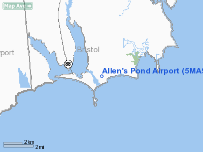
Allen's Pond Airport
Address:
Bristol County, MA
Tel:
508-636-3762
Images
and information placed above are from
http://www.airport-data.com/airport/5MA9/
We
thank them for the data!
|
General Info |
| Country |
United
States |
| State |
MASSACHUSETTS |
| FAA ID |
5MA9
|
| Latitude |
41-30-40.375N |
|
Longitude |
071-01-41.143W |
|
Elevation |
60 feet
|
| Near
City |
WESTPORT
|
We don't guarantee the information is fresh and accurate. The data may
be wrong or outdated.
For more up-to-date information please refer to other sources.
|
|


