 |
|
|
Location &
QuickFacts
|
FAA
Information Effective: |
2008-09-25 |
|
Airport Identifier: |
MA88 |
|
Airport Status: |
Operational |
|
Longitude/Latitude: |
072-55-51.3520W/42-23-24.3130N
-72.930931/42.390087 (Estimated) |
|
Elevation: |
1425
ft / 434.34 m (Estimated) |
|
Land: |
0
acres |
|
From
nearest city: |
1 nautical miles SE of Worthington, MA |
|
Location: |
Hampshire County, MA |
|
Magnetic Variation: |
14W (1985) |
Owner &
Manager
|
Ownership: |
Privately owned |
|
Owner: |
Ben
Albert |
|
Address: |
Box 265 Huntington Rd
Worthington, MA 01098 |
|
Phone number: |
413-238-5521 |
|
Manager: |
Ben
Albert |
|
Address: |
Box 265 Huntington Rd
Worthington, MA 01098 |
|
Phone number: |
413-238-5521 |
Airport Operations and
Facilities
|
Airport Use: |
Private |
|
Wind
indicator: |
No |
|
Segmented Circle: |
No |
|
Control Tower: |
No |
|
Landing fee charge: |
No |
|
Sectional chart: |
New
York |
|
Region: |
ANE
- New England |
|
Boundary ARTCC: |
ZBW
- Boston |
|
Tie-in FSS: |
BTV
- Burlington |
|
FSS
on Airport: |
No |
|
FSS
Toll Free: |
1-800-WX-BRIEF |
|
Runway Information
Runway N/S
|
Dimension: |
2800 x 50 ft / 853.4 x 15.2 m |
|
Surface: |
ASPH-GRVL,
CNTR PORTION OF RY 25'WIDE ASPH 12.5'GRVL ON EACH SIDE OF ASPH FOR TOTAL
WIDTH OF 50' |
|
|
Runway N
|
Runway S
|
|
Traffic Pattern: |
Left |
Left |
|
Radio Navigation
Aids
|
ID |
Type |
Name |
Ch |
Freq |
Var |
Dist |
|
PSF |
FAN MARKER |
Abyss |
|
|
13W |
13.1 nm |
|
GBR |
FAN MARKER |
Sheffield |
|
|
13W |
24.9 nm |
|
DXT |
NDB |
Dalton |
|
370.00 |
15W |
11.7 nm |
|
GBR |
NDB |
Great Barrington |
|
395.00 |
14W |
24.4 nm |
|
ORE |
NDB |
Orange |
|
205.00 |
15W |
30.5 nm |
|
VWD |
NDB |
Mount Snow |
|
224.00 |
15W |
32.4 nm |
|
PFH |
NDB |
Philmont |
|
272.00 |
13W |
36.2 nm |
|
HF |
NDB |
Lomis |
|
244.00 |
15W |
47.4 nm |
|
CTR |
VOR/DME |
Chester |
098X |
115.10 |
13W |
6.0 nm |
|
CAM |
VOR/DME |
Cambridge |
097X |
115.00 |
14W |
40.6 nm |
|
PWL |
VOR/DME |
Pawling |
090X |
114.30 |
12W |
47.8 nm |
|
HFD |
VOR/DME |
Hartford |
096X |
114.90 |
13W |
48.2 nm |
|
BAF |
VORTAC |
Barnes |
077X |
113.00 |
14W |
16.7 nm |
|
CEF |
VORTAC |
Westover |
87X |
114.00 |
14W |
21.4 nm |
|
BDL |
VORTAC |
Bradley |
027X |
109.00 |
14W |
29.1 nm |
|
EEN |
VORTAC |
Keene |
031X |
109.40 |
14W |
37.3 nm |
|
GDM |
VORTAC |
Gardner |
043X |
110.60 |
14W |
39.8 nm |
|
ALB |
VORTAC |
Albany |
100X |
115.30 |
13W |
44.2 nm |
|
BDL |
VOT |
Bradley Intl |
|
111.40 |
|
29.3 nm |
|
HFD |
VOT |
Hartford |
|
108.20 |
|
41.3 nm |
|
ALB |
VOT |
Albany County |
|
108.20 |
|
44.8 nm |
|
ORH |
VOT |
Worcester |
|
108.20 |
|
47.8 nm |
Remarks
-
OWNER DESIRES
ARPT TO BE CHARTED.
-
EXISTED PRIOR TO 1959.
Based Aircraft
|
Aircraft
based on field: |
3 |
|
Single
Engine Airplanes: |
3 |
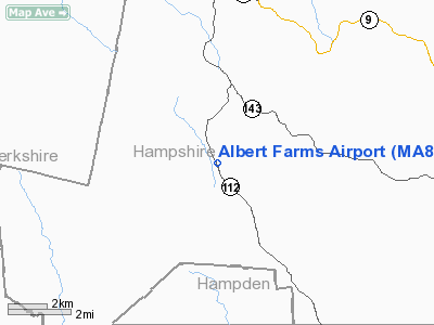
Albert Farms Airport
Address:
Hampshire County, MA
Tel:
413-238-5521
Images
and information placed above are from
http://www.airport-data.com/airport/MA88/
We
thank them for the data!
|
General Info |
| Country |
United
States |
| State |
MASSACHUSETTS |
| FAA ID |
MA88
|
| Latitude |
42-23-24.313N |
|
Longitude |
072-55-51.352W |
|
Elevation |
1425
feet |
| Near
City |
WORTHINGTON |
We don't guarantee the information is fresh and accurate. The data may
be wrong or outdated.
For more up-to-date information please refer to other sources.
|
|


