 |
|
Location & QuickFacts
| FAA Information Effective: | 2008-09-25 |
| Airport Identifier: | MD01 |
| Airport Status: | Operational |
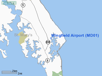
| Longitude/Latitude: | 076-21-23.8130W/38-08-36.4510N
-76.356615/38.143459 (Estimated) |
| Elevation: | 20 ft / 6.10 m (Surveyed) |
| Land: | 20 acres |
| From nearest city: | 2 nautical miles NE of Ridge, MD |
| Location: | St Marys County, MD |
| Magnetic Variation: | 10W (1985) |
Owner & Manager
| Ownership: | Privately owned |
| Owner: | Stanley J. Sweikar, Jr. |
| Address: | Po Box 9, 49595 Diamond Na
Dameron, MD 20628 |
| Phone number: | 301-872-4055 |
| Manager: | Stanley J. Sweikar, Jr. |
| Address: | Po, Box 9, 49595 Diamond La
Dameron, MD 20628 |
| Phone number: | 301-872-4055 |
Airport Operations and Facilities
| Airport Use: | Private
PERSONAL USE. |
| Wind indicator: | Yes |
| Segmented Circle: | No |
| Control Tower: | No |
| Sectional chart: | Washington |
| Region: | AEA - Eastern |
| Boundary ARTCC: | ZDC - Washington |
| Tie-in FSS: | DCA - Leesburg |
| FSS Toll Free: | 1-800-WX-BRIEF |
Airport Services
Runway Information
Runway 01W/19W
| Dimension: | 4200 x 500 ft / 1280.2 x 152.4 m |
| Surface: | WATER, |
| |
Runway 01W |
Runway 19W |
| Traffic Pattern: | Left | Left |
|
Runway 11/29
| Dimension: | 1200 x 50 ft / 365.8 x 15.2 m |
| Surface: | TURF, |
| |
Runway 11 |
Runway 29 |
| Traffic Pattern: | Right | Left |
| Obstruction: | 60 ft trees, 100.0 ft from runway | |
|
Runway 14W/32W
| Dimension: | 3600 x 300 ft / 1097.3 x 91.4 m |
| Surface: | WATER, |
| |
Runway 14W |
Runway 32W |
| Traffic Pattern: | Left | Left |
|
Radio Navigation Aids
| ID |
Type |
Name |
Ch |
Freq |
Var |
Dist |
| NHK | NDB | Patuxent | | 400.00 | 10W | 8.8 nm |
| CGE | NDB | Cambridge | | 355.00 | 10W | 28.2 nm |
| ESN | NDB | Easton | | 212.00 | 10W | 42.0 nm |
| BDB | NDB | Accomack | | 336.00 | 11W | 43.5 nm |
| APH | NDB | A P Hill | | 396.00 | 10W | 45.9 nm |
| VKX | NDB | Potomac | | 241.00 | 10W | 46.1 nm |
| DC | NDB | Oxonn | | 332.00 | 11W | 48.9 nm |
| PXT | VORTAC | Patuxent | 123X | 117.60 | 10W | 8.9 nm |
| OTT | VORTAC | Nottingham | 084X | 113.70 | 10W | 38.4 nm |
| SBY | VORTAC | Salisbury | 049X | 111.20 | 12W | 41.7 nm |
| SWL | VORTAC | Snow Hill | 071X | 112.40 | 08W | 42.5 nm |
| HCM | VORTAC | Harcum | 025X | 108.80 | 07W | 45.0 nm |
| ADW | VORTAC | Andrews | 078X | 113.10 | 10W | 46.5 nm |
| BRV | VORTAC | Brooke | 092X | 114.50 | 09W | 48.4 nm |
| ADW | VOT | Andrews Afb | | 109.60 | | 45.9 nm |
Remarks
- LAND RY 29, DEP RY 11.
- PROVIDED A LETTER OF AGREEMENT IS MADE FAA REPRESENTATIVE AT PATUXENT NAS; DEPART ONLY FROM RY 11 LAND ONLY ON RY 29. PRVDD SPB VFR ONLY, MAINTAIN CLEAR 20:1 APCH /DEP PATH, COORDINATE WITH AGENCIES RESPONSIBLE FOR WATERWAYS USED FOR TKOFS/ LDGS.
Images and information placed above are from
http://www.airport-data.com/airport/MD01/
We thank them for the data!
| General Info
|
| Country |
United States
|
| State |
MARYLAND
|
| FAA ID |
MD01
|
| Latitude |
38-08-36.451N
|
| Longitude |
076-21-23.813W
|
| Elevation |
20 feet
|
| Near City |
RIDGE
|
We don't guarantee the information is fresh and accurate. The data may
be wrong or outdated.
For more up-to-date information please refer to other sources.
|
|


