 |
|
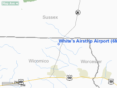
Location & QuickFacts
| FAA Information Effective: | 2008-09-25 |
| Airport Identifier: | 6MD8 |
| Airport Status: | Operational |
| Longitude/Latitude: | 075-24-11.7030W/38-26-32.4150N
-75.403251/38.442338 (Estimated) |
| Elevation: | 55 ft / 16.76 m (Estimated) |
| Land: | 140 acres |
| From nearest city: | 3 nautical miles N of Pittsville, MD |
| Location: | Wicomico County, MD |
| Magnetic Variation: | 11W (1990) |
Owner & Manager
| Ownership: | Privately owned |
| Owner: | Raymond F White |
| Address: | 9092 Greenbranch Rd
Willards, MD 21874 |
| Address: |
|
Airport Operations and Facilities
| Airport Use: | Private |
| Wind indicator: | Yes |
| Segmented Circle: | No |
| Control Tower: | No |
| Sectional chart: | Washington |
| Region: | AEA - Eastern |
| Boundary ARTCC: | ZDC - Washington |
| Tie-in FSS: | DCA - Leesburg |
| FSS on Airport: | No |
| FSS Toll Free: | 1-800-WX-BRIEF |
Runway Information
Runway 18/36
| Dimension: | 2750 x 105 ft / 838.2 x 32.0 m |
| Surface: | TURF, |
| |
Runway 18 |
Runway 36 |
| Traffic Pattern: | Left | Left |
|
Radio Navigation Aids
| ID |
Type |
Name |
Ch |
Freq |
Var |
Dist |
| OX | NDB | Landy | | 407.00 | 12W | 10.8 nm |
| CGE | NDB | Cambridge | | 355.00 | 10W | 30.1 nm |
| ESN | NDB | Easton | | 212.00 | 10W | 38.1 nm |
| NHK | NDB | Patuxent | | 400.00 | 10W | 48.1 nm |
| DOV | TACAN | Dover | 037X | | 09W | 41.6 nm |
| ATR | VOR/DME | Waterloo | 073X | 112.60 | 09W | 23.9 nm |
| SBY | VORTAC | Salisbury | 049X | 111.20 | 12W | 7.7 nm |
| SWL | VORTAC | Snow Hill | 071X | 112.40 | 08W | 23.4 nm |
| ENO | VORTAC | Smyrna | 051X | 111.40 | 09W | 47.7 nm |
| PXT | VORTAC | Patuxent | 123X | 117.60 | 10W | 47.9 nm |
| SIE | VORTAC | Sea Isle | 095X | 114.80 | 09W | 48.4 nm |
Remarks
- VFR DALGT ONLY; RY 36 THLD DSPLCD TO PROVIDE 20:1 CLEARANCE; SINGLE ENGINE ACFT ONLY; SPECIAL USE AIRSPACE WEST.
Images and information placed above are from
http://www.airport-data.com/airport/6MD8/
We thank them for the data!
| General Info
|
| Country |
United States
|
| State |
MARYLAND
|
| FAA ID |
6MD8
|
| Latitude |
38-26-32.415N
|
| Longitude |
075-24-11.703W
|
| Elevation |
55 feet
|
| Near City |
PITTSVILLE
|
We don't guarantee the information is fresh and accurate. The data may
be wrong or outdated.
For more up-to-date information please refer to other sources.
|
|


