 |
|
Location & QuickFacts
| FAA Information Effective: | 2008-09-25 |
| Airport Identifier: | 3MD6 |
| Airport Status: | Operational |
| Longitude/Latitude: | 076-26-48.8260W/38-11-20.4530N
-76.446896/38.189015 (Estimated) |
| Elevation: | 50 ft / 15.24 m (Estimated) |
| Land: | 5 acres |
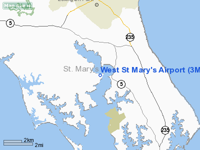
| From nearest city: | 2 nautical miles E of Drayden, MD |
| Location: | St Marys County, MD |
| Magnetic Variation: | 10W (1985) |
Owner & Manager
| Ownership: | Privately owned |
| Owner: | Shepard & Patsy Mc Kenney |
| Address: |
Drayden, MD 20630 |
| Phone number: | 301-994-0214 |
| Address: |
|
Airport Operations and Facilities
| Airport Use: | Private |
| Wind indicator: | Yes |
| Segmented Circle: | No |
| Control Tower: | No |
| Landing fee charge: | No |
| Sectional chart: | Washington |
| Region: | AEA - Eastern |
| Boundary ARTCC: | ZDC - Washington |
| Tie-in FSS: | DCA - Leesburg |
| FSS on Airport: | No |
| FSS Toll Free: | 1-800-WX-BRIEF |
Runway Information
Runway 18/36
| Dimension: | 2200 x 100 ft / 670.6 x 30.5 m |
| Surface: | TURF, |
| |
Runway 18 |
Runway 36 |
| Traffic Pattern: | Left | Left |
| Obstruction: | | 60 ft bldg, 500.0 ft from runway |
|
Radio Navigation Aids
| ID |
Type |
Name |
Ch |
Freq |
Var |
Dist |
| NHK | NDB | Patuxent | | 400.00 | 10W | 6.2 nm |
| CGE | NDB | Cambridge | | 355.00 | 10W | 28.7 nm |
| ESN | NDB | Easton | | 212.00 | 10W | 41.1 nm |
| VKX | NDB | Potomac | | 241.00 | 10W | 41.3 nm |
| APH | NDB | A P Hill | | 396.00 | 10W | 42.0 nm |
| DC | NDB | Oxonn | | 332.00 | 11W | 44.1 nm |
| EZF | NDB | Shannon | | 237.00 | 10W | 47.6 nm |
| BDB | NDB | Accomack | | 336.00 | 11W | 48.3 nm |
| DCA | VOR/DME | Washington | 047X | 111.00 | 09W | 48.9 nm |
| PXT | VORTAC | Patuxent | 123X | 117.60 | 10W | 6.3 nm |
| OTT | VORTAC | Nottingham | 084X | 113.70 | 10W | 34.1 nm |
| ADW | VORTAC | Andrews | 078X | 113.10 | 10W | 42.1 nm |
| BRV | VORTAC | Brooke | 092X | 114.50 | 09W | 43.7 nm |
| SBY | VORTAC | Salisbury | 049X | 111.20 | 12W | 45.2 nm |
| HCM | VORTAC | Harcum | 025X | 108.80 | 07W | 46.2 nm |
| SWL | VORTAC | Snow Hill | 071X | 112.40 | 08W | 47.2 nm |
| ADW | VOT | Andrews Afb | | 109.60 | | 41.4 nm |
| DCA | VOT | Washington National | | 109.40 | | 48.1 nm |
Remarks
- PROVIDED OWNER ENTERS INTO A LTR OF AGREEMENT WITH PARK HALL ARPT REGARDING TRAFFIC PATTERNS; OWNERS ABIDE BY LETTER OF AUTHORIZATION WITH PATUXENT NAS.
Images and information placed above are from
http://www.airport-data.com/airport/3MD6/
We thank them for the data!
| General Info
|
| Country |
United States
|
| State |
MARYLAND
|
| FAA ID |
3MD6
|
| Latitude |
38-11-20.453N
|
| Longitude |
076-26-48.826W
|
| Elevation |
50 feet
|
| Near City |
DRAYDEN
|
We don't guarantee the information is fresh and accurate. The data may
be wrong or outdated.
For more up-to-date information please refer to other sources.
|
|


