 |
|
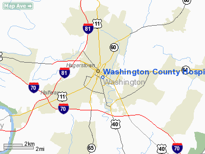
Washington County Hospital Heliport |
Location & QuickFacts
| FAA Information Effective: | 2008-09-25 |
| Airport Identifier: | 1MD9 |
| Airport Status: | Operational |
| Longitude/Latitude: | 077-42-52.9740W/39-38-14.3460N
-77.714715/39.637318 (Estimated) |
| Elevation: | 589 ft / 179.53 m (Estimated) |
| Land: | 0 acres |
| From nearest city: | 0 nautical miles N of Hagerstown, MD |
| Location: | Washington County, MD |
| Magnetic Variation: | 09W (1985) |
Owner & Manager
| Ownership: | Privately owned |
| Owner: | Washington County Hosp Assn. |
| Address: | 251 East Antietam St
Hagerstown, MD 21740 |
| Phone number: | 301-582-3390 |
| Manager: | J. J. Mc Elwee, Jr. |
| Address: | 251 East Antietam St
Hagerstown, MD 21740 |
| Phone number: | 301-582-3390 |
>
Airport Operations and Facilities
| Airport Use: | Private
MEDICAL USE. |
| Wind indicator: | Yes |
| Segmented Circle: | No |
| Control Tower: | No |
| Landing fee charge: | No |
| Sectional chart: | Washington |
| Region: | AEA - Eastern |
| Boundary ARTCC: | ZDC - Washington |
| Tie-in FSS: | DCA - Leesburg |
| FSS on Airport: | No |
| FSS Toll Free: | 1-800-WX-BRIEF |
Runway Information
Helipad H1
| Dimension: | 51 x 51 ft / 15.5 x 15.5 m |
| Surface: | CONC,
ROOFTOP. |
| |
Runway H1 |
Runway |
| Traffic Pattern: | Left | Left |
|
Radio Navigation Aids
| ID |
Type |
Name |
Ch |
Freq |
Var |
Dist |
| TZ | NDB | Cogan | | 364.00 | 10W | 37.0 nm |
| GAI | NDB | Gaithersburg | | 385.00 | 09W | 37.9 nm |
| GDX | NDB | Goodwin Lake | | 227.00 | 08W | 41.4 nm |
| EUD | NDB | York | | 254.00 | 11W | 42.2 nm |
| CBE | NDB | Cumberland | | 317.00 | 07W | 47.8 nm |
| FND | NDB | Ellicott | | 371.00 | 11W | 48.3 nm |
| HGR | VOR | Hagerstown | | 109.80 | 07W | 7.5 nm |
| FDK | VOR | Frederick | | 109.00 | 08W | 20.8 nm |
| AOO | VOR | Altoona | | 108.80 | 07W | 49.5 nm |
| MRB | VORTAC | Martinsburg | 058X | 112.10 | 07W | 16.4 nm |
| THS | VORTAC | St Thomas | 097X | 115.00 | 07W | 20.9 nm |
| EMI | VORTAC | Westminster | 126X | 117.90 | 08W | 35.2 nm |
| AML | VORTAC | Armel | 082X | 113.50 | 08W | 43.8 nm |
| HAR | VORTAC | Harrisburg | 072X | 112.50 | 10W | 49.8 nm |
Remarks
- INGRESS/EGRESS RESTRICTED TO N/S DIRECTION, OBSTRUCTIONS ARE APPROPRIATELY LIGHTED; FOR NIGHT OPERATIONS PAD & WIND SOCK ARE TO BE LIGHTED.
Images and information placed above are from
http://www.airport-data.com/airport/1MD9/
We thank them for the data!
| General Info
|
| Country |
United States
|
| State |
MARYLAND
|
| FAA ID |
1MD9
|
| Latitude |
39-38-14.346N
|
| Longitude |
077-42-52.974W
|
| Elevation |
589 feet
|
| Near City |
HAGERSTOWN
|
We don't guarantee the information is fresh and accurate. The data may
be wrong or outdated.
For more up-to-date information please refer to other sources.
|
|


