 |
|
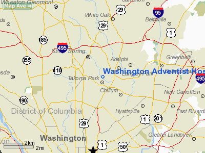
Washington Adventist Hospital Heliport |
Location & QuickFacts
| FAA Information Effective: | 2008-09-25 |
| Airport Identifier: | 6MD9 |
| Airport Status: | Operational |
| Longitude/Latitude: | 077-00-06.9300W/38-59-09.4200N
-77.001925/38.985950 (Estimated) |
| Elevation: | 242 ft / 73.76 m (Estimated) |
| Land: | 16 acres |
| From nearest city: | 2 nautical miles E of Takoma Park, MD |
| Location: | Montgomery County, MD |
| Magnetic Variation: | 10W (1990) |
Owner & Manager
| Ownership: | Privately owned |
| Owner: | Washington Adventist Hospital |
| Address: | 7600 Carroll Ave
Takoma Park, MD 20912 |
| Phone number: | 301-891-5458 |
| Manager: | Geoff Morgan |
| Address: | 7600 Carroll Ave
Takoma Park, MD 20912 |
| Phone number: | 301-891-5458 |
Airport Operations and Facilities
| Airport Use: | Private
MEDICAL. |
| Wind indicator: | Yes |
| Segmented Circle: | No |
| Control Tower: | No |
| Sectional chart: | Washington |
| Region: | AEA - Eastern |
| Boundary ARTCC: | ZDC - Washington |
| Tie-in FSS: | DCA - Leesburg |
| FSS on Airport: | No |
| FSS Toll Free: | 1-800-WX-BRIEF |
Runway Information
Helipad H1
| Dimension: | 40 x 40 ft / 12.2 x 12.2 m |
| Surface: | CONC, |
| |
Runway H1 |
Runway |
| Traffic Pattern: | Left | Left |
|
Radio Navigation Aids
| ID |
Type |
Name |
Ch |
Freq |
Var |
Dist |
| GTN | NDB | Georgetown | | 323.00 | 09W | 6.6 nm |
| BUH | NDB | Anne Arundel | | 260.00 | 10W | 12.7 nm |
| DC | NDB | Oxonn | | 332.00 | 11W | 13.3 nm |
| GAI | NDB | Gaithersburg | | 385.00 | 09W | 13.4 nm |
| VKX | NDB | Potomac | | 241.00 | 10W | 14.4 nm |
| FND | NDB | Ellicott | | 371.00 | 11W | 20.9 nm |
| IUB | NDB | Institute | | 404.00 | 08W | 25.2 nm |
| MTN | NDB | Martin | | 342.00 | 11W | 34.6 nm |
| GDX | NDB | Goodwin Lake | | 227.00 | 08W | 38.8 nm |
| ESN | NDB | Easton | | 212.00 | 10W | 45.0 nm |
| EZF | NDB | Shannon | | 237.00 | 10W | 48.1 nm |
| CJR | NDB | Culpeper | | 252.00 | 09W | 48.6 nm |
| MTN | TACAN | Martin | 068X | | 11W | 34.5 nm |
| FDK | VOR | Frederick | | 109.00 | 08W | 31.0 nm |
| DCA | VOR/DME | Washington | 047X | 111.00 | 09W | 7.8 nm |
| PPM | VOR/DME | Phillips | 021X | 108.40 | 09W | 48.3 nm |
| ADW | VORTAC | Andrews | 078X | 113.10 | 10W | 12.5 nm |
| BAL | VORTAC | Baltimore | 098X | 115.10 | 11W | 19.4 nm |
| OTT | VORTAC | Nottingham | 084X | 113.70 | 10W | 20.7 nm |
| AML | VORTAC | Armel | 082X | 113.50 | 08W | 21.9 nm |
| EMI | VORTAC | Westminster | 126X | 117.90 | 08W | 30.6 nm |
| BRV | VORTAC | Brooke | 092X | 114.50 | 09W | 42.4 nm |
| CSN | VORTAC | Casanova | 110X | 116.30 | 06W | 45.4 nm |
| MRB | VORTAC | Martinsburg | 058X | 112.10 | 07W | 46.2 nm |
| DCA | VOT | Washington National | | 109.40 | | 8.6 nm |
| ADW | VOT | Andrews Afb | | 109.60 | | 13.2 nm |
Remarks
- SEE AIRSPACE DETERMINATION LETTER DATED 03/03/95.
Images and information placed above are from
http://www.airport-data.com/airport/6MD9/
We thank them for the data!
| General Info
|
| Country |
United States
|
| State |
MARYLAND
|
| FAA ID |
6MD9
|
| Latitude |
38-59-09.420N
|
| Longitude |
077-00-06.930W
|
| Elevation |
242 feet
|
| Near City |
TAKOMA PARK
|
We don't guarantee the information is fresh and accurate. The data may
be wrong or outdated.
For more up-to-date information please refer to other sources.
|
|


