 |
|
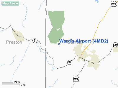
Location & QuickFacts
| FAA Information Effective: | 2008-09-25 |
| Airport Identifier: | 4MD2 |
| Airport Status: | Operational |
| Longitude/Latitude: | 079-27-14.1660W/39-25-47.3430N
-79.453935/39.429817 (Estimated) |
| Elevation: | 2500 ft / 762.00 m (Estimated) |
| Land: | 15 acres |
| From nearest city: | 4 nautical miles WN of Oakland, MD |
| Location: | Garrett County, MD |
| Magnetic Variation: | 08W (1990) |
Owner & Manager
| Ownership: | Privately owned |
| Owner: | Harry Ward Hinebaugh, Iii |
| Address: | 1260 E Woodland Ave
Springfield, PA 19064 |
| Phone number: | 215-543-0222 |
| Address: |
|
Airport Operations and Facilities
| Airport Use: | Private |
| Wind indicator: | Yes |
| Segmented Circle: | No |
| Control Tower: | No |
| Sectional chart: | Cincinnati |
| Region: | AEA - Eastern |
| Boundary ARTCC: | ZOB - Cleveland |
| Tie-in FSS: | EKN - Elkins |
| FSS on Airport: | No |
| FSS Toll Free: | 1-800-WX-BRIEF |
Runway Information
Runway 10/28
| Dimension: | 1883 x 75 ft / 573.9 x 22.9 m |
| Surface: | TURF,
SOFT DURING WET SEASON. |
| |
Runway 10 |
Runway 28 |
| Traffic Pattern: | Left | Left |
| Obstruction: | 70 ft trees, 1400.0 ft from runway | |
|
Radio Navigation Aids
| ID |
Type |
Name |
Ch |
Freq |
Var |
Dist |
| VV | NDB | Camor | | 299.00 | 08W | 30.4 nm |
| CBE | NDB | Cumberland | | 317.00 | 07W | 35.3 nm |
| RQY | NDB | Randolph County | | 284.00 | 07W | 37.3 nm |
| SYS | NDB | Stoystown | | 209.00 | 08W | 46.6 nm |
| GRV | VOR/DME | Grantsville | 070X | 112.30 | 06W | 22.4 nm |
| ESL | VOR/DME | Kessel | 045X | 110.80 | 06W | 24.8 nm |
| CKB | VOR/DME | Clarksburg | 073X | 112.60 | 04W | 39.3 nm |
| MGW | VORTAC | Morgantown | 053X | 111.60 | 05W | 20.3 nm |
| IHD | VORTAC | Indian Head | 019X | 108.20 | 06W | 33.0 nm |
| EKN | VORTAC | Elkins | 089X | 114.20 | 07W | 43.2 nm |
Remarks
- FENCE AT EACH END OF RY 10/28.
- PRVDD USED FOR DALGT ONLY, NO IFR OPNS; HANGAR WHICH IS 175 FT FM CNTRLN IS APPROPRIATELY MKD AS IT PENETRATES THE TSNL SFC.
Images and information placed above are from
http://www.airport-data.com/airport/4MD2/
We thank them for the data!
| General Info
|
| Country |
United States
|
| State |
MARYLAND
|
| FAA ID |
4MD2
|
| Latitude |
39-25-47.343N
|
| Longitude |
079-27-14.166W
|
| Elevation |
2500 feet
|
| Near City |
OAKLAND
|
We don't guarantee the information is fresh and accurate. The data may
be wrong or outdated.
For more up-to-date information please refer to other sources.
|
|


