 |
|
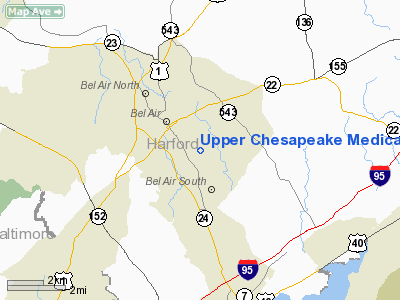
Upper Chesapeake Medical Center Heliport |
Location & QuickFacts
| FAA Information Effective: | 2008-09-25 |
| Airport Identifier: | 03MD |
| Airport Status: | Operational |
| Longitude/Latitude: | 076-19-35.9900W/39-31-20.9900N
-76.326664/39.522497 (Estimated) |
| Elevation: | 302 ft / 92.05 m () |
| Land: | 0 acres |
| From nearest city: | 1 nautical miles NW of Bel Air, MD |
| Location: | Harford County, MD |
| Magnetic Variation: | 11W (2000) |
Owner & Manager
| Ownership: | Privately owned |
| Owner: | Upper Chesapeake Health System |
| Address: | 1916 Bel Air Rd
Fallston, MD 21047 |
| Phone number: | 410-893-0322 |
| Manager: | Lyle Sheldon |
| Address: | 1916 Bel Air Rd
Fallston, MD 21047 |
| Phone number: | 410-893-0322 |
Airport Operations and Facilities
| Airport Use: | Private |
| Wind indicator: | Yes |
| Segmented Circle: | No |
| Control Tower: | No |
| Lighting Schedule: | DUSK-DAWN |
| Region: | AEA - Eastern |
| Boundary ARTCC: | ZNY - New York |
| Tie-in FSS: | DCA - Leesburg |
| FSS Toll Free: | 1-800-WX-BRIEF |
Runway Information
Helipad H1
| Dimension: | 50 x 50 ft / 15.2 x 15.2 m |
| Surface: | CONC, |
| |
Runway H1 |
Runway |
| Traffic Pattern: | Left | Left |
|
Radio Navigation Aids
| ID |
Type |
Name |
Ch |
Freq |
Var |
Dist |
| APG | NDB | Aberdeen | | 349.00 | 11W | 10.2 nm |
| MTN | NDB | Martin | | 342.00 | 11W | 13.6 nm |
| IUB | NDB | Institute | | 404.00 | 08W | 19.8 nm |
| FND | NDB | Ellicott | | 371.00 | 11W | 25.2 nm |
| BUH | NDB | Anne Arundel | | 260.00 | 10W | 33.2 nm |
| EUD | NDB | York | | 254.00 | 11W | 34.9 nm |
| GAI | NDB | Gaithersburg | | 385.00 | 09W | 44.4 nm |
| ESN | NDB | Easton | | 212.00 | 10W | 44.8 nm |
| MTN | TACAN | Martin | 068X | | 11W | 12.2 nm |
| DOV | TACAN | Dover | 037X | | 09W | 46.3 nm |
| FDK | VOR | Frederick | | 109.00 | 08W | 49.1 nm |
| PPM | VOR/DME | Phillips | 021X | 108.40 | 09W | 8.0 nm |
| BAL | VORTAC | Baltimore | 098X | 115.10 | 11W | 26.2 nm |
| EMI | VORTAC | Westminster | 126X | 117.90 | 08W | 30.3 nm |
| DQO | VORTAC | Dupont | 087X | 114.00 | 10W | 34.6 nm |
| LRP | VORTAC | Lancaster | 120X | 117.30 | 09W | 36.0 nm |
| MXE | VORTAC | Modena | 079X | 113.20 | 09W | 38.5 nm |
| ENO | VORTAC | Smyrna | 051X | 111.40 | 09W | 41.5 nm |
| OOD | VORTAC | Woodstown | 075X | 112.80 | 10W | 47.9 nm |
| ADW | VORTAC | Andrews | 078X | 113.10 | 10W | 49.8 nm |
| MDT | VOT | Harrisburg International | | 110.00 | | 45.3 nm |
Remarks
- PRVDD--VFR ONLY, CLEAR 8:1 INGRESS/EGRESS, VEHICLE TFC CONTROLLED DURING OPNS, MKGS FOR INGRESS/EGREES, MINIMIZE NOISE OVER RESIDENCES, SCHOOLS & CHURCHES.
Images and information placed above are from
http://www.airport-data.com/airport/03MD/
We thank them for the data!
| General Info
|
| Country |
United States
|
| State |
MARYLAND
|
| FAA ID |
03MD
|
| Latitude |
39-31-20.990N
|
| Longitude |
076-19-35.990W
|
| Elevation |
302 feet
|
| Near City |
BEL AIR
|
We don't guarantee the information is fresh and accurate. The data may
be wrong or outdated.
For more up-to-date information please refer to other sources.
|
|


