 |
|
University Of Maryland Shock Trauma Center Heliport |
|
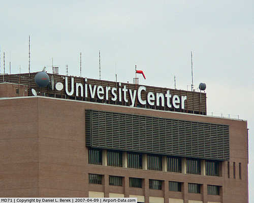 |
(Click on the photo to enlarge) |
Location & QuickFacts
| FAA Information Effective: | 2008-09-25 |
| Airport Identifier: | MD71 |
| Airport Status: | Operational |
| Longitude/Latitude: | 076-37-32.8830W/39-17-19.3850N
-76.625801/39.288718 (Estimated) |
| Elevation: | 166 ft / 50.60 m (Surveyed) |
| Land: | 0 acres |
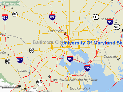
| From nearest city: | 0 nautical miles S of Baltimore, MD |
| Location: | Baltimore County, MD |
| Magnetic Variation: | 09W (1985) |
Owner & Manager
| Ownership: | Privately owned |
| Owner: | Univ Of Md Medical System |
| Address: | 22 S. Greene St.
Baltimore, MD 21201 |
| Phone number: | 410-328-6975 |
| Manager: | John Ashworth |
| Address: | 22 S. Greene St.
Baltimore, MD 21201 |
| Phone number: | 410-328-3774 |
Airport Operations and Facilities
| Airport Use: | Private
MEDICAL USE |
| Wind indicator: | Yes |
| Segmented Circle: | No |
| Control Tower: | No |
| Sectional chart: | Washington |
| Region: | AEA - Eastern |
| Boundary ARTCC: | ZDC - Washington |
| Tie-in FSS: | DCA - Leesburg |
| FSS Toll Free: | 1-800-WX-BRIEF |
Airport Communications
Runway Information
Helipad H1
| Dimension: | 32 x 32 ft / 9.8 x 9.8 m |
| Surface: | CONC, |
| |
Runway H1 |
Runway |
| Traffic Pattern: | Left | Left |
|
Radio Navigation Aids
| ID |
Type |
Name |
Ch |
Freq |
Var |
Dist |
| IUB | NDB | Institute | | 404.00 | 08W | 0.1 nm |
| FND | NDB | Ellicott | | 371.00 | 11W | 7.0 nm |
| MTN | NDB | Martin | | 342.00 | 11W | 11.4 nm |
| BUH | NDB | Anne Arundel | | 260.00 | 10W | 13.8 nm |
| GAI | NDB | Gaithersburg | | 385.00 | 09W | 26.1 nm |
| APG | NDB | Aberdeen | | 349.00 | 11W | 28.3 nm |
| GTN | NDB | Georgetown | | 323.00 | 09W | 31.7 nm |
| VKX | NDB | Potomac | | 241.00 | 10W | 35.9 nm |
| DC | NDB | Oxonn | | 332.00 | 11W | 36.6 nm |
| ESN | NDB | Easton | | 212.00 | 10W | 39.0 nm |
| EUD | NDB | York | | 254.00 | 11W | 39.7 nm |
| MTN | TACAN | Martin | 068X | | 11W | 10.3 nm |
| FDK | VOR | Frederick | | 109.00 | 08W | 35.6 nm |
| PPM | VOR/DME | Phillips | 021X | 108.40 | 09W | 23.7 nm |
| DCA | VOR/DME | Washington | 047X | 111.00 | 09W | 32.1 nm |
| BAL | VORTAC | Baltimore | 098X | 115.10 | 11W | 7.3 nm |
| EMI | VORTAC | Westminster | 126X | 117.90 | 08W | 20.5 nm |
| ADW | VORTAC | Andrews | 078X | 113.10 | 10W | 31.0 nm |
| OTT | VORTAC | Nottingham | 084X | 113.70 | 10W | 35.5 nm |
| AML | VORTAC | Armel | 082X | 113.50 | 08W | 44.6 nm |
| ADW | VOT | Andrews Afb | | 109.60 | | 32.3 nm |
| DCA | VOT | Washington National | | 109.40 | | 32.8 nm |
Remarks
Images and information placed above are from
http://www.airport-data.com/airport/MD71/
We thank them for the data!
| General Info
|
| Country |
United States
|
| State |
MARYLAND
|
| FAA ID |
MD71
|
| Latitude |
39-17-19.385N
|
| Longitude |
076-37-32.883W
|
| Elevation |
166 feet
|
| Near City |
BALTIMORE
|
We don't guarantee the information is fresh and accurate. The data may
be wrong or outdated.
For more up-to-date information please refer to other sources.
|
|


