 |
|
Location & QuickFacts
| FAA Information Effective: | 2008-09-25 |
| Airport Identifier: | MD17 |
| Airport Status: | Operational |
| Longitude/Latitude: | 076-43-58.9080W/39-31-00.3790N
-76.733030/39.516772 (Estimated) |
| Elevation: | 400 ft / 121.92 m (Estimated) |
| Land: | 0 acres |
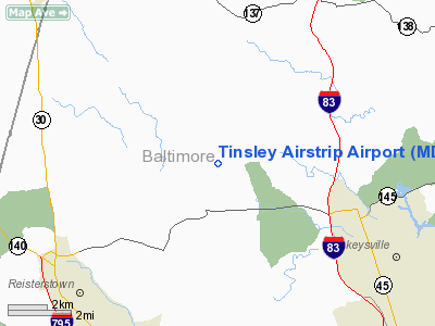
| From nearest city: | 1 nautical miles SW of Butler, MD |
| Location: | Baltimore County, MD |
| Magnetic Variation: | 10W (1985) |
Owner & Manager
| Ownership: | Privately owned |
| Owner: | Thomas G. Tinsley |
| Address: | 2800 Butler Rd
Glyndon, MD 21071 |
| Phone number: | 410-833-0456 |
| Address: |
|
Airport Operations and Facilities
| Airport Use: | Private |
| Wind indicator: | Yes |
| Segmented Circle: | No |
| Control Tower: | No |
| Lighting Schedule: | PHONE REQ
FOR RTG BCN AND RWY LGTS, PHONE 301-833-0456. |
| Beacon Color: | Clear-Green (lighted land airport) |
| Landing fee charge: | No |
| Sectional chart: | Washington |
| Region: | AEA - Eastern |
| Boundary ARTCC: | ZNY - New York |
| Responsible ARTCC: | ZDC - Washington |
| Tie-in FSS: | DCA - Leesburg |
| FSS on Airport: | No |
| FSS Toll Free: | 1-800-WX-BRIEF |
Airport Services
| Airframe Repair: | NONE |
| Power Plant Repair: | NONE |
Runway Information
Runway 09/27
| Dimension: | 1900 x 100 ft / 579.1 x 30.5 m |
| Surface: | TURF, |
| Edge Lights: | Low |
| |
Runway 09 |
Runway 27 |
| Traffic Pattern: | Left | Left |
|
Radio Navigation Aids
| ID |
Type |
Name |
Ch |
Freq |
Var |
Dist |
| FND | NDB | Ellicott | | 371.00 | 11W | 13.9 nm |
| IUB | NDB | Institute | | 404.00 | 08W | 14.7 nm |
| MTN | NDB | Martin | | 342.00 | 11W | 20.9 nm |
| EUD | NDB | York | | 254.00 | 11W | 25.1 nm |
| BUH | NDB | Anne Arundel | | 260.00 | 10W | 26.0 nm |
| GAI | NDB | Gaithersburg | | 385.00 | 09W | 29.0 nm |
| APG | NDB | Aberdeen | | 349.00 | 11W | 29.1 nm |
| GTN | NDB | Georgetown | | 323.00 | 09W | 39.7 nm |
| DC | NDB | Oxonn | | 332.00 | 11W | 47.2 nm |
| VKX | NDB | Potomac | | 241.00 | 10W | 47.3 nm |
| MTN | TACAN | Martin | 068X | | 11W | 18.7 nm |
| FDK | VOR | Frederick | | 109.00 | 08W | 30.5 nm |
| PPM | VOR/DME | Phillips | 021X | 108.40 | 09W | 26.2 nm |
| DCA | VOR/DME | Washington | 047X | 111.00 | 09W | 42.0 nm |
| EMI | VORTAC | Westminster | 126X | 117.90 | 08W | 11.5 nm |
| BAL | VORTAC | Baltimore | 098X | 115.10 | 11W | 21.0 nm |
| LRP | VORTAC | Lancaster | 120X | 117.30 | 09W | 41.6 nm |
| ADW | VORTAC | Andrews | 078X | 113.10 | 10W | 43.1 nm |
| OTT | VORTAC | Nottingham | 084X | 113.70 | 10W | 48.7 nm |
| AML | VORTAC | Armel | 082X | 113.50 | 08W | 48.9 nm |
| HAR | VORTAC | Harrisburg | 072X | 112.50 | 10W | 49.7 nm |
| MDT | VOT | Harrisburg International | | 110.00 | | 40.9 nm |
| DCA | VOT | Washington National | | 109.40 | | 42.7 nm |
| ADW | VOT | Andrews Afb | | 109.60 | | 44.3 nm |
Remarks
Images and information placed above are from
http://www.airport-data.com/airport/MD17/
We thank them for the data!
| General Info
|
| Country |
United States
|
| State |
MARYLAND
|
| FAA ID |
MD17
|
| Latitude |
39-31-00.379N
|
| Longitude |
076-43-58.908W
|
| Elevation |
400 feet
|
| Near City |
BUTLER
|
We don't guarantee the information is fresh and accurate. The data may
be wrong or outdated.
For more up-to-date information please refer to other sources.
|
|


