 |
|
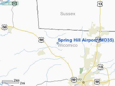
Location & QuickFacts
| FAA Information Effective: | 2008-09-25 |
| Airport Identifier: | MD35 |
| Airport Status: | Operational |
| Longitude/Latitude: | 075-39-04.7390W/38-26-05.4210N
-75.651316/38.434839 (Estimated) |
| Elevation: | 42 ft / 12.80 m (Estimated) |
| Land: | 174 acres |
| From nearest city: | 2 nautical miles NE of Hebron, MD |
| Location: | Wicomico County, MD |
| Magnetic Variation: | 10W (1985) |
Owner & Manager
| Ownership: | Privately owned |
| Owner: | James Brooke |
| Address: | 8739 Spring Hill Lane
Salisbury, MD 21801 |
| Phone number: | 410-219-5011 |
| Manager: | James Brooke |
| Address: | 8739 Spring Hill Lane
Salisbury, MD 21801 |
| Phone number: | 410-219-5011 |
Airport Operations and Facilities
| Airport Use: | Private |
| Wind indicator: | Yes |
| Segmented Circle: | No |
| Control Tower: | No |
| Sectional chart: | Washington |
| Region: | AEA - Eastern |
| Boundary ARTCC: | ZDC - Washington |
| Tie-in FSS: | DCA - Leesburg |
| FSS on Airport: | No |
| FSS Toll Free: | 1-800-WX-BRIEF |
Runway Information
Runway 02/20
| Dimension: | 2200 x 100 ft / 670.6 x 30.5 m |
| Surface: | TURF, Good Condition |
| |
Runway 02 |
Runway 20 |
| Traffic Pattern: | Left | Left |
|
Runway 12/30
| Dimension: | 3400 x 75 ft / 1036.3 x 22.9 m |
| Surface: | TURF, Good Condition |
| |
Runway 12 |
Runway 30 |
| Traffic Pattern: | Left | Left |
|
Radio Navigation Aids
| ID |
Type |
Name |
Ch |
Freq |
Var |
Dist |
| CGE | NDB | Cambridge | | 355.00 | 10W | 19.0 nm |
| OX | NDB | Landy | | 407.00 | 12W | 21.8 nm |
| ESN | NDB | Easton | | 212.00 | 10W | 29.7 nm |
| NHK | NDB | Patuxent | | 400.00 | 10W | 36.5 nm |
| DOV | TACAN | Dover | 037X | | 09W | 42.8 nm |
| ATR | VOR/DME | Waterloo | 073X | 112.60 | 09W | 30.6 nm |
| SBY | VORTAC | Salisbury | 049X | 111.20 | 12W | 8.6 nm |
| SWL | VORTAC | Snow Hill | 071X | 112.40 | 08W | 24.4 nm |
| PXT | VORTAC | Patuxent | 123X | 117.60 | 10W | 36.4 nm |
| ENO | VORTAC | Smyrna | 051X | 111.40 | 09W | 48.3 nm |
Remarks
- PRVDD COORDINATE ACTIVITY AT BENNETT ARPT; CTC PATUXENT RIVER NAS FOR BRIEFING OF OPNS IN SPECIAL USE AIRSPACE; RY 04 USED FOR TAKEOFFS ONLY; ROAD TO NORTH OF RY 04/22 MUST BE OUTSIDE PRIMARY SFC.
Images and information placed above are from
http://www.airport-data.com/airport/MD35/
We thank them for the data!
| General Info
|
| Country |
United States
|
| State |
MARYLAND
|
| FAA ID |
MD35
|
| Latitude |
38-26-05.421N
|
| Longitude |
075-39-04.739W
|
| Elevation |
42 feet
|
| Near City |
HEBRON
|
We don't guarantee the information is fresh and accurate. The data may
be wrong or outdated.
For more up-to-date information please refer to other sources.
|
|


