 |
|
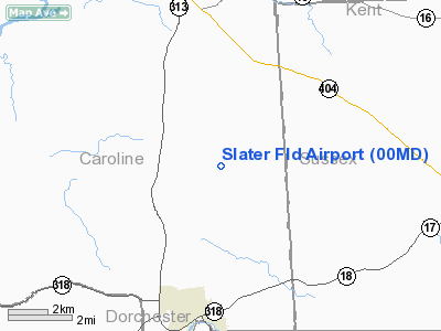
Location & QuickFacts
| FAA Information Effective: | 2008-09-25 |
| Airport Identifier: | 00MD |
| Airport Status: | Operational |
| Longitude/Latitude: | 075-45-13.7550W/38-45-25.4080N
-75.753821/38.757058 (Estimated) |
| Elevation: | 45 ft / 13.72 m (Estimated) |
| Land: | 0 acres |
| From nearest city: | 3 nautical miles NE of Federalsburg, MD |
| Location: | Caroline County, MD |
| Magnetic Variation: | 10W (1985) |
Owner & Manager
| Ownership: | Privately owned |
| Owner: | Calvin J. Houghton |
| Address: | 5366 Smithville Road
Federalsburg, MD 21632 |
| Phone number: | 410-754-8797 |
| Manager: | Calvin J. Houghton |
| Address: | 5366 Smithville Road
Federalsburg, MD 21632 |
| Phone number: | 410-754-8797 |
Airport Operations and Facilities
| Airport Use: | Private |
| Wind indicator: | Yes |
| Segmented Circle: | No |
| Control Tower: | No |
| Landing fee charge: | No |
| Sectional chart: | Washington |
| Region: | AEA - Eastern |
| Boundary ARTCC: | ZDC - Washington |
| Tie-in FSS: | DCA - Leesburg |
| FSS on Airport: | No |
| FSS Toll Free: | 1-800-WX-BRIEF |
Airport Services
| Airframe Repair: | NONE |
| Power Plant Repair: | NONE |
Runway Information
Runway 14/32
| Dimension: | 1700 x 75 ft / 518.2 x 22.9 m |
| Surface: | TURF, |
| |
Runway 14 |
Runway 32 |
| Traffic Pattern: | Left | Right |
| Obstruction: | | 50 ft pline, 50.0 ft from runway |
|
Radio Navigation Aids
| ID |
Type |
Name |
Ch |
Freq |
Var |
Dist |
| ESN | NDB | Easton | | 212.00 | 10W | 15.1 nm |
| CGE | NDB | Cambridge | | 355.00 | 10W | 18.5 nm |
| OX | NDB | Landy | | 407.00 | 12W | 35.3 nm |
| NHK | NDB | Patuxent | | 400.00 | 10W | 41.6 nm |
| MTN | NDB | Martin | | 342.00 | 11W | 43.8 nm |
| RNB | NDB | Rainbow | | 363.00 | 11W | 49.1 nm |
| APG | NDB | Aberdeen | | 349.00 | 11W | 49.6 nm |
| DOV | TACAN | Dover | 037X | | 09W | 26.2 nm |
| MTN | TACAN | Martin | 068X | | 11W | 46.2 nm |
| ATR | VOR/DME | Waterloo | 073X | 112.60 | 09W | 25.6 nm |
| PPM | VOR/DME | Phillips | 021X | 108.40 | 09W | 46.9 nm |
| SBY | VORTAC | Salisbury | 049X | 111.20 | 12W | 27.3 nm |
| ENO | VORTAC | Smyrna | 051X | 111.40 | 09W | 30.6 nm |
| PXT | VORTAC | Patuxent | 123X | 117.60 | 10W | 41.5 nm |
| SWL | VORTAC | Snow Hill | 071X | 112.40 | 08W | 44.3 nm |
| OTT | VORTAC | Nottingham | 084X | 113.70 | 10W | 46.6 nm |
| SIE | VORTAC | Sea Isle | 095X | 114.80 | 09W | 49.0 nm |
| BAL | VORTAC | Baltimore | 098X | 115.10 | 11W | 49.2 nm |
Images and information placed above are from
http://www.airport-data.com/airport/00MD/
We thank them for the data!
| General Info
|
| Country |
United States
|
| State |
MARYLAND
|
| FAA ID |
00MD
|
| Latitude |
38-45-25.408N
|
| Longitude |
075-45-13.755W
|
| Elevation |
45 feet
|
| Near City |
FEDERALSBURG
|
We don't guarantee the information is fresh and accurate. The data may
be wrong or outdated.
For more up-to-date information please refer to other sources.
|
|


