 |
|
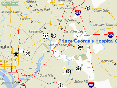
Prince George's Hospital Center Heliport |
Location & QuickFacts
| FAA Information Effective: | 2008-09-25 |
| Airport Identifier: | 1MD4 |
| Airport Status: | Operational |
| Longitude/Latitude: | 076-55-15.0000W/38-55-49.0000N
-76.920833/38.930278 (Estimated) |
| Elevation: | 297 ft / 90.53 m (Surveyed) |
| Land: | 0 acres |
| From nearest city: | 0 nautical miles N of Cheverly, MD |
| Location: | Prince Georges County, MD |
| Magnetic Variation: | 10W (1985) |
Owner & Manager
| Ownership: | Privately owned |
| Owner: | Prince Georges Hospital Center |
| Address: | 3001 Hospital Dr
Cheverly, MD 20785 |
| Phone number: | 301-618-2100 |
| Manager: | Phyliss Wingate-jones |
| Address: | 3001 Hospital Dr
Cheverly, MD 20785 |
| Phone number: | 301-618-2100 |
Airport Operations and Facilities
| Airport Use: | Private
MEDICAL USE. |
| Wind indicator: | Yes |
| Segmented Circle: | No |
| Control Tower: | No |
| Lighting Schedule: | 24 HRS |
| Beacon Color: | Clear-Green-Yellow (heliport) |
| Landing fee charge: | No |
| Sectional chart: | Washington |
| Region: | AEA - Eastern |
| Boundary ARTCC: | ZDC - Washington |
| Tie-in FSS: | DCA - Leesburg |
| FSS on Airport: | No |
| FSS Toll Free: | 1-800-WX-BRIEF |
Airport Communications
Runway Information
Helipad H1
| Dimension: | 67 x 67 ft / 20.4 x 20.4 m |
| Surface: | CONC,
ROOFTOP. |
| |
Runway H1 |
Runway |
| Traffic Pattern: | Left | Left |
|
Helipad H2
| Dimension: | 40 x 40 ft / 12.2 x 12.2 m |
| Surface: | CONC,
ROOFTOP. |
| |
Runway H2 |
Runway |
| Traffic Pattern: | Left | Left |
|
Radio Navigation Aids
| ID |
Type |
Name |
Ch |
Freq |
Var |
Dist |
| GTN | NDB | Georgetown | | 323.00 | 09W | 9.5 nm |
| VKX | NDB | Potomac | | 241.00 | 10W | 11.0 nm |
| DC | NDB | Oxonn | | 332.00 | 11W | 11.0 nm |
| BUH | NDB | Anne Arundel | | 260.00 | 10W | 11.9 nm |
| GAI | NDB | Gaithersburg | | 385.00 | 09W | 18.4 nm |
| FND | NDB | Ellicott | | 371.00 | 11W | 22.5 nm |
| IUB | NDB | Institute | | 404.00 | 08W | 25.5 nm |
| MTN | NDB | Martin | | 342.00 | 11W | 33.6 nm |
| ESN | NDB | Easton | | 212.00 | 10W | 40.6 nm |
| GDX | NDB | Goodwin Lake | | 227.00 | 08W | 42.6 nm |
| NHK | NDB | Patuxent | | 400.00 | 10W | 45.7 nm |
| EZF | NDB | Shannon | | 237.00 | 10W | 47.0 nm |
| CGE | NDB | Cambridge | | 355.00 | 10W | 47.9 nm |
| MTN | TACAN | Martin | 068X | | 11W | 33.8 nm |
| FDK | VOR | Frederick | | 109.00 | 08W | 35.9 nm |
| DCA | VOR/DME | Washington | 047X | 111.00 | 09W | 6.9 nm |
| PPM | VOR/DME | Phillips | 021X | 108.40 | 09W | 47.5 nm |
| ADW | VORTAC | Andrews | 078X | 113.10 | 10W | 7.8 nm |
| OTT | VORTAC | Nottingham | 084X | 113.70 | 10W | 15.8 nm |
| BAL | VORTAC | Baltimore | 098X | 115.10 | 11W | 18.9 nm |
| AML | VORTAC | Armel | 082X | 113.50 | 08W | 25.5 nm |
| EMI | VORTAC | Westminster | 126X | 117.90 | 08W | 34.1 nm |
| BRV | VORTAC | Brooke | 092X | 114.50 | 09W | 41.1 nm |
| PXT | VORTAC | Patuxent | 123X | 117.60 | 10W | 45.7 nm |
| CSN | VORTAC | Casanova | 110X | 116.30 | 06W | 47.5 nm |
| DCA | VOT | Washington National | | 109.40 | | 7.4 nm |
| ADW | VOT | Andrews Afb | | 109.60 | | 8.8 nm |
Remarks
- PRVDD SECURITY OFFICER DURG HEL OPNS FENCE TO BE REMOVED BEFORE BGNG OPNS; USE OF HELI BE LTD TO EMERG PATIENTS WHILE THE WEST PAD BE USED FOR NON-EMERG SITUATIONS.
- EGRESS/INGRESS LTD TO NORTH - SOUTH AXIS; OBSTNS TO BE LGTD; HELI LGTD IN ACCORDANCE WITH AC 150/5390-3B FOR NIGHT OPNS; LGT POLES ON WEST SIDE OF ROAD ARE REMOVED;
Images and information placed above are from
http://www.airport-data.com/airport/1MD4/
We thank them for the data!
| General Info
|
| Country |
United States
|
| State |
MARYLAND
|
| FAA ID |
1MD4
|
| Latitude |
38-56-23.400N
|
| Longitude |
076-55-18.950W
|
| Elevation |
200 feet
|
| Near City |
CHEVERLY
|
We don't guarantee the information is fresh and accurate. The data may
be wrong or outdated.
For more up-to-date information please refer to other sources.
|
|


