 |
|
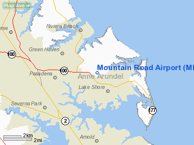
Location & QuickFacts
| FAA Information Effective: | 2008-09-25 |
| Airport Identifier: | MD43 |
| Airport Status: | Operational |
| Longitude/Latitude: | 076-29-47.8610W/39-07-06.3940N
-76.496628/39.118443 (Estimated) |
| Elevation: | 70 ft / 21.34 m (Estimated) |
| Land: | 110 acres |
| From nearest city: | 1 nautical miles E of Lakeshore, MD |
| Location: | Anne Arundel County, MD |
| Magnetic Variation: | 10W (1985) |
Owner & Manager
| Ownership: | Privately owned |
| Owner: | Henry A Schmidt |
| Address: | 8328 Schmidt's Lane
Pasadena, MD 21122-4624 |
| Phone number: | 410-255-7969 |
| Manager: | Henry A Schmidt |
| Address: | 8328 Schmidt's Lane
Pasadena, MD 21122-4624 |
| Phone number: | 410-255-7969 |
Airport Operations and Facilities
| Airport Use: | Private |
| Wind indicator: | Yes |
| Segmented Circle: | No |
| Control Tower: | No |
| Landing fee charge: | No |
| Sectional chart: | Washington |
| Region: | AEA - Eastern |
| Boundary ARTCC: | ZDC - Washington |
| Tie-in FSS: | DCA - Leesburg |
| FSS on Airport: | No |
| FSS Toll Free: | 1-800-WX-BRIEF |
Airport Services
| Airframe Repair: | NONE |
| Power Plant Repair: | NONE |
Runway Information
Runway E/W
| Dimension: | 1800 x 100 ft / 548.6 x 30.5 m |
| Surface: | TURF, |
| |
Runway E |
Runway W |
| Traffic Pattern: | Left | Left |
|
Radio Navigation Aids
| ID |
Type |
Name |
Ch |
Freq |
Var |
Dist |
| IUB | NDB | Institute | | 404.00 | 08W | 11.8 nm |
| MTN | NDB | Martin | | 342.00 | 11W | 12.2 nm |
| BUH | NDB | Anne Arundel | | 260.00 | 10W | 12.5 nm |
| FND | NDB | Ellicott | | 371.00 | 11W | 16.5 nm |
| ESN | NDB | Easton | | 212.00 | 10W | 27.5 nm |
| VKX | NDB | Potomac | | 241.00 | 10W | 30.9 nm |
| APG | NDB | Aberdeen | | 349.00 | 11W | 30.9 nm |
| GAI | NDB | Gaithersburg | | 385.00 | 09W | 31.4 nm |
| GTN | NDB | Georgetown | | 323.00 | 09W | 31.4 nm |
| DC | NDB | Oxonn | | 332.00 | 11W | 32.6 nm |
| CGE | NDB | Cambridge | | 355.00 | 10W | 41.1 nm |
| MTN | TACAN | Martin | 068X | | 11W | 13.4 nm |
| DOV | TACAN | Dover | 037X | | 09W | 48.0 nm |
| FDK | VOR | Frederick | | 109.00 | 08W | 44.5 nm |
| PPM | VOR/DME | Phillips | 021X | 108.40 | 09W | 25.8 nm |
| DCA | VOR/DME | Washington | 047X | 111.00 | 09W | 29.6 nm |
| BAL | VORTAC | Baltimore | 098X | 115.10 | 11W | 8.3 nm |
| ADW | VORTAC | Andrews | 078X | 113.10 | 10W | 25.5 nm |
| OTT | VORTAC | Nottingham | 084X | 113.70 | 10W | 27.4 nm |
| EMI | VORTAC | Westminster | 126X | 117.90 | 08W | 31.9 nm |
| ENO | VORTAC | Smyrna | 051X | 111.40 | 09W | 46.2 nm |
| AML | VORTAC | Armel | 082X | 113.50 | 08W | 46.6 nm |
| ADW | VOT | Andrews Afb | | 109.60 | | 26.7 nm |
| DCA | VOT | Washington National | | 109.40 | | 30.0 nm |
Remarks
Images and information placed above are from
http://www.airport-data.com/airport/MD43/
We thank them for the data!
| General Info
|
| Country |
United States
|
| State |
MARYLAND
|
| FAA ID |
MD43
|
| Latitude |
39-07-06.394N
|
| Longitude |
076-29-47.861W
|
| Elevation |
70 feet
|
| Near City |
LAKESHORE
|
We don't guarantee the information is fresh and accurate. The data may
be wrong or outdated.
For more up-to-date information please refer to other sources.
|
|


