 |
|
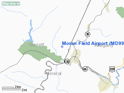
Location & QuickFacts
| FAA Information Effective: | 2008-09-25 |
| Airport Identifier: | MD99 |
| Airport Status: | Operational |
| Longitude/Latitude: | 079-04-20.1090W/39-30-02.3300N
-79.072253/39.500647 (Estimated) |
| Elevation: | 2080 ft / 633.98 m (Estimated) |
| Land: | 0 acres |
| From nearest city: | 1 nautical miles NW of Westernport, MD |
| Location: | Garrett County, MD |
| Magnetic Variation: | 08W (1985) |
Owner & Manager
| Ownership: | Privately owned |
| Owner: | Moran Coal Co., Inc. |
| Address: | Drawer E
Westernport, MD 21562 |
| Phone number: | 301-359-0622 |
| Manager: | Donald Moran |
| Address: | Drawer E
Westernport, MD 21562 |
| Phone number: | 301-359-0622 |
Airport Operations and Facilities
| Airport Use: | Private |
| Wind indicator: | Yes |
| Segmented Circle: | No |
| Control Tower: | No |
| Lighting Schedule: | DUSK-DAWN |
| Beacon Color: | Clear-Green (lighted land airport) |
| Landing fee charge: | No |
| Sectional chart: | Cincinnati |
| Region: | AEA - Eastern |
| Boundary ARTCC: | ZDC - Washington |
| Tie-in FSS: | EKN - Elkins |
| FSS on Airport: | No |
| FSS Toll Free: | 1-800-WX-BRIEF |
Runway Information
Runway 14/32
| Dimension: | 4000 x 60 ft / 1219.2 x 18.3 m |
| Surface: | ASPH, |
| Edge Lights: | Low |
| |
Runway 14 |
Runway 32 |
| Traffic Pattern: | Left | Left |
|
Radio Navigation Aids
| ID |
Type |
Name |
Ch |
Freq |
Var |
Dist |
| CBE | NDB | Cumberland | | 317.00 | 07W | 17.5 nm |
| SYS | NDB | Stoystown | | 209.00 | 08W | 35.9 nm |
| VV | NDB | Camor | | 299.00 | 08W | 38.7 nm |
| GRV | VOR/DME | Grantsville | 070X | 112.30 | 06W | 8.1 nm |
| ESL | VOR/DME | Kessel | 045X | 110.80 | 06W | 17.0 nm |
| IHD | VORTAC | Indian Head | 019X | 108.20 | 06W | 31.4 nm |
| MGW | VORTAC | Morgantown | 053X | 111.60 | 05W | 36.7 nm |
Remarks
- AVOID TAXIING OFF RWY ON NORTH SIDE - POSSIBLE DROP.
- PRVD ARPT IS SHOWN ON AERO CHART AS A RSTRD USE FAC.
Images and information placed above are from
http://www.airport-data.com/airport/MD99/
We thank them for the data!
| General Info
|
| Country |
United States
|
| State |
MARYLAND
|
| FAA ID |
MD99
|
| Latitude |
39-30-02.330N
|
| Longitude |
079-04-20.109W
|
| Elevation |
2080 feet
|
| Near City |
WESTERNPORT
|
We don't guarantee the information is fresh and accurate. The data may
be wrong or outdated.
For more up-to-date information please refer to other sources.
|
|


