 |
|
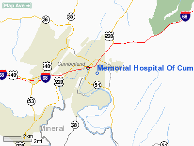
Memorial Hospital Of Cumberland Heliport |
Location & QuickFacts
| FAA Information Effective: | 2008-09-25 |
| Airport Identifier: | 2MD5 |
| Airport Status: | Operational |
| Longitude/Latitude: | 078-45-04.0650W/39-38-34.3160N
-78.751129/39.642866 (Estimated) |
| Elevation: | 900 ft / 274.32 m (Estimated) |
| Land: | 0 acres |
| From nearest city: | 1 nautical miles SE of Cumberland, MD |
| Location: | Allegany County, MD |
| Magnetic Variation: | 08W (1985) |
Owner & Manager
| Ownership: | Privately owned |
| Owner: | Mem Hosp Med Cntr Cumberland |
| Address: | 600 Memorial Avenue
Cumberland, MD 21502 |
| Phone number: | 301-777-4000 |
| Manager: | Scott D. Burleson |
| Address: | 600 Memorial Avenue
Cumberland, MD 21502 |
| Phone number: | 301-777-4177 |
Airport Operations and Facilities
| Airport Use: | Private
MEDICAL USE |
| Wind indicator: | No |
| Segmented Circle: | No |
| Control Tower: | No |
| Landing fee charge: | No |
| Sectional chart: | Washington |
| Region: | AEA - Eastern |
| Boundary ARTCC: | ZOB - Cleveland |
| Tie-in FSS: | EKN - Elkins |
| FSS on Airport: | No |
| FSS Toll Free: | 1-800-WX-BRIEF |
Runway Information
Helipad H1
| Dimension: | 40 x 40 ft / 12.2 x 12.2 m |
| Surface: | MATS,
ALUMINUM DECK |
| |
Runway H1 |
Runway |
| Traffic Pattern: | Left | Left |
|
Radio Navigation Aids
| ID |
Type |
Name |
Ch |
Freq |
Var |
Dist |
| CBE | NDB | Cumberland | | 317.00 | 07W | 0.4 nm |
| SYS | NDB | Stoystown | | 209.00 | 08W | 27.7 nm |
| TZ | NDB | Cogan | | 364.00 | 10W | 46.1 nm |
| VV | NDB | Camor | | 299.00 | 08W | 48.1 nm |
| HGR | VOR | Hagerstown | | 109.80 | 07W | 41.6 nm |
| AOO | VOR | Altoona | | 108.80 | 07W | 45.9 nm |
| GRV | VOR/DME | Grantsville | 070X | 112.30 | 06W | 13.9 nm |
| ESL | VOR/DME | Kessel | 045X | 110.80 | 06W | 27.4 nm |
| IHD | VORTAC | Indian Head | 019X | 108.20 | 06W | 34.4 nm |
| JST | VORTAC | Johnstown | 077X | 113.00 | 06W | 40.7 nm |
| THS | VORTAC | St Thomas | 097X | 115.00 | 07W | 40.9 nm |
| MRB | VORTAC | Martinsburg | 058X | 112.10 | 07W | 44.6 nm |
Remarks
- PROVIDED HELIPORT CONFORMS TO AC 150/5390-1B; FIRE PROTECTION CONFORM TO LOCAL CODES; HELIPORT IS INSPECTED BY FAA FOR SAFETY.
Images and information placed above are from
http://www.airport-data.com/airport/2MD5/
We thank them for the data!
| General Info
|
| Country |
United States
|
| State |
MARYLAND
|
| FAA ID |
2MD5
|
| Latitude |
39-38-34.316N
|
| Longitude |
078-45-04.065W
|
| Elevation |
900 feet
|
| Near City |
CUMBERLAND
|
We don't guarantee the information is fresh and accurate. The data may
be wrong or outdated.
For more up-to-date information please refer to other sources.
|
|


