 |
|
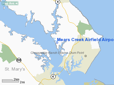
Mears Creek Airfield Airport |
Location & QuickFacts
| FAA Information Effective: | 2008-09-25 |
| Airport Identifier: | 4MD0 |
| Airport Status: | Operational |
| Longitude/Latitude: | 076-28-58.8290W/38-22-27.4460N
-76.483008/38.374291 (Estimated) |
| Elevation: | 27 ft / 8.23 m (Estimated) |
| Land: | 60 acres |
| From nearest city: | 3 nautical miles SW of Lusby, MD |
| Location: | Calvert County, MD |
| Magnetic Variation: | 10W (1985) |
Owner & Manager
| Ownership: | Privately owned |
| Owner: | William J. Bass
CHARLES F. BASS |
| Address: | 1627 21 St., N.w.
Washington, DC 20009 |
| Phone number: | 202-232-4851 |
| Manager: | William J. Bass |
| Address: | Box 38 Turner Road
Lusby, MD 20657 |
| Phone number: | 410-326-3427 |
Airport Operations and Facilities
| Airport Use: | Private
PERSONAL USE. |
| Wind indicator: | Yes |
| Segmented Circle: | No |
| Control Tower: | No |
| Landing fee charge: | No |
| Sectional chart: | Washington |
| Region: | AEA - Eastern |
| Boundary ARTCC: | ZDC - Washington |
| Tie-in FSS: | DCA - Leesburg |
| FSS Toll Free: | 1-800-WX-BRIEF |
Runway Information
Runway 15/33
| Dimension: | 1600 x 60 ft / 487.7 x 18.3 m |
| Surface: | TURF, |
| |
Runway 15 |
Runway 33 |
| Traffic Pattern: | Left | Right |
| Displaced threshold: | 0.00 ft | 300.00 ft |
|
Radio Navigation Aids
| ID |
Type |
Name |
Ch |
Freq |
Var |
Dist |
| NHK | NDB | Patuxent | | 400.00 | 10W | 6.5 nm |
| CGE | NDB | Cambridge | | 355.00 | 10W | 23.4 nm |
| VKX | NDB | Potomac | | 241.00 | 10W | 31.6 nm |
| ESN | NDB | Easton | | 212.00 | 10W | 32.4 nm |
| DC | NDB | Oxonn | | 332.00 | 11W | 34.7 nm |
| APH | NDB | A P Hill | | 396.00 | 10W | 43.3 nm |
| BUH | NDB | Anne Arundel | | 260.00 | 10W | 44.6 nm |
| GTN | NDB | Georgetown | | 323.00 | 09W | 45.0 nm |
| EZF | NDB | Shannon | | 237.00 | 10W | 46.1 nm |
| DCA | VOR/DME | Washington | 047X | 111.00 | 09W | 39.1 nm |
| PXT | VORTAC | Patuxent | 123X | 117.60 | 10W | 6.5 nm |
| OTT | VORTAC | Nottingham | 084X | 113.70 | 10W | 23.4 nm |
| ADW | VORTAC | Andrews | 078X | 113.10 | 10W | 31.6 nm |
| BRV | VORTAC | Brooke | 092X | 114.50 | 09W | 41.1 nm |
| SBY | VORTAC | Salisbury | 049X | 111.20 | 12W | 45.9 nm |
| BAL | VORTAC | Baltimore | 098X | 115.10 | 11W | 48.6 nm |
| ADW | VOT | Andrews Afb | | 109.60 | | 31.1 nm |
| DCA | VOT | Washington National | | 109.40 | | 38.3 nm |
Remarks
- PROVIDED RWY 33 THRESHOLD DISPLACED TO PROVIDE CLEARANCE OVER ROAD; PLINE SOUTH IS BURIED; COORDINATION WITH NHK ATCT REGARDING OPERATIONS.
Images and information placed above are from
http://www.airport-data.com/airport/4MD0/
We thank them for the data!
| General Info
|
| Country |
United States
|
| State |
MARYLAND
|
| FAA ID |
4MD0
|
| Latitude |
38-22-27.446N
|
| Longitude |
076-28-58.829W
|
| Elevation |
27 feet
|
| Near City |
LUSBY
|
We don't guarantee the information is fresh and accurate. The data may
be wrong or outdated.
For more up-to-date information please refer to other sources.
|
|


