 |
|
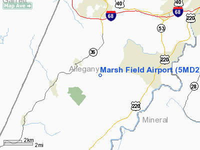
Location & QuickFacts
| FAA Information Effective: | 2008-09-25 |
| Airport Identifier: | 5MD2 |
| Airport Status: | Operational |
| Longitude/Latitude: | 078-55-07.0000W/39-34-36.0000N
-78.918611/39.576667 (Estimated) |
| Elevation: | 2600 ft / 792.48 m (Estimated) |
| Land: | 1 acres |
| From nearest city: | 6 nautical miles S of Frostburg, MD |
| Location: | Allegany County, MD |
| Magnetic Variation: | 09W (1995) |
Owner & Manager
| Ownership: | Privately owned |
| Owner: | Joseph Gary Marsh |
| Address: | 18101 Buskirk Hollow Rd Sw
Frostburg, MD 21532 |
| Phone number: | 301-463-6557 |
| Manager: | Joseph Gary Marsh |
| Address: | 18101 Buskirk Hollow Rd Sw
Frostburg, MD 21532 |
| Phone number: | 301-463-6557 |
Airport Operations and Facilities
| Airport Use: | Private |
| Wind indicator: | Yes |
| Segmented Circle: | No |
| Control Tower: | No |
| Sectional chart: | Washington |
| Region: | AEA - Eastern |
| Boundary ARTCC: | ZOB - Cleveland |
| Tie-in FSS: | EKN - Elkins |
| FSS Toll Free: | 1-800-WX-BRIEF |
Runway Information
Runway 08/26
| Dimension: | 1200 x 50 ft / 365.8 x 15.2 m |
| Surface: | TURF, Good Condition |
| |
Runway 08 |
Runway 26 |
| Traffic Pattern: | Right | Right |
|
Radio Navigation Aids
| ID |
Type |
Name |
Ch |
Freq |
Var |
Dist |
| CBE | NDB | Cumberland | | 317.00 | 07W | 9.0 nm |
| SYS | NDB | Stoystown | | 209.00 | 08W | 30.6 nm |
| VV | NDB | Camor | | 299.00 | 08W | 42.4 nm |
| TZ | NDB | Cogan | | 364.00 | 10W | 49.3 nm |
| HGR | VOR | Hagerstown | | 109.80 | 07W | 49.7 nm |
| GRV | VOR/DME | Grantsville | 070X | 112.30 | 06W | 7.0 nm |
| ESL | VOR/DME | Kessel | 045X | 110.80 | 06W | 21.4 nm |
| IHD | VORTAC | Indian Head | 019X | 108.20 | 06W | 31.4 nm |
| MGW | VORTAC | Morgantown | 053X | 111.60 | 05W | 43.7 nm |
| JST | VORTAC | Johnstown | 077X | 113.00 | 06W | 44.7 nm |
| THS | VORTAC | St Thomas | 097X | 115.00 | 07W | 49.6 nm |
Remarks
- PRVDD VFR ONLY, CLEAR 20:1 APCH/DEP PATH, IF HOUSE/HANGAR ARE WITHIN APCH SFC DSPLCD THLD BE TAKEN INTO ACCOUNT.
Images and information placed above are from
http://www.airport-data.com/airport/5MD2/
We thank them for the data!
| General Info
|
| Country |
United States
|
| State |
MARYLAND
|
| FAA ID |
5MD2
|
| Latitude |
39-34-36.000N
|
| Longitude |
078-55-07.000W
|
| Elevation |
2600 feet
|
| Near City |
FROSTBURG
|
We don't guarantee the information is fresh and accurate. The data may
be wrong or outdated.
For more up-to-date information please refer to other sources.
|
|


